
KNOWPIA
WELCOME TO KNOWPIA

Damerey 
Summary
Damerey (French pronunciation: [damʁɛ]) is a commune in the Saône-et-Loire department in the region of Bourgogne-Franche-Comté in eastern France.
Damerey | |
|---|---|
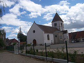 The church in Damerey | |
Location of Damerey .mw-parser-output .locmap .od{position:absolute}.mw-parser-output .locmap .id{position:absolute;line-height:0}.mw-parser-output .locmap .l0{font-size:0;position:absolute}.mw-parser-output .locmap .pv{line-height:110%;position:absolute;text-align:center}.mw-parser-output .locmap .pl{line-height:110%;position:absolute;top:-0.75em;text-align:right}.mw-parser-output .locmap .pr{line-height:110%;position:absolute;top:-0.75em;text-align:left}.mw-parser-output .locmap .pv>div{display:inline;padding:1px}.mw-parser-output .locmap .pl>div{display:inline;padding:1px;float:right}.mw-parser-output .locmap .pr>div{display:inline;padding:1px;float:left}html.skin-theme-clientpref-night .mw-parser-output .od,html.skin-theme-clientpref-night .mw-parser-output .od .pv>div,html.skin-theme-clientpref-night .mw-parser-output .od .pl>div,html.skin-theme-clientpref-night .mw-parser-output .od .pr>div{background:#000;color:#fff}html.skin-theme-clientpref-night .mw-parser-output .locmap{filter:grayscale(0.6)}@media(prefers-color-scheme:dark){html.skin-theme-clientpref-os .mw-parser-output .locmap{filter:grayscale(0.6)}html.skin-theme-clientpref-os .mw-parser-output .od,html.skin-theme-clientpref-os .mw-parser-output .od .pv>div,html.skin-theme-clientpref-os .mw-parser-output .od .pl>div,html.skin-theme-clientpref-os .mw-parser-output .od .pr>div{background:#000;color:#fff}}  Damerey  Damerey | |
| Coordinates: 46°50′07″N 4°59′30″E / 46.8353°N 4.9917°E | |
| Country | France |
| Region | Bourgogne-Franche-Comté |
| Department | Saône-et-Loire |
| Arrondissement | Chalon-sur-Saône |
| Canton | Gergy |
| Intercommunality | Saône Doubs Bresse |
| Area 1 | 11.62 km2 (4.49 sq mi) |
| Population (2021)[1] | 546 |
| • Density | 47/km2 (120/sq mi) |
| Time zone | UTC+01:00 (CET) |
| • Summer (DST) | UTC+02:00 (CEST) |
| INSEE/Postal code | 71167 /71620 |
| Elevation | 174–196 m (571–643 ft) (avg. 180 m or 590 ft) |
| 1 French Land Register data, which excludes lakes, ponds, glaciers > 1 km2 (0.386 sq mi or 247 acres) and river estuaries. | |
Geography edit
Damerey is part of the Bresse Chalonnaise. The Saône defines the northwest boundary of the commune.
Population edit
| Year | Pop. | ±% p.a. |
|---|---|---|
| 1968 | 389 | — |
| 1975 | 364 | −0.94% |
| 1982 | 409 | +1.68% |
| 1990 | 432 | +0.69% |
| 1999 | 421 | −0.29% |
| 2009 | 572 | +3.11% |
| 2014 | 557 | −0.53% |
| 2020 | 549 | −0.24% |
| Source: INSEE[2] | ||
Notable people edit
- Marie Guillot (9 September 1880 – 5 March 1934) was born in Damerey. She was a teacher in Saône-et-Loire and a pioneer of trade unionism in primary education.[3]
- Roger Mercier: The commune holds the original work of this man, a roadside artist who since 1984 has built a remarkable city of Hispanic inspiration with buildings and sculptures in painted concrete. At the age of 80 he continued maintenance and development of his work.
See also edit
References edit
- ^ "Populations légales 2021". The National Institute of Statistics and Economic Studies. 28 December 2023.
- ^ Population en historique depuis 1968, INSEE
- ^ Liszek, Slava (1994-01-01). Marie Guillot: de l'émancipation des femmes à celle du syndicalisme. Editions L'Harmattan. p. 18ff. ISBN 978-2-7384-2947-6. Retrieved 2013-09-15.
Wikimedia Commons has media related to Damerey.