


Summary
Dans Mountain State Park is a public recreation area located nine miles (14 km) south of Frostburg and to the east of the town of Lonaconing in Allegany County, Maryland. The state park occupies 482 acres (195 ha) on 16-mile-long (26 km) Dans Mountain and is managed by the Maryland Department of Natural Resources.[4]
| Dans Mountain State Park | |
|---|---|
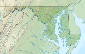 Location in Maryland | |
| Location | Allegany County, Maryland, United States |
| Nearest city | Frostburg, Maryland |
| Coordinates | 39°33′25″N 78°57′13″W / 39.55694°N 78.95361°W[1] |
| Area | 482 acres (195 ha)[2] |
| Elevation | 2,208 ft (673 m)[1] |
| Designation | Maryland state park |
| Established | 1952[3] |
| Administrator | Maryland Department of Natural Resources |
| Website | Dans Mountain State Park |
History edit
Dans Mountain was named after Daniel Cresap, the son of Thomas Cresap and an early settler of Allegany County who fell from a tree on the mountain while hunting bear cubs. According to the legendary tale, Cresap's hunting companion, the Delaware Indian Nemacolin, found his unconscious body and using a horse and litter dragged him home to safety.[5]
The state park opened in 1952[3] and was developed in the 1970s. The General Assembly provided over $800,000 from 1973 to 1978 for the planning and construction of the park's swimming pool and other improvements.[6]
Activities and amenities edit
In addition to wildlife, mountain streams, and scenic overlooks, the park features an Olympic-sized swimming pool with bathhouse, concession stands during warm weather months, and a fishing pond that is stocked annually.[4]
Dan's Rock edit
Dan's Rock, the highest point in Allegany County at 2,898 feet (883 m), sits about three miles (4.8 km) from the park at the northeast edge of Dan's Mountain Wildlife Management Area.[4][7] It can be accessed from Old Dan's Rock Road in Midland. There is no direct access to Dan's Rock Overlook from Dan's Mountain State Park.
References edit
- ^ a b "Dans Mountain State Park". Geographic Names Information System. United States Geological Survey, United States Department of the Interior.
- ^ "DNR Lands Acreage" (PDF). Maryland Department of Natural Resources. Retrieved December 4, 2019.
- ^ a b "Maryland State Park History". Maryland Department of Natural Resources. Retrieved December 4, 2019.
- ^ a b c "Dan's Mountain State Park". Maryland Department of Natural Resources. Retrieved October 14, 2016.
- ^ Goodwin, Lt. Col. Vaughn K. (September 1996). "Frontiersman Odyssey: The Cresaps of Maryland". Muzzle Blasts Online. National Muzzle Loading Rifle Association. Retrieved November 19, 2013.
- ^ "Dans Rock". Geographic Names Information System. United States Geological Survey, United States Department of the Interior.
External links edit
- Dan's Mountain State Park Maryland Department of Natural Resources