


Summary
Danville Regional Airport (IATA: DAN, ICAO: KDAN, FAA LID: DAN) is three miles east of Danville, in southern Virginia.[1] The Federal Aviation Administration (FAA) National Plan of Integrated Airport Systems for 2017–2021 categorized it as a regional general aviation facility.[2]
Danville Regional Airport | |||||||||||||||
|---|---|---|---|---|---|---|---|---|---|---|---|---|---|---|---|
| Summary | |||||||||||||||
| Airport type | Public | ||||||||||||||
| Owner | City of Danville | ||||||||||||||
| Serves | Danville, Virginia | ||||||||||||||
| Elevation AMSL | 571 ft / 174 m | ||||||||||||||
| Coordinates | 36°34′20″N 079°20′10″W / 36.57222°N 79.33611°W | ||||||||||||||
| Website | www.danville-va.gov/... | ||||||||||||||
| Map | |||||||||||||||
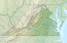 DAN  DAN | |||||||||||||||
| Runways | |||||||||||||||
| |||||||||||||||
| Statistics (2019) | |||||||||||||||
| |||||||||||||||
The first scheduled flights to the airport were Eastern Airlines DC-3s in 1947; Eastern pulled out in 1964. Piedmont Airlines arrived in 1948.
Facilities edit
The airport covers 800 acres (320 ha) at an elevation of 571 feet (174 m). It has two asphalt runways: 2/20 is 5,900 by 100 feet (1,798 x 30 m) and 13/31 is 3,910 by 100 feet (1,192 x 30 m).[1]
In the year ending December 31, 2019 the airport had 19,120 aircraft operations, average 52 per day: 100% general aviation and <1% military. In December 2019, 38 aircraft were based at the airport: 35 single-engine, 1 multi-engine, 1 jet, and 1 helicopter.[1]
Taxiway revamp edit
In January 2017 the City Council of Danville approved a 3.1 million dollar project to rebuild taxiway A, and narrow it to 35 feet. Construction work was scheduled to begin in March 2017.[3]
References edit
- ^ a b c d FAA Airport Form 5010 for DAN PDF, effective August 10, 2023.
- ^ "List of NPIAS Airports" (PDF). FAA.gov. Federal Aviation Administration. 21 October 2016. Retrieved 23 January 2017.
- ^ Pinto, Caren (2017-01-18). "Revamp of Taxiway at Danville Regional Airport is about to take off". 13 WSET News. Danville, Virginia. Retrieved 2017-01-23.
City Council approved a revamp for Taxiway A
External links edit
- Danville Regional Airport at City of Danville website
- Aerial photo as of 1 April 1994 from USGS The National Map
- FAA Terminal Procedures for DAN, effective April 18, 2024
- Resources for this airport:
- FAA airport information for DAN
- AirNav airport information for KDAN
- ASN accident history for DAN
- FlightAware airport information and live flight tracker
- NOAA/NWS weather observations: current, past three days
- SkyVector aeronautical chart, Terminal Procedures