
KNOWPIA
WELCOME TO KNOWPIA

Dashiqiao 
Summary
Dashiqiao (simplified Chinese: 大石桥; traditional Chinese: 大石橋; pinyin: Dàshíqiáo; lit. 'Great Stone Bridge') is a county-level city in south-central Liaoning province, Northeast China. It is under the administration of the prefectural city of Yingkou, the downtown of which is 23 kilometres (14 mi) to the west.
Dashiqiao
大石桥市 Tashihkiao | |
|---|---|
 Location of the county within Yingkou | |
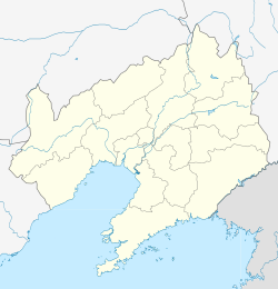 Dashiqiao Location in Liaoning | |
| Coordinates: 40°37′N 122°31′E / 40.617°N 122.517°E | |
| Country | People's Republic of China |
| Province | Liaoning |
| Prefecture-level city | Yingkou |
| Area | |
| • County-level city | 1,610.0 km2 (621.6 sq mi) |
| • Urban | 150.00 km2 (57.92 sq mi) |
| Elevation | 45 m (148 ft) |
| Population (2017)[1] | |
| • County-level city | 698,000 |
| • Density | 430/km2 (1,100/sq mi) |
| • Urban | 261,600 |
| Time zone | UTC+8 (China Standard) |
| Dashiqiao | |||||||||
|---|---|---|---|---|---|---|---|---|---|
| Simplified Chinese | 大石桥 | ||||||||
| Traditional Chinese | 大石橋 | ||||||||
| Postal | Tashihkiao | ||||||||
| |||||||||
Administrative Divisions edit
There are five subdistricts and 11 towns under the city's administration.[2]
Subdistricts:
- Shiqiao Subdistrict (石桥街道), Qinghua Subdistrict (青花街道), Jinqiao Subdistrict (金桥街道), Gangdu Subdistrict (钢都街道), Nanlou Subdistrict (南楼街道)
Towns:
- Shuiyuan (水源镇), Gouyan (沟沿镇), Shifo (石佛镇), Gaokan (高坎镇), Qikou, Huzhuang (虎庄镇), Guantun (官屯镇), Boluopu (博洛铺镇), Yong'an (永安镇), Tangchi (汤池镇), Huangtuling (黄土岭镇), Zhoujia (周家镇)
Climate edit
| Climate data for Dashiqiao (1991–2014 normals, extremes 1981–2010) | |||||||||||||
|---|---|---|---|---|---|---|---|---|---|---|---|---|---|
| Month | Jan | Feb | Mar | Apr | May | Jun | Jul | Aug | Sep | Oct | Nov | Dec | Year |
| Record high °C (°F) | 9.1 (48.4) |
19.1 (66.4) |
21.1 (70.0) |
29.9 (85.8) |
34.1 (93.4) |
34.5 (94.1) |
35.0 (95.0) |
35.3 (95.5) |
33.1 (91.6) |
28.1 (82.6) |
21.0 (69.8) |
14.6 (58.3) |
35.3 (95.5) |
| Mean daily maximum °C (°F) | −2.8 (27.0) |
1.7 (35.1) |
8.1 (46.6) |
17.1 (62.8) |
23.8 (74.8) |
27.5 (81.5) |
29.6 (85.3) |
29.2 (84.6) |
25.2 (77.4) |
17.5 (63.5) |
7.7 (45.9) |
−0.3 (31.5) |
15.4 (59.7) |
| Daily mean °C (°F) | −8.2 (17.2) |
−3.8 (25.2) |
2.8 (37.0) |
11.5 (52.7) |
18.4 (65.1) |
22.8 (73.0) |
25.5 (77.9) |
24.7 (76.5) |
19.5 (67.1) |
11.9 (53.4) |
2.6 (36.7) |
−5.3 (22.5) |
10.2 (50.4) |
| Mean daily minimum °C (°F) | −12.9 (8.8) |
−8.6 (16.5) |
−1.9 (28.6) |
6.1 (43.0) |
13.2 (55.8) |
18.4 (65.1) |
22.0 (71.6) |
20.9 (69.6) |
14.5 (58.1) |
6.9 (44.4) |
−1.8 (28.8) |
−9.6 (14.7) |
5.6 (42.1) |
| Record low °C (°F) | −30.8 (−23.4) |
−27.2 (−17.0) |
−18.1 (−0.6) |
−6.9 (19.6) |
0.3 (32.5) |
7.2 (45.0) |
13.8 (56.8) |
11.8 (53.2) |
0.3 (32.5) |
−7.2 (19.0) |
−17.8 (0.0) |
−23.2 (−9.8) |
−30.8 (−23.4) |
| Average precipitation mm (inches) | 3.7 (0.15) |
7.0 (0.28) |
11.7 (0.46) |
32.7 (1.29) |
53.5 (2.11) |
77.3 (3.04) |
141.9 (5.59) |
165.2 (6.50) |
53.6 (2.11) |
36.5 (1.44) |
20.8 (0.82) |
8.7 (0.34) |
612.6 (24.13) |
| Average precipitation days (≥ 0.1 mm) | 2.6 | 2.7 | 3.9 | 6.1 | 7.8 | 9.6 | 10.6 | 10.1 | 6.8 | 6.2 | 5.1 | 3.3 | 74.8 |
| Average snowy days | 4.0 | 3.4 | 2.8 | 0.7 | 0 | 0 | 0 | 0 | 0 | 0.3 | 3.2 | 4.0 | 18.4 |
| Average relative humidity (%) | 58 | 53 | 52 | 51 | 55 | 67 | 77 | 78 | 70 | 63 | 61 | 60 | 62 |
| Mean monthly sunshine hours | 186.8 | 192.6 | 232.8 | 240.3 | 264.9 | 228.4 | 199.1 | 206.5 | 227.5 | 212.5 | 168.8 | 167.0 | 2,527.2 |
| Percent possible sunshine | 63 | 64 | 63 | 60 | 59 | 51 | 44 | 49 | 62 | 62 | 57 | 58 | 58 |
| Source: China Meteorological Administration[3][4] | |||||||||||||
References edit
- ^ a b Ministry of Housing and Urban-Rural Development, ed. (2019). China Urban Construction Statistical Yearbook 2017. Beijing: China Statistics Press. p. 50. Archived from the original on 18 June 2019. Retrieved 11 January 2020.
- ^ 营口市-行政区划网
- ^ 中国气象数据网 – WeatherBk Data (in Simplified Chinese). China Meteorological Administration. Retrieved 29 July 2023.
- ^ 中国气象数据网 (in Simplified Chinese). China Meteorological Administration. Retrieved 29 July 2023.
External links edit