


Summary
Depalpur is a town of shri 24 avtaar mandir belong God Vishnu and a Nagar panchayat in Indore district in the state of Madhya Pradesh, India. Depalpur is around 41.7Km from Indore.
Depalpur
Deypaulpoor | |
|---|---|
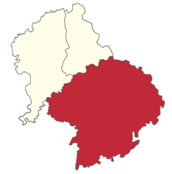 Depalpur Tehsil in Indore district (MP) | |
 Depalpur Location in Madhya Pradesh, India  Depalpur Depalpur (India) | |
| Coordinates: 22°51′N 75°33′E / 22.85°N 75.55°E | |
| Country | |
| State | Madhya Pradesh |
| District | Indore |
| Government | |
| • Type | Municipal corporation |
| Elevation | 533 m (1,749 ft) |
| Population (2011) | |
| • Total | 25,300 |
| Languages | |
| • Official | Hindi, Malvi Language |
| Time zone | UTC+5:30 (IST) |
| ISO 3166 code | IN-MP |
| Vehicle registration | MP |
Origin of name edit
According to tradition, the town is named after the Paramara dynasty ruler Devapala (reigned 1216–40).
History edit
In the Ain-i-Akbari, Depalpur is mentioned as one of the 10 mahals of the Ujjain sarkar in Malwa Subah.[1] Later, it became part of the Princely state of Indore. The Zagirdar of Depalpur was Meer sayyed Abdul kadir Hussain sahb .(Dada miya)After his demise, his descendants distributed the family property to the farmers of Depalpur and pamalpur and currently, they are living in santer,depalpur and Indore. [2]
Geography edit
Depalpur is located at 22°51′N 75°33′E / 22.85°N 75.55°E.[3] It has an average elevation of 533 metres (1748 feet).
Demographics edit
As of 2001[update] India census,[4] Depalpur had a population of 15,200. Males constitute 51% of the population while the females constitute the remaining 49%. Depalpur has an average literacy rate of 57%, lower than the national average of 59.5%. The male literacy rate is at 69%, while the female literacy rate is at 45%. In Depalpur, 16% of the population is under 6 years of age.
Transport edit
The nearest airport is Devi Ahilya Bai Holkar Airport, Indore.
References edit
- ^ Abul Fazl-i-Allami (1949, reprint 1993). Ain-i-Akbari, Vol.II (English tr. by H.S. Jarrett, rev. by J.N. Sarkar), Calcutta: The Asiatic Society, p.209
- ^ indore state
- ^ Falling Rain Genomics, Inc - Depalpur
- ^ "Census of India 2001: Data from the 2001 Census, including cities, villages and towns (Provisional)". Census Commission of India. Archived from the original on 16 June 2004. Retrieved 1 November 2008.