


Summary
Deseret (/ˌdɛzəˈrɛt/ ⓘ)[4] is a census-designated place in Millard County, Utah, United States. The population was 353 at the 2010 census. Deseret is located approximately 10 miles (16 km) southwest of Delta, and about 150 miles (240 km) southwest of Salt Lake City. The name Deseret comes from the Book of Mormon.[5]
Deseret | |
|---|---|
![Deseret Relief Society Hall, listed in the National Register of Historic Places[1]](http://upload.wikimedia.org/wikipedia/commons/thumb/a/ac/Deseret_Relief_Society_Hall_from_SW_1.JPG/250px-Deseret_Relief_Society_Hall_from_SW_1.JPG) Deseret Relief Society Hall, listed in the National Register of Historic Places[1] | |
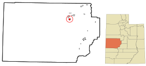 Location in Millard County and the state of Utah. | |
| Coordinates: 39°17′15″N 112°39′04″W / 39.28750°N 112.65111°W | |
| Country | United States |
| State | Utah |
| County | Millard |
| Named for | Deseret |
| Elevation | 4,590 ft (1,400 m) |
| Population | |
| • Total | 353 |
| Time zone | UTC-7 (Mountain (MST)) |
| • Summer (DST) | UTC-6 (MDT) |
| ZIP code | 84624 |
| Area code | 435 |
| GNIS feature ID | 2584761[2] |
Climate edit
Deseret has a cold semi-arid climate (Köppen BSk) with hot summers and cold winters.
| Climate data for Deseret, Utah, 1991–2020 normals, extremes 1893–present | |||||||||||||
|---|---|---|---|---|---|---|---|---|---|---|---|---|---|
| Month | Jan | Feb | Mar | Apr | May | Jun | Jul | Aug | Sep | Oct | Nov | Dec | Year |
| Record high °F (°C) | 64 (18) |
74 (23) |
84 (29) |
91 (33) |
103 (39) |
108 (42) |
110 (43) |
107 (42) |
107 (42) |
93 (34) |
79 (26) |
69 (21) |
110 (43) |
| Mean maximum °F (°C) | 53.5 (11.9) |
62.2 (16.8) |
75.4 (24.1) |
83.4 (28.6) |
91.9 (33.3) |
99.6 (37.6) |
103.0 (39.4) |
100.7 (38.2) |
94.6 (34.8) |
84.3 (29.1) |
68.5 (20.3) |
56.7 (13.7) |
103.6 (39.8) |
| Mean daily maximum °F (°C) | 38.8 (3.8) |
46.4 (8.0) |
59.0 (15.0) |
66.2 (19.0) |
76.0 (24.4) |
87.4 (30.8) |
94.9 (34.9) |
92.7 (33.7) |
82.4 (28.0) |
67.5 (19.7) |
51.4 (10.8) |
39.0 (3.9) |
66.8 (19.3) |
| Daily mean °F (°C) | 27.6 (−2.4) |
33.9 (1.1) |
43.5 (6.4) |
49.7 (9.8) |
58.7 (14.8) |
68.6 (20.3) |
76.2 (24.6) |
74.6 (23.7) |
64.2 (17.9) |
50.5 (10.3) |
37.5 (3.1) |
27.4 (−2.6) |
51.0 (10.6) |
| Mean daily minimum °F (°C) | 16.4 (−8.7) |
21.4 (−5.9) |
27.9 (−2.3) |
33.2 (0.7) |
41.4 (5.2) |
49.8 (9.9) |
57.5 (14.2) |
56.5 (13.6) |
45.9 (7.7) |
33.6 (0.9) |
23.5 (−4.7) |
15.8 (−9.0) |
35.2 (1.8) |
| Mean minimum °F (°C) | −2.8 (−19.3) |
3.0 (−16.1) |
14.1 (−9.9) |
19.1 (−7.2) |
26.9 (−2.8) |
35.8 (2.1) |
46.1 (7.8) |
44.3 (6.8) |
31.0 (−0.6) |
18.6 (−7.4) |
6.9 (−13.9) |
−3.4 (−19.7) |
−8.4 (−22.4) |
| Record low °F (°C) | −32 (−36) |
−29 (−34) |
−14 (−26) |
6 (−14) |
12 (−11) |
22 (−6) |
32 (0) |
26 (−3) |
19 (−7) |
−3 (−19) |
−11 (−24) |
−32 (−36) |
−32 (−36) |
| Average precipitation inches (mm) | 0.69 (18) |
0.66 (17) |
0.84 (21) |
0.96 (24) |
0.95 (24) |
0.47 (12) |
0.41 (10) |
0.53 (13) |
0.68 (17) |
0.90 (23) |
0.55 (14) |
0.62 (16) |
8.26 (210) |
| Average snowfall inches (cm) | 4.3 (11) |
4.2 (11) |
2.7 (6.9) |
1.6 (4.1) |
0.0 (0.0) |
0.0 (0.0) |
0.0 (0.0) |
0.0 (0.0) |
0.0 (0.0) |
0.0 (0.0) |
2.3 (5.8) |
4.5 (11) |
19.6 (50) |
| Average precipitation days (≥ 0.01 in) | 4.8 | 5.4 | 5.1 | 6.1 | 6.1 | 2.8 | 3.1 | 3.4 | 3.8 | 4.7 | 3.6 | 4.1 | 53.0 |
| Average snowy days (≥ 0.1 in) | 2.2 | 2.0 | 1.5 | 0.8 | 0.1 | 0.0 | 0.0 | 0.0 | 0.0 | 0.0 | 0.9 | 2.2 | 8.6 |
| Source: NOAA[6][7] | |||||||||||||
Demographics edit
| Census | Pop. | Note | %± |
|---|---|---|---|
| 1870 | 150 | — | |
| 1880 | 617 | 311.3% | |
| 1890 | 661 | 7.1% | |
| 1900 | 506 | −23.4% | |
| 1910 | 414 | −18.2% | |
| 1920 | 463 | 11.8% | |
| 1930 | 411 | −11.2% | |
| 1940 | 350 | −14.8% | |
| 1950 | 332 | −5.1% | |
| 2010 | 353 | — | |
| Source: U.S. Census Bureau[8] | |||
As of the census of 2010,[3] there were 353 people living in the CDP. There were 124 housing units. The racial makeup of the town was 97.7% White, 1.4% American Indian and Alaska Native, 0.3% Native Hawaiian and Other Pacific Islander, and 0.6% from two or more races. Hispanic or Latino of any race were 2.3% of the population.
See also edit
References edit
- ^ "National Register of Historic Places Registration Form: Deseret Relief Society Hall" Retrieved 2014-08-28.
- ^ a b U.S. Geological Survey Geographic Names Information System: Deseret, Utah
- ^ a b "U.S. Census website". United States Census Bureau. Retrieved May 25, 2011.
- ^ churchofjesuschrist.org: "Book of Mormon Pronunciation Guide" (retrieved 2012-02-25), IPA-ified from «dĕz-a-rĕt´»
- ^ Cott, John W. Van (1990). Utah Place Names: A Comprehensive Guide to the Origins of Geographic Names : a Compilation. University of Utah Press. p. 108. ISBN 978-0-87480-345-7.
- ^ "NOWData – NOAA Online Weather Data". National Oceanic and Atmospheric Administration. Retrieved November 25, 2022.
- ^ "Summary of Monthly Normals 1991–2020". National Oceanic and Atmospheric Administration. Retrieved December 3, 2022.
- ^ "Census of Population and Housing". U.S. Census Bureau. Retrieved November 18, 2011.
External links edit
![]() Media related to Deseret, Utah at Wikimedia Commons
Media related to Deseret, Utah at Wikimedia Commons