
KNOWPIA
WELCOME TO KNOWPIA

Deverall Island 
Summary
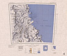
Deverall Island (81°28′S 161°54′E / 81.467°S 161.900°E) is a small ice-covered island, rising above the Ross Ice Shelf just northeast of Beaumont Bay. It was named by the New Zealand Geological Survey Antarctic Expedition (1960–61) for William H. Deverall, a radio operator at Scott Base, 1961.[1] It is considered to be the southernmost island in the world.
See also edit
References edit
- ^ "Deverall Island". Geographic Names Information System. United States Geological Survey, United States Department of the Interior. Retrieved 2012-01-16.
![]() This article incorporates public domain material from "Deverall Island". Geographic Names Information System. United States Geological Survey.
This article incorporates public domain material from "Deverall Island". Geographic Names Information System. United States Geological Survey.