
KNOWPIA
WELCOME TO KNOWPIA

Dewa Mountains 
Summary
Dewa Mountains (Japanese: 出羽山地) is a mountain range that runs north and south on the west side of the Tohoku region of Japan.[2] The mountain range spans Aomori, Akita, and Yamagata prefectures.[2][3][4] The highest peak of the mountain range is Mount Chokai (2,236m).[5]
| Dewa Mountains | |
|---|---|
| 出羽山地 (Japanese) | |
 | |
| Highest point | |
| Peak | Mount Chōkai |
| Elevation | 2,236 m (7,336 ft)[1] |
| Coordinates | 39°30′0″N 140°9′36″E / 39.50000°N 140.16000°E |
| Geography | |
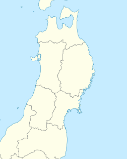 Dewa Mountains  Dewa Mountains Dewa Mountains (Japan) | |
| Country | Japan |
| Prefectures | Aomori Akita Yamagata |
| Parent range | Japanese Alps |
 | |
The range is the focal point for the Akinomine (秋の嶺 "peak of autumn") ritual, which is observed by the Mount Haguro lineage of Shugendō.[6]
See also edit
References edit
- ^ "Japan Ultra-Prominences". Peaklist.org. Retrieved 2015-01-01.
- ^ a b 第2版, ブリタニカ国際大百科事典 小項目事典,デジタル大辞泉,日本大百科全書(ニッポニカ),百科事典マイペディア,精選版 日本国語大辞典,世界大百科事典. "出羽山地とは". コトバンク (in Japanese). Retrieved 2021-05-25.
{{cite web}}: CS1 maint: multiple names: authors list (link) CS1 maint: numeric names: authors list (link) - ^ "でわさんち【出羽山地】 | て | 辞典". 学研キッズネット (in Japanese). Retrieved 2021-05-25.
- ^ "【出羽山地】とは・意味 | エキサイト辞書". エキサイト辞書 (in Japanese). Archived from the original on 2021-05-25. Retrieved 2021-05-25.
- ^ 第2版,世界大百科事典内言及, 日本大百科全書(ニッポニカ),事典・日本の観光資源,国指定史跡ガイド,ブリタニカ国際大百科事典 小項目事典,百科事典マイペディア,デジタル大辞泉,精選版 日本国語大辞典,事典 日本の地域遺産,世界大百科事典. "鳥海山とは". コトバンク (in Japanese). Retrieved 2021-05-25.
{{cite web}}: CS1 maint: multiple names: authors list (link) CS1 maint: numeric names: authors list (link) - ^ Ōuchi, Fumi; 大内典 (2009). "The Lotus Repentance Liturgy of Shugendō: Identification from Vocal Arts". Cahiers d'Extrême-Asie. 18: 169–193. doi:10.3406/asie.2009.1336. ISSN 0766-1177. JSTOR 44167438.