
KNOWPIA
WELCOME TO KNOWPIA

Dogondoutchi Airport 
Summary
Dogondoutchi Airport (ICAO: DRRC) is an airport serving Dogondoutchi, Niger. It is 8 kilometres (5.0 mi) east-northeast of the city centre.
Dogondoutchi Airport | |||||||||||
|---|---|---|---|---|---|---|---|---|---|---|---|
| Summary | |||||||||||
| Airport type | Public | ||||||||||
| Serves | Dogondoutchi | ||||||||||
| Elevation AMSL | 961 ft / 293 m | ||||||||||
| Coordinates | 13°39′45″N 4°06′00″E / 13.66250°N 4.10000°E | ||||||||||
| Map | |||||||||||
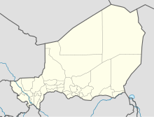 DRRC Location of the airport in Niger | |||||||||||
| Runways | |||||||||||
| |||||||||||
Source: Google Maps[1] | |||||||||||
See also edit
 Aviation portal
- Transport in Niger
- List of airports in Niger
References edit
- ^ Google Maps - Dogondoutchi
External links edit
- OurAirports - Niger
- Great Circle Mapper - Dogondoutchi
- Dogondoutchi Airport
- Google Earth