
KNOWPIA
WELCOME TO KNOWPIA

Doingt 
Summary
Doingt (French pronunciation: [dwɛ̃]) is a commune in the Somme department in Hauts-de-France in northern France.
Doingt | |
|---|---|
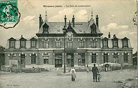 The railway station of Péronne-Flamicourt, in 1909 | |
 Coat of arms | |
Location of Doingt .mw-parser-output .locmap .od{position:absolute}.mw-parser-output .locmap .id{position:absolute;line-height:0}.mw-parser-output .locmap .l0{font-size:0;position:absolute}.mw-parser-output .locmap .pv{line-height:110%;position:absolute;text-align:center}.mw-parser-output .locmap .pl{line-height:110%;position:absolute;top:-0.75em;text-align:right}.mw-parser-output .locmap .pr{line-height:110%;position:absolute;top:-0.75em;text-align:left}.mw-parser-output .locmap .pv>div{display:inline;padding:1px}.mw-parser-output .locmap .pl>div{display:inline;padding:1px;float:right}.mw-parser-output .locmap .pr>div{display:inline;padding:1px;float:left}html.skin-theme-clientpref-night .mw-parser-output .od,html.skin-theme-clientpref-night .mw-parser-output .od .pv>div,html.skin-theme-clientpref-night .mw-parser-output .od .pl>div,html.skin-theme-clientpref-night .mw-parser-output .od .pr>div{background:#000;color:#fff}html.skin-theme-clientpref-night .mw-parser-output .locmap{filter:grayscale(0.6)}@media(prefers-color-scheme:dark){html.skin-theme-clientpref-os .mw-parser-output .locmap{filter:grayscale(0.6)}html.skin-theme-clientpref-os .mw-parser-output .od,html.skin-theme-clientpref-os .mw-parser-output .od .pv>div,html.skin-theme-clientpref-os .mw-parser-output .od .pl>div,html.skin-theme-clientpref-os .mw-parser-output .od .pr>div{background:#000;color:#fff}}  Doingt  Doingt | |
| Coordinates: 49°55′25″N 2°57′58″E / 49.9236°N 2.9661°E | |
| Country | France |
| Region | Hauts-de-France |
| Department | Somme |
| Arrondissement | Péronne |
| Canton | Péronne |
| Intercommunality | Haute Somme |
| Government | |
| • Mayor (2020–2026) | Romuald Helfried[1] |
| Area 1 | 8.61 km2 (3.32 sq mi) |
| Population (2021)[2] | 1,393 |
| • Density | 160/km2 (420/sq mi) |
| Time zone | UTC+01:00 (CET) |
| • Summer (DST) | UTC+02:00 (CEST) |
| INSEE/Postal code | 80240 /80200 |
| Elevation | 47–113 m (154–371 ft) (avg. 150 m or 490 ft) |
| 1 French Land Register data, which excludes lakes, ponds, glaciers > 1 km2 (0.386 sq mi or 247 acres) and river estuaries. | |
Geography edit
Doingt is situated on the D937 and D199 junction, on the banks of the river Somme, some 30 miles (48 km) east of Amiens.
History edit
During World War I the settlement was destroyed. A Commonwealth cemetery is just outside the town. The village and its church has been rebuilt and, in 2023, a crucifix, salvaged from the ruins of the village's church by a British military chaplain after the Battle of the Somme and placed in All Saints' Church, Tinwell in Rutland, England, was returned to the new church.[3]
Population edit
| Year | Pop. | ±% p.a. |
|---|---|---|
| 1968 | 1,542 | — |
| 1975 | 1,564 | +0.20% |
| 1982 | 1,449 | −1.09% |
| 1990 | 1,415 | −0.30% |
| 1999 | 1,383 | −0.25% |
| 2007 | 1,323 | −0.55% |
| 2012 | 1,334 | +0.17% |
| 2017 | 1,427 | +1.36% |
| Source: INSEE[4] | ||
See also edit
References edit
- ^ "Répertoire national des élus: les maires". data.gouv.fr, Plateforme ouverte des données publiques françaises (in French). 2 December 2020.
- ^ "Populations légales 2021". The National Institute of Statistics and Economic Studies. 28 December 2023.
- ^ "Crucifix returned from England to France after 107 years". BBC News. 3 July 2023.
- ^ Population en historique depuis 1968, INSEE
External links edit
Wikimedia Commons has media related to Doingt.
- CWG Cemetery
- Doingt on the Quid website (in French)