
KNOWPIA
WELCOME TO KNOWPIA

Donatyre 
Summary
Donatyre is a village in the district of Avenches of the Canton of Vaud, Switzerland. Since losing its status as an independent municipality on 1 July 2006, it has been part of the municipality of Avenches.[1]
Donatyre | |
|---|---|
 Coat of arms | |
Location of Donatyre .mw-parser-output .locmap .od{position:absolute}.mw-parser-output .locmap .id{position:absolute;line-height:0}.mw-parser-output .locmap .l0{font-size:0;position:absolute}.mw-parser-output .locmap .pv{line-height:110%;position:absolute;text-align:center}.mw-parser-output .locmap .pl{line-height:110%;position:absolute;top:-0.75em;text-align:right}.mw-parser-output .locmap .pr{line-height:110%;position:absolute;top:-0.75em;text-align:left}.mw-parser-output .locmap .pv>div{display:inline;padding:1px}.mw-parser-output .locmap .pl>div{display:inline;padding:1px;float:right}.mw-parser-output .locmap .pr>div{display:inline;padding:1px;float:left}html.skin-theme-clientpref-night .mw-parser-output .od,html.skin-theme-clientpref-night .mw-parser-output .od .pv>div,html.skin-theme-clientpref-night .mw-parser-output .od .pl>div,html.skin-theme-clientpref-night .mw-parser-output .od .pr>div{background:#fff;color:#000}html.skin-theme-clientpref-night .mw-parser-output .locmap{filter:grayscale(0.6)}@media(prefers-color-scheme:dark){html.skin-theme-clientpref-os .mw-parser-output .locmap{filter:grayscale(0.6)}html.skin-theme-clientpref-os .mw-parser-output .od,html.skin-theme-clientpref-os .mw-parser-output .od .pv>div,html.skin-theme-clientpref-os .mw-parser-output .od .pl>div,html.skin-theme-clientpref-os .mw-parser-output .od .pr>div{background:white;color:#000}}  Donatyre 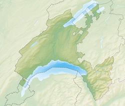 Donatyre | |
| Coordinates: 46°53′N 07°03′E / 46.883°N 7.050°E | |
| Country | Switzerland |
| Canton | Vaud |
| District | Avenches |
| Area | |
| • Total | 1.11 km2 (0.43 sq mi) |
| Elevation | 505 m (1,657 ft) |
| Population (2003) | |
| • Total | 140 |
| • Density | 130/km2 (330/sq mi) |
| Time zone | UTC+01:00 (Central European Time) |
| • Summer (DST) | UTC+02:00 (Central European Summer Time) |
| Postal code(s) | 1582 |
| SFOS number | 5457 |
| ISO 3166 code | CH-VD |
| Surrounded by | Avenches, Misery-Courtion (FR), Villarepos (FR) |
| Website | Profile (in French), |
The village, which follows the old Roman wall of Aventicum,[2] contains a chapel dedicated to Saint Thecla.
References edit