Summary
Dumraha is a village development committee in Sunsari District in the Kosi Zone of south-eastern Nepal. According to the State Reformation Act by the Nepal Government, it now lies in two municipalities; Inaruwa Municipality and Ramdhuni Municipality. The main wards and villages of Dumaraha are Arta, Sitpur, Marchaya, Kansamadan, and Bankulwa. At the time of the 1991 Nepal census, it had a population of 13,215 people living in 2426 individual households.
Dumraha
डुम्राहा | |
|---|---|
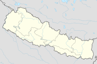
 Dumraha Location in Nepal | |
| Coordinates: 26°39′27″N 87°08′57″E / 26.65737°N 87.14904°E | |
| Country | |
| Zone | Kosi Zone |
| District | Sunsari District |
| Population (1991) | |
| • Total | 13,215 |
| Time zone | UTC+5:45 (Nepal Time) |
Community schools in the district include Shree Tribhuvan Secondary School, Shera Primary School, Thule Mohor Primary School, and Sanischare Secondary School. Private schools include Siddhartha Shikshya Sadan and M.S. Standard English School, The Shera River flows by the side of the Ramdhuni forest past Arta village. Nearby is Ramdhuni Temple. The village is connected by roads but electricity and the development of infrastructure are not as rapid as expected.[1]
Location edit
Dumraha is located at 26.65737 degrees north and 87.14904 degrees east. The neighboring Village Development Committees (VDC) and Municipalities are Ramdhuni Bhasi municipality, Inaruwa municipality, Bhokraha VDC and Prakashpur VDC. The office of Dumraha VDC is about 6 kilometers away from Inaruwa. It's a monsoon-influenced humid subtropical climate.[2]
History edit
Dumraha VDC is historic in the sense that the ethnic groups of Tharu, Musahar, and Dom have been living there for several generations. The name Dumraha may have been named because of the Dom community people living there, as Dumraha can be linguistically broken as "DUM- RAHA" where "DUM" refers to Dom Community, and "RAHA" in Maithali or Tharu language means "staying". So, Dumraha could have been named as "Dom Community People were living there in the past."
Ethnic groups edit
In the past, people from Tharu, Dhanuk, Muhasar and Dom communities were living there. But after 2007 B.S. due to migration of people from the hilly region and later of people from India, the chief ethnic groups are Brahmin, Chhetri, Tharu, Mehata, Newar, Rai, Limbu, Dom, Dhanuk, Musahar etc.
Natural resources edit
Dumraha is rich in natural resources. The soil is appreciably fertile and large amounts of rice, wheat, maize, sugarcane, jute etc are grown and supplied to nearby trade centres.
Ramdhuni Forest which is in Dumraha VDC is rich in timber and Shehara River flows by the side if forest.
References edit
- ^ "Nepal Census 2001". Nepal's Village Development Committees. Digital Himalaya. Archived from the original on 12 October 2008. Retrieved 2 December 2008.
- ^ "Dumraha Map and Weather Forecast". www.worldplaces.net. Retrieved 2020-09-17.


