
KNOWPIA
WELCOME TO KNOWPIA

Dundonnell River 
Summary
The Dundonnell River is a river in Ross and Cromarty, in the Scottish Highlands.
| Dundonnell River | |
|---|---|
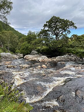 The Dundonnell River at Airigh Ghiorid | |
| Location | |
| Country | Scotland |
| Physical characteristics | |
| Source | |
| • location | Meall Dubh |
| • coordinates | 57°43′23″N 5°11′30″W / 57.723000°N 5.191793°W |
| • elevation | 2,356 ft (718 m) |
| Mouth | |
• location | Little Loch Broom |
• coordinates | 57°50′56″N 5°13′21″W / 57.848970979581765°N 5.22251814648912°W |
• elevation | 0 ft (0 m) |
| Length | 14.4 mi (23.2 km) |
The river rises in a lochan on the slopes of Meall Dubh, before flowing north into the Dundonnell Forest. The A832 road follows its course roughly NNW, before the river flows through Strath Beag and meets Little Loch Broom at its estuary just north-west of Dundonnell.[1]
References edit
- ^ Ordnance Survey. OS Maps Online (Map). 1:25,000. Leisure. Retrieved 8 December 2021.