


Summary
East Manggarai Regency (Indonesian: Kabupaten Manggarai Timur) is a regency in East Nusa Tenggara province of Indonesia. Established on 17 July 2007 (out of the eastern six districts of the original Manggarai Regency), the regency has its seat (capital) in the town of Borong. It covers a land area of 2,391.45 km2. The population at the 2010 Census was 252,754,[2] and at the 2020 Census was 275,603;[3] the official estimate as at mid 2023 was 290,790 (comprising 147,041 males and 143,749 females).[1]
East Manggarai Regency
Kabupaten Manggarai Timur | |
|---|---|
 Seal | |
 Location within East Nusa Tenggara | |
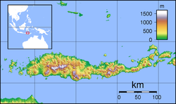 East Manggarai Regency  East Manggarai Regency East Manggarai Regency (Lesser Sunda Islands)  East Manggarai Regency East Manggarai Regency (Indonesia) | |
| Coordinates: 8°33′19″S 120°35′51″E / 8.5553°S 120.5976°E | |
| Country | |
| Province | |
| Capital | Borong |
| Government | |
| • Regent | Yoseph Tote |
| • Vice Regent | Agas Andreas |
| Area | |
| • Total | 923.34 sq mi (2,391.45 km2) |
| Population (mid 2023 estimate)[1] | |
| • Total | 290,790 |
| • Density | 310/sq mi (120/km2) |
| Area code | (+62) 384 |
| Website | manggaraitimurkab |
Tourism edit
The local government is aiming to promote a range of tourist sites including the following:[4]
- Nanga Labang village, on the seashore with pristine beaches
- Lake Air Panas (Hot Water) in Rana Masak
- Gampang Mas village near Borong
- Laka Rana Tojong where the Victoria amazonica giant lily grows.
An additional feature of interest in the regency is the Pota Komodo dragon which has similar traits to the more well-known Komodo dragon found in neighbouring West Manggarai Regency. The population of the Pota Komodo dragon has been declining and there is now concern about conservation of the local dragon population.[5]
International visitors travel through various parts of the district, sometimes liaising with local groups such as village Catholic communities. In late 2012, one visiting Polish couple took the decision to be married in Lait Valley in the Kota Komba area.[6]
Administrative Districts edit
The East Manggarai Regency, when established in 2007, was divided into six districts (kecamatan), Borong and Kota Kombo districts in the south of the regency and Elar, Sambi Rampas, Poco Renata and Lamba Leda districts in the north. However, after 2010 three additional districts (Elar Selatan, Poco Ranaka Timur and Rana Mese) have been created by splitting of existing districts, and in 2021 three more districts were created from existing districts (Kota Komba Utara from part of Kota Komba District, Congkar from part of Sambi Rampas District, and Lamba Leda Utara from part of Lamba Leda District), while Poco Renata and Poco Renata Timur districts were renamed Lamba Leda Selatan and Lamba Leda Timur respectively.
The 12 districts are tabulated below with their areas and their populations at the 2010 Census[2] and the 2020 Census,[3] together with the official estimates as at mid 2023.[1] The table also includes the locations of the administrative centres, the number of administrative villages in each district (a total of 159 rural desa and 17 urban kelurahan), and its post codes.
| Kode Wilayah |
Name of District (kecamatan) |
Area in km2 |
Pop'n Census 2010 |
Pop'n Census 2020 |
Pop'n Estimate mid 2023 |
Admin centre |
No. of villages |
Post codes |
|---|---|---|---|---|---|---|---|---|
| 53.19.01 | Borong | 177.44 | 61,509 | 42,600 | 46,300 | Kota Ndora | 18 (a) | 86571 |
| 53.19.07 | Rana Mese | 209.54 | (b) | 28,900 | 30,700 | Golo Mongkok | 21 | 86570 |
| 53.19.06 | Kota Kombo | 327.79 | 46,171 | 51,300 | 33,200 | Watu Nggene | 11 (a) | 86572 |
| 53.19.10 | Kota Kombo Utara | 183.13 | (c) | (c) | 21,200 | Rana Mbeling | 11 | 86572 |
| 53.19.05 | Elar | 280.74 | 29,981 | 15,100 | 16,000 | Tiwu Kondo | 15 (d) | 86581 |
| 53.19.09 | Elar Selatan (South Elar) |
223.57 | (d) | 17,600 | 18,600 | Lempang Paji | 14 (d) | 86580 |
| 53.19.04 | Sambi Rampas | 288.37 | 26,175 | 27,300 | 14,800 | Pota | 9 (a) | 86584 |
| 53.19.12 | Congkar | 80.14 | (f) | (f) | 13,600 | Watunggong | 11 (a) | 86584 |
| 53.19.02 | Lamba Leda Selatan (South Lamba Leda) |
122.02 | 57,459 | 33,400 | 34,500 | Mandosawu | 24 (a) | 86583 |
| 53.19.08 | Lamba Leda Timur (East Lamba Leda) |
104.24 | (g) | 27,070 | 28,000 | Lawir | 18 | 86585 |
| 53.19.03 | Lamba Leda | 121.85 | 31,449 | 32,600 | 16,200 | Tengku Leda | 13 | 86582 |
| 53.19.11 | Lamba Leda Utara (North Lamba Leda) |
272.63 | (h) | (g) | 17,700 | Satar Padut | 11 | 86582 |
| Totals | 2,391.45 | 252,754 | 275,603 | 290,790 | Borong | 176 |
Notes: (a) including 3 kelurahan. (b) the 2010 population of the new Rana Mese District is included with the figure for Borong District. (c) the 2010 and 2020 populations of the new Kota Komba Utara District are included with the figures for Kota Komba District. (d) including one kelurahan. (e) the 2010 population of the new Elar Selatan District is included with the figure for Elar District. (f) the 2010 and 2020 populations of the new Congkar District are included with the figures for Sambia Rampas District.(g) the 2010 population of the new Lamba Leda Timur District is included with the figure for Lamba Leda Selatan District. (h) the 2010 and 2020 populations of the new Lamba Leda Utara District are included with the figures for Lamba Leda District.
References edit
- ^ a b c Badan Pusat Statistik, Jakarta, 28 February 2024, Kabupaten Manggarai Timur Dalam Angka 2024 (Katalog-BPS 1102001.5319)
- ^ a b Biro Pusat Statistik, Jakarta, 2011.
- ^ a b Badan Pusat Statistik, Jakarta, 2021.
- ^ Markus Makur, 'Nanga Labang in NTT set to become tourist village', The Jakarta Post, 5 May 2011.
- ^ Markus Makur, 'East Nusa Tenggara: Pota komodo population dwindling', The Jakarta Post, 29 June 2013.
- ^ Markus Makur, 'Polish couple get married in remote village', The Jakarta Post, 11 September 2012.