


Summary
East Siang (Pron:/ˈsjæŋ or ˈsɪæŋ/) is an administrative district in the state of Arunachal Pradesh in India.
East Siang district | |
|---|---|
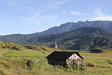
 Siang river entering plains at Ranaghat | |
East Siang districtLocation in Arunachal PradeshCoordinates: .mw-parser-output .geo-default,.mw-parser-output .geo-dms,.mw-parser-output .geo-dec{display:inline}.mw-parser-output .geo-nondefault,.mw-parser-output .geo-multi-punct,.mw-parser-output .geo-inline-hidden{display:none}.mw-parser-output .longitude,.mw-parser-output .latitude{white-space:nowrap}28°04′N 95°20′E / 28.07°N 95.33°E | |
| Country | |
| State | Arunachal Pradesh |
| Government | |
| • Lok Sabha constituencies | Tapir Gao |
| • Vidhan Sabha constituencies | Lombo Tayeng, Kaling Moyong, Ninong Ering |
| Area | |
| • Total | 4,005 km2 (1,546 sq mi) |
| Population (2011) | |
| • Total | 70,956 |
| • Density | 18/km2 (46/sq mi) |
| • Urban | Yes |
| Demographics | |
| • Literacy | 73.5%[1] |
| • Sex ratio | 962[1] |
| Time zone | UTC+05:30 (IST) |
| Major highways | NH-52 |
| Website | eastsiang |
History edit
In 1989 territory was transferred from West Siang district to East Siang.[2] A decade later, in 1999, the district was bifurcated to make Upper Siang district.[2] East Siang district was first settled by Dibu-marang clans and was later driven away by some padam clan (subtribe of adi). Later padam clans accompanied it's close ally pasi and settled near padam mone and balek respectively. Later, due to epidemic (considered as spiritual) in the mone areas padams had to retreat.
Geography edit
The district headquarters are located at Pasighat. East Siang district occupies an area of 4,005 square kilometres (1,546 sq mi),[3] comparatively equivalent to Indonesia's Nias Island.[4]
Divisions edit
There are 5 Arunachal Pradesh Legislative Assembly constituencies located in this district: Panging, Nari-Koyu, Pasighat West, Pasighat East, and Mebo. All of these are part of Arunachal East Lok Sabha constituency.[5] The district consists of 6 circles: Mebo, Namsing, Sile-Oyan, Pasighat, Bilat and Ruksin.
Demographics edit
| Year | Pop. | ±% p.a. |
|---|---|---|
| 1961 | 32,421 | — |
| 1971 | 33,138 | +0.22% |
| 1981 | 55,170 | +5.23% |
| 1991 | 71,864 | +2.68% |
| 2001 | 87,397 | +1.98% |
| 2011 | 99,214 | +1.28% |
| source:[6] | ||
According to the 2011 census East Siang district has a population of 99,214,[7] roughly equal to the nation of Kiribati.[8] This gives it a ranking of 615th in India (out of a total of 640).[7] The district has a population density of 27 inhabitants per square kilometre (70/sq mi) .[7] Its population growth rate over the decade 2001–2011 was 13.3%.[7] East Siang has a sex ratio of 962 females for every 1000 males,[7] and a literacy rate of 73.54%.[7] After division, the residual district has a population of 70,956. Scheduled Tribes make up 46,334 which is 65.30% of the population.[9]
Religion edit
Religions recorded as 'other' in the census, mainly Donyi-Polo, make up 32,728 which is 46.12% of the population. Hinduism is a sizeable minority religion which makes up 23,597 which is 33.26% of the population. Christians make up 11,249 which is 15.85% of the population. Muslims are 2,137 which is 3.01% of the population. Buddhists are 670 which is 0.94% of the population.
Various tribal groups of the Adi people live in various parts of the district. The local people traditionally follow Donyi-Polo, although a sizeable minority have converted to Christianity.
Languages edit
At the time of the 2011 census, 62.78% of the population spoke Adi, 12.17% Nepali, 8.29% Hindi, 5.12% Bengali, 4.82% Bhojpuri, 3.34% Assamese, 1.80% Mishing and 1.32% Boro as their first language.[11]
Flora and fauna edit
In 1978 East Siang district became home to the D’Ering Memorial (Lali) Wildlife Sanctuary, which has an area of 190 km2 (73.4 sq mi).[12]
References edit
- ^ a b "District Census 2011". Census2011.co.in.
- ^ a b Law, Gwillim (25 September 2011). "Districts of India". Statoids. Retrieved 11 October 2011.
- ^ Srivastava, Dayawanti, ed. (2010). "States and Union Territories: Arunachal Pradesh: Government". India 2010: A Reference Annual (54th ed.). New Delhi, India: Additional Director General, Publications Division, Ministry of Information and Broadcasting (India), Government of India. p. 1113. ISBN 978-81-230-1617-7.
- ^ "Island Directory Tables: Islands by Land Area". United Nations Environment Program. 18 February 1998. Archived from the original on 20 February 2018. Retrieved 11 October 2011.
Nias 4,048km2
- ^ "Assembly Constituencies allocation w.r.t District and Parliamentary Constituencies". Chief Electoral Officer, Arunachal Pradesh website. Archived from the original on 13 August 2011. Retrieved 21 March 2011.
- ^ Decadal Variation In Population Since 1901
- ^ a b c d e f "District Census 2011 – East Siang" (PDF). Office of the Registrar General & Census Commissioner, India.
- ^ US Directorate of Intelligence. "Country Comparison:Population". Archived from the original on 13 June 2007. Retrieved 1 October 2011.
Kiribati 100,743 July 2011 est.
- ^ District census 2011 – East Siang
- ^ "C-16 Population By Religion – Arunachal Pradesh". census.gov.in. Office of the Registrar General & Census Commissioner, India.
- ^ 2011 Census of India, Population By Mother Tongue
- ^ Indian Ministry of Forests and Environment. "Protected areas: Arunachal Pradesh". Archived from the original on 23 August 2011. Retrieved 25 September 2011.
External links edit
- Official website