


Summary
Eneabba is a town on the Brand Highway 278 kilometres (173 mi) north of Perth, Western Australia.
| Eneabba Western Australia | |
|---|---|
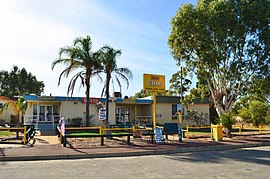 Eneabba Sands Tavern, 2014. | |
 Eneabba | |
 | |
| Coordinates | 29°49′09″S 115°16′09″E / 29.81917°S 115.26917°E |
| Population | 142 (SAL 2021)[1] |
| Established | 1961 |
| Postcode(s) | 6518 |
| Elevation | 99 m (325 ft) |
| Area | 1,407.6 km2 (543.5 sq mi) |
| Location | |
| LGA(s) | Shire of Carnamah |
| State electorate(s) | Moore |
| Federal division(s) | Durack |
The area is famous for its spectacular display of wildflowers in the spring. It is also home to the Iluka Resources mineral sands facility.[2]
The first European visit to the area was in 1839 by the second disastrous George Grey expedition along the west coast. Grey and his party were forced to walk through the area after their boats were lost. On 11 April, Grey discovered and named the Arrowsmith River, after John Arrowsmith the English cartographer.[3]
The next Europeans in the area were government Assistant Surveyor Augustus Charles Gregory and Francis Thomas Gregory (both attached to the department of the Surveyor-General) and their brother Henry Churchman Gregory, on a public-private funded expedition to search for new agricultural land beyond the settled areas. They camped at Eneabba Springs, 14 km (9 mi) east of Eneabba on 14 September 1846, while returning to Perth from the Irwin River.[4]
In 1870 the first settler, William Horsley Rowland, arrived from Greenough. He took up a 1,200 ha (3,000 acres) lease at Eneabba Springs and survived by shepherding, trapping horses and pigs and living on wild game.[5]
The area around Eneabba (also known as the Eneabba sandplain) was opened up for agricultural purposes in the 1950s for a large group of model farms comprising the Eneabba War Service Land Settlement Project.[6] This in turn initiated the need for a town to be developed. The town was gazetted on 27 January 1961.[7]
The name of the town means "ground spring", from the aboriginal name of Eneabba Springs, the site of Rowland's original homestead.[7]
The Warradarge Wind Farm is being constructed southeast of Eneabba.
Climate edit
Eneabba has a Mediterranean climate#Hot-summer mediterranean climate (Köppen Csa).
| Climate data for Eneabba (1981–2010 normals; extremes 1972–2017) | |||||||||||||
|---|---|---|---|---|---|---|---|---|---|---|---|---|---|
| Month | Jan | Feb | Mar | Apr | May | Jun | Jul | Aug | Sep | Oct | Nov | Dec | Year |
| Record high °C (°F) | 47.3 (117.1) |
48.7 (119.7) |
44.9 (112.8) |
40.0 (104.0) |
36.1 (97.0) |
29.0 (84.2) |
29.3 (84.7) |
30.5 (86.9) |
35.4 (95.7) |
41.0 (105.8) |
45.2 (113.4) |
45.9 (114.6) |
48.7 (119.7) |
| Mean daily maximum °C (°F) | 36.3 (97.3) |
36.3 (97.3) |
33.6 (92.5) |
29.6 (85.3) |
24.5 (76.1) |
20.9 (69.6) |
19.6 (67.3) |
20.7 (69.3) |
23.2 (73.8) |
26.8 (80.2) |
30.3 (86.5) |
33.3 (91.9) |
27.9 (82.2) |
| Mean daily minimum °C (°F) | 18.6 (65.5) |
19.4 (66.9) |
18.1 (64.6) |
15.4 (59.7) |
12.4 (54.3) |
10.2 (50.4) |
8.9 (48.0) |
9.0 (48.2) |
9.8 (49.6) |
11.4 (52.5) |
14.0 (57.2) |
16.1 (61.0) |
13.6 (56.5) |
| Record low °C (°F) | 9.2 (48.6) |
8.8 (47.8) |
9.7 (49.5) |
7.6 (45.7) |
4.2 (39.6) |
1.7 (35.1) |
0.5 (32.9) |
2.3 (36.1) |
2.9 (37.2) |
3.4 (38.1) |
5.9 (42.6) |
7.5 (45.5) |
0.5 (32.9) |
| Average precipitation mm (inches) | 8.3 (0.33) |
15.3 (0.60) |
15.5 (0.61) |
22.4 (0.88) |
71.6 (2.82) |
88.0 (3.46) |
93.3 (3.67) |
75.4 (2.97) |
46.8 (1.84) |
22.8 (0.90) |
15.5 (0.61) |
10.4 (0.41) |
486.3 (19.15) |
| Average precipitation days | 1.5 | 2.1 | 2.9 | 5.1 | 10.2 | 12.8 | 14.7 | 13.4 | 10.7 | 6.4 | 4.2 | 2.4 | 86.4 |
| Average afternoon relative humidity (%) | 31 | 30 | 34 | 40 | 47 | 55 | 57 | 54 | 49 | 42 | 38 | 33 | 43 |
| Source: Bureau of Meteorology[8] | |||||||||||||
References edit
- ^ Australian Bureau of Statistics (28 June 2022). "Eneabba (suburb and locality)". Australian Census 2021 QuickStats. Retrieved 28 June 2022.
- ^ Network Published by Railways of Australia Committee May, 1978 p18
- ^ Grey, George (1841). Journals of two expeditions of discovery in North-West and Western Australia, during the years 1837, 38, and 39, describing many newly discovered, important, and fertile districts, with observations on the moral and physical condition of the aboriginal inhabitants, etc. etc. Vol. 2. London: T. and W. Boone. p. 56. Retrieved 17 March 2012.
- ^ Gregory, Augustus Charles; Gregory, Francis Thomas (1884). Journals of Australian Explorations. Brisbane: James C. Beal, Government Printer. Retrieved 6 June 2019.
- ^ Heydon, P.R. (1988). Westward to the Sea – Reminiscences and History of the Carnamah District 1861-1897. Carnamah, Western Australia: Carnamah Historical Society. pp. 118–130. ISBN 0-7316-3629-5.
- ^ "A New W.A. Scheme for Soldier Farms". The West Australian. Vol. 69, no. 20, 737. Perth, WA. 6 January 1953. p. 1. Retrieved 9 April 2016.
- ^ a b Gerritsen, Rupert (December 2010). "Exploring Eneabba" (PDF). Placenames Australia. Sydney, NSW: Australian National Placenames Survey. Retrieved 6 May 2016.
- ^ "Climate Statistics for Eneabba". Bureau of Meteorology. Retrieved 15 September 2018.
External links edit
![]() Media related to Eneabba, Western Australia at Wikimedia Commons
Media related to Eneabba, Western Australia at Wikimedia Commons
- Shire of Carnamah
- The Carnamah-Winchester Database – past residents of Carnamah, Winchester and Eneabba
- The Three Springs Database – past residents of Three Springs, Arrino and Eneabba