
KNOWPIA
WELCOME TO KNOWPIA

Erechim Airport 
Summary
Erechim Airport (IATA: ERM, ICAO: SSER) is the airport serving Erechim, Brazil.
Erechim Airport Aeroporto de Erechim | |||||||||||
|---|---|---|---|---|---|---|---|---|---|---|---|
| Summary | |||||||||||
| Airport type | Public | ||||||||||
| Operator | DAP | ||||||||||
| Serves | Erechim | ||||||||||
| Time zone | BRT (UTC−03:00) | ||||||||||
| Elevation AMSL | 761 m / 2,497 ft | ||||||||||
| Coordinates | 27°39′48″S 052°16′19″W / 27.66333°S 52.27194°W | ||||||||||
| Map | |||||||||||
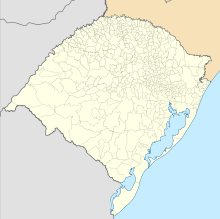 ERM Location in Brazil  ERM ERM (Brazil) | |||||||||||
| Runways | |||||||||||
| |||||||||||
It is operated by DAP.
History edit
In 2010, the entire airport complex received major investments, including renovation of the runway and of the terminal building.[3]
Airlines and destinations edit
No scheduled flights operate at this airport.
Access edit
The airport is located 2 km (1 mi) from downtown Erechim.
See also edit
References edit
External links edit
- Airport information for SSER at Great Circle Mapper. Source: DAFIF (effective October 2006).
- Current weather for SSER at NOAA/NWS
- Accident history for ERM at Aviation Safety Network