


Summary
Essequibo Islands-West Demerara (Region 3) is a region of Guyana. It is situated around the Essequibo River, the largest river in Guyana that lies between the Orinoco and Amazon rivers of South America.
Essequibo Islands-West Demerara
Region 3 | |
|---|---|
Administrative Region | |
 Arrowpoint | |
 Flag | |
 Map of Guyana showing Essequibo Islands-West Demerara region | |
| Country | |
| Regional Capital | Vreed-en-Hoop |
| Area | |
| • Total | 3,755 km2 (1,450 sq mi) |
| Population (2012 census) | |
| • Total | 107,416 |
| • Density | 29/km2 (74/sq mi) |
| [1] | |
It is bordered by the Atlantic Ocean to the north, the region of Demerara-Mahaica and Demerara River to the east, the region of Upper Demerara-Berbice to the south and the region of Pomeroon-Supenaam to the west. In this region are the villages of Parika, Tuschen and Uitvlugt. Along the Essequibo River are 365 islands,[2] of which three of the largest are to be found at the mouth of the Essequibo: Hogg Island, Wakenaam and Leguan.
Population edit
The Government of Guyana has administered three official censuses since the 1980 administrative reforms, in 1980, 1991 and 2002.[3] In 2002, the population of Essequibo Islands-West Demerara was recorded at 103,061 people.[4] Official census records for the population of Essequibo Islands-West Demerara are as follows:
- 2012: 107,416
- 2002: 103,061
- 1991: 95,975
- 1980: 104,750
Communities edit
(including name variants):[5]
- Ampa Bay (Post Ampa)
- Anna Catherina
- Caledonia
- Cornelia Ida
- De Jonge Rachael
- De Willem
- Den Amstel (Den Amstel Village, Amstel)
- Fort Island
- Fredericksburg
- Goed Fortuin
- Hague Backdam (Hague Front/Jib, Hague)
- Harlem
- Hogg Island
- Hopetown
- Hubu
- La Parfaite Harmonie
- Leonora
- Louisiana
- Makouria
- McDoom Village (McDoom)
- Met-en-Meerzorg (Meten-Meer-Zorg)
- Melville
- Morasi
- Nismes
- Noitgedacht
- Parika
- Patentia
- Phoenix Town
- Ruimzight
- Santa Mission (Santa Aratak)
- Sarah
- Saxacalli (Saxakalli, Saxsacali)
- Schoonord (SchoonordSchoon Ord)
- Stanleytown
- Stewartville
- Tuschen
- Uitvlugt
- Vergenoegen
- Greenwich Park
- Barnwell
- Philadelphia
- Good Hope
- Ruby
- Farm
- Vreed-en-Hoop
- Vriesland
- Vive-la-force, Guyana
- Windsor Forest
- Zeeburg
- Zeelandia
Gallery edit
-
 Coconut grove on Wakenaam Island, Essequibo River
 -
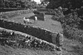 Ruins of Fort Zeelandia on Fort Island, Essequibo River
 -
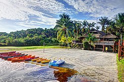
 Parika on the east bank of the Essequibo River
 -
 Santa Mission a nature reserve
 -
 Trail in Wakenaam


See also edit
References edit
- ^ Macmillan Publishers (2009). "Administrative Regions - 2 and 3". Macmillan Junior Atlas: Guyana. Oxford: Macmillan Caribbean. p. 34. ISBN 9780333934173.
- ^ "Home Affairs Minister visits several Essequibo Islands". Guyana Chronicle. 1 June 2009. Retrieved 26 August 2020.
- ^ Beaie, Sonkarley Tiatun (19 September 2007). "Chapter 3: National Redistribution and Internal Migration" (PDF). 2002 Population and Housing Census - Guyana National Report. Bureau of Statistics. p. 51. Archived from the original (PDF) on 17 February 2012. Retrieved 29 August 2012.
- ^ Beaie, Sonkarley Tiatun (19 September 2007). "National Population Trends: Size, Growth and Distribution" (PDF Download). 2002 Population and Housing Census - Guyana National Report. Bureau of Statistics. p. 25. Retrieved 29 August 2012.
- ^ "2012 Population by Village". Statistics Guyana. Retrieved 8 December 2021.
6°42′54″N 58°32′56″W / 6.715056°N 58.54902°W