
KNOWPIA
WELCOME TO KNOWPIA

Estherville Township, Emmet County, Iowa 
Summary
Estherville Township is one of twelve townships in Emmet County, Iowa, United States. As of the 2000 census, its population was 7,077.[1]
Estherville Township | |
|---|---|
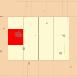 Location in Emmet County | |
| Coordinates: 43°23′03″N 94°50′56″W / 43.38417°N 94.84889°W | |
| Country | |
| State | |
| County | Emmet |
| Area | |
| • Total | 93.63 km2 (36.15 sq mi) |
| • Land | 92.75 km2 (35.81 sq mi) |
| • Water | 0.88 km2 (0.34 sq mi) 0.94% |
| Elevation | 435 m (1,427 ft) |
| Population (2000) | |
| • Total | 7,077 |
| • Density | 76.3/km2 (197.6/sq mi) |
| Time zone | UTC-6 (CST) |
| • Summer (DST) | UTC-5 (CDT) |
| ZIP codes | 51334, 51364 |
| GNIS feature ID | 0467798 |
History edit
Estherville Township takes its name from the county seat of Estherville. It was created prior to 1876, but the exact date is unknown because the records were destroyed in a courthouse fire.[2]
Geography edit
According to the United States Census Bureau, Estherville Township covers an area of 36.15 square miles (93.63 square kilometers); of this, 35.81 square miles (92.75 square kilometers, 99.06 percent) is land and 0.34 square miles (0.88 square kilometers, 0.94 percent) is water.
Cities, towns, villages edit
Adjacent townships edit
- Emmet Township (north)
- Ellsworth Township (northeast)
- Center Township (east)
- High Lake Township (southeast)
- Twelve Mile Lake Township (south)
- Lloyd Township, Dickinson County (southwest)
- Richland Township, Dickinson County (west)
- Superior Township, Dickinson County (northwest)
Cemeteries edit
The township contains these five cemeteries: East Side, Estherville Lutheran, Norwegian, Oak Hill and Saint Patricks.
Major highways edit
Lakes edit
- Cheever Lake
- Fourmile Lake
Landmarks edit
School districts edit
- Estherville Lincoln Central Com School District
Political districts edit
- Iowa's 4th congressional district
- State House District 7
- State Senate District 4
References edit
- United States Census Bureau 2008 TIGER/Line Shapefiles
- United States Board on Geographic Names (GNIS)
- United States National Atlas
External links edit
- US-Counties.com
- City-Data.com