


Summary
Etimesgut, formerly Ahimesut, is a municipality and metropolitan district of Ankara Province, Turkey.[2] Its area is 273 km2,[3] and its population is 614,891 (2022).[1] It mainly consists of large public housing projects, 25 km (16 mi) from Ankara city centre. Its elevation is 843 m (2,766 ft).[4]
Etimesgut | |
|---|---|
District and municipality | |
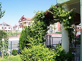 Eryaman neighborhood in Etimesgut | |
 Map showing Etimesgut District in Ankara Province | |
 Etimesgut Location in Turkey  Etimesgut Etimesgut (Turkey Central Anatolia) | |
| Coordinates: 39°56′45″N 32°40′10″E / 39.94583°N 32.66944°E | |
| Country | Turkey |
| Province | Ankara |
| Government | |
| • Mayor | Erdal Beşikçioğlu (CHP) |
| Area | 273 km2 (105 sq mi) |
| Elevation | 843 m (2,766 ft) |
| Population (2022)[1] | 614,891 |
| • Density | 2,300/km2 (5,800/sq mi) |
| Time zone | UTC+3 (TRT) |
| Postal code | 06790 |
| Area code | 0312 |
| Website | www |
History edit
Archaeological research shows habitation since 2000 BC, including a Phrygian settlement in the 8th century BC. Then of course the district began to share the history of the city of Ankara with its Lydians, Persians, Galatians, Ancient Romans, Byzantines and finally Turks. Etimesgut is on the ancient Silk Road to the orient, and still today the road and railway from Ankara to Istanbul pass through the district.
Atatürk was fond of the area and would come here to ride horses and chat to the locals. He had a room in the building that is the public health laboratory today, and many other public buildings, including the hospital and the post office, that were built by his order still stand today.
Etimesgut began as a housing project of 50 homes ordered by Atatürk in 1924 to accommodate Turkish refugees from Bulgaria. From the 1950s, as poverty forced people to migrate from the countryside into the city much illegal housing gecekondu was thrown up in this district. Some of this has been replaced by public housing projects such as Elvankent, Eryaman and Güzelkent and also military and civil service accommodation. However much gecekondu remains, inhabited by working-class people from cities such as Erzurum, many of whom commute to jobs in the city of Ankara. The Islamic terrorist organisation Hizbullah had a number of hidden cells here in the 1990s.[citation needed]
Present edit
The area has only the most basic shops and amenities. Almost all of the housing in Etimesgut is apartment buildings except for the Güzelkent project. As building land in the city of Ankara is now impossible to find, areas like this on the fringes of the city, where building land is cheap, are growing faster and faster.
Public buildings include the sugar factory, the Turkish aviation authority headquarters at Etimesgut Airport and a military training camp.
As for places to shop, Etimesgut has a myriad of shopping malls, with one of the latest of them constructed being also one of the biggest and most popular: Metromall AVM.[5] The building is made up of 5 floors, 2 of them being basement floors, and the second basement being a closed car park.[6] The construction of the shopping mall started in 2014 in Eryaman, Etimesgut, and it finished construction officially in 2017.[7] Both the design and the construction of the building was done by "MSA Mimarlık", an architecture company based in Ankara.[8] Today, the shopping mall is one of the most popular shopping malls in Etimesgut, and increased the property value and overall popularity of Eryaman since its construction.
The local football team Etimesgut Şekerspor has a chequered history; in recent years it has gained popularity by hiring former national team player Sergen Yalçın.
Demographics edit
| Year | Pop. | ±% p.a. |
|---|---|---|
| 2007 | 289,601 | — |
| 2012 | 425,947 | +8.02% |
| 2017 | 566,500 | +5.87% |
| 2022 | 614,891 | +1.65% |
| Source: TÜIK (2007-2022)[1] | ||
Planned security campus edit
The construction of a new building in Etimesgut is underway, to serve as the joint new headquarters of the Turkish National Intelligence Organization (MİT), the Ministry of National Defence, and the Turkish General Staff together with the commands of the Army, Navy and Air Force branches of the Turkish Armed Forces. Reportedly, the move, which will turn the area into a "security campus" comparable to the US Pentagon, is part of measures taken after the failed 2016 Turkish coup d'état attempt.[9][10]
Composition edit
There are 38 neighbourhoods in Etimesgut District:[11]
- 30 Ağustos
- Ahi Mesut
- Alsancak
- Altay
- Aşağıyurtçu
- Atakent
- Atayurt
- Ayyıldız
- Bağlıca
- Bahçekapı
- Balıkuyumcu
- Devlet
- Elvan
- Erler
- Eryaman
- Etiler
- Fatih Sultan
- Fevziye
- Göksu
- Güzelkent
- İstasyon
- Kazım Karabekir
- Oğuzlar
- Orhun
- Piyade
- Şehit Osman Avcı
- Şehitali
- Şeker
- Şeyh Şamil
- Süvari
- Topçu
- Tunahan
- Turkuaz
- Yapracık
- Yavuz Selim
- Yeni Bağlıca
- Yeşilova
- Yukarıyurtçu
Former broadcasting site edit
At Etimesgut, there was a longwave broadcasting station with two masts each 256 metres tall, which worked on 198 kHz. The station, whose masts stood at 39°56′24.07″N 32°40′3.2″E / 39.9400194°N 32.667556°E and at 39°56′14.33″N 32°40′3.03″E / 39.9373139°N 32.6675083°E was built in 1938 and shut-down in 2004 and was afterwards demolished.
Places of interest edit
Image gallery edit
-
 Güzelkent houses
 -
 A house in Güzelkent
 -
 Villas in Güzelkent
 -
 Güzelkent Towers
 -
 Eryaman housing project


References edit
- ^ a b c "Population Of SRE-1, SRE-2, Provinces and Districts". TÜIK. Retrieved 27 June 2023.
- ^ Büyükşehir İlçe Belediyesi, Turkey Civil Administration Departments Inventory. Retrieved 8 June 2023.
- ^ "İl ve İlçe Yüz ölçümleri". General Directorate of Mapping. Retrieved 22 May 2023.
- ^ Falling Rain Genomics, Inc. "Geographical information on Etimesgut, Turkey". Retrieved 27 June 2023.
- ^ "Metromall Alışveriş Merkezi". metromallavm.com/tr. Retrieved 30 March 2023.
- ^ "Metromall AVM fllor plan". metromallavm.com/tr. Retrieved 30 March 2023.
- ^ "Metromall AVM". www.arkiv.com.tr. Retrieved 30 March 2023.
- ^ "msamimarlik". www.msamimarlik.com.tr/. Retrieved 30 March 2023.
- ^ Deniz Çiçek (4 October 2016). "MİT, MSB ve komutanlıklar Etimesgut'ta toplanacak". Haberturk (in Turkish). Retrieved 5 October 2016.
- ^ "'Turkish Pentagon' to be formed in capital Ankara: Report". Hürriyet Daily News. 4 October 2016. Retrieved 5 October 2016.
- ^ Mahalle, Turkey Civil Administration Departments Inventory. Retrieved 22 May 2023.
External links edit
- District governor's official website (in Turkish)
- District municipality's official website (in Turkish)
- Governorship of Etimesgut, Turkey. "Brief history and geography of Etimesgut" (in Turkish). Archived from the original on 2008-03-15.
- Kenthaber.com. "General information on Etimesgut" (in Turkish). Archived from the original on 2011-07-19.