
KNOWPIA
WELCOME TO KNOWPIA

Ettal 
Summary
Ettal is a German municipality and a village in the district of Garmisch-Partenkirchen in Bavaria.
Ettal | |
|---|---|
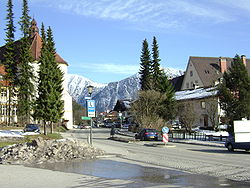 Ettal in March 2008 | |
 Coat of arms | |
Location of Ettal within Garmisch-Partenkirchen district  | |
 Ettal  Ettal | |
| Coordinates: 47°34′N 11°6′E / 47.567°N 11.100°E | |
| Country | Germany |
| State | Bavaria |
| Admin. region | Oberbayern |
| District | Garmisch-Partenkirchen |
| Municipal assoc. | Unterammergau |
| Government | |
| • Mayor (2020–26) | Vanessa Voit[1] (FW) |
| Area | |
| • Total | 140.75 km2 (54.34 sq mi) |
| Elevation | 877 m (2,877 ft) |
| Population (2022-12-31)[2] | |
| • Total | 776 |
| • Density | 5.5/km2 (14/sq mi) |
| Time zone | UTC+01:00 (CET) |
| • Summer (DST) | UTC+02:00 (CEST) |
| Postal codes | 82488 |
| Dialling codes | 08822 |
| Vehicle registration | GAP |
| Website | www |
Geography edit
Ettal is situated in the Oberland area in the Graswangtal between the Loisachtal and Ammertal, approx. 10 km north of Garmisch-Partenkirchen, the district capital, and approx. 4 km southwest of Oberammergau.
Division of the town edit


The town consists of 5 districts
- Ettal
- Graswang
- Linderhof
- Dickelschwaig
- Rahm
See also edit
References edit
- ^ Liste der ersten Bürgermeister/Oberbürgermeister in kreisangehörigen Gemeinden, Bayerisches Landesamt für Statistik, 15 July 2021.
- ^ Genesis Online-Datenbank des Bayerischen Landesamtes für Statistik Tabelle 12411-003r Fortschreibung des Bevölkerungsstandes: Gemeinden, Stichtag (Einwohnerzahlen auf Grundlage des Zensus 2011) (Hilfe dazu).
External links edit
- Official site (in German)