
KNOWPIA
WELCOME TO KNOWPIA

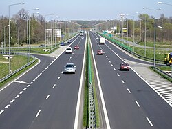
Expressway S52 (Poland) 
Summary
Expressway S52 is a Polish highway under construction, in the Silesian and Lesser Poland voivodeships. Upon completion it will connect the border of the Czech Republic in Cieszyn (along with the D48 motorway) with Kraków. The road is planned to get completed by 2031.[1]
| Droga ekspresowa S52 | ||||
 | ||||
| Route information | ||||
| Part of | ||||
| Maintained by GDDKiA | ||||
| Length | 60.1 km (37.3 mi) 142.9 km (88.8 mi) planned | |||
| Major junctions | ||||
| West end | ||||
| East end | ||||
| Location | ||||
| Country | Poland | |||
| Major cities | Cieszyn, Bielsko-Biała, Kraków | |||
| Highway system | ||||
| ||||
Road numbering edit
Before 2016, the section from Bielsko-Biała to the state border in Cieszyn was part of the expressway S1. This section was renumbered to S52 when the S1 was rerouted over expressway S69.
From 1999 to 2003-2004, the section from Balice to Modlniczka (formerly Kraków Radzikowskiego) was designated as the A41 motorway,[2] and the route number was not shown on maps and road atlases at that time.[3]
Route description edit
Cieszyn - Bielsko-Biała edit
| Number of exit(facility) | Name | Mileage from beginning | History of construction | Notes |
|---|---|---|---|---|
| 1) | Suchy Potok(planned) | 0 km | With environmental decision | To the Bielsko-Biała-Komorowice interchange parallel to |
| 2) | Bielsko-Biała - Rosta | 1.6 km (0.99 mi) | The contract was signed in October 2008, works started in 2009.[4] | |
| 3) | Bielsko-Biała Komorowice |
4.5 km (2.80 mi) | Works from Bielsko-Biała-Rosta to this interchange were allowed on 5.05.2009[4] | |
| 4) | Bielsko-Biała - Andersa | 7.0 km (4.35 mi) | Constructed 06.2003-10.2006[5] | |
| 5) | Bielsko-Biała - Francuska | 8.3 km (5.16 mi) | Exit to the shopping center[6] | |
| 6) | Bielsko-Biała - Wapienica |
9.6 km (5.97 mi) | ||
| 7)(1) | Jasienica | 13.9 km (8.64 mi) | Exit to rest area(westbound)(restaurant, petrol station); interchange both ways[6] | |
| 8)(2) | Świętoszówka | 16.4 km (10.19 mi) | Constructed 11.2004-11.2006[5] | Exit to rest area(eastbound)(restaurant, petrol station); exit eastbound only[6] |
| 9)(3) | No name | 20.7 km (12.86 mi) | Exit to rest area(eastbound)(restaurant, petrol station); exit eastbound only, exit to Grodziec via a gravel road[6] | |
| 10) | Skoczów-I | 22.4 km (13.92 mi) | Constructed 06.2003-11.2007[5] | Construction was delayed because of the bankruptcy of the first contractor[6] |
| 11) | Skoczów-II |
23.3 km (14.48 mi) | ||
| 12) | MOP Gumna | 31.7 km (19.70 mi) | Constructed 10.2002-10.2005[5] | Rest area(restaurant, petrol station)[5][6] |
| 13) | Cieszyn Wschód | 33.0 km (20.51 mi) | Constructed 1991–1995, renovation 11.2006-10.2007[5] | |
| (4) | MOP Cieszyn | 35.3 km (21.93 mi) | Rest area(restaurant, petrol station, motel)[6] | |
| 14) | Cieszyn Zachód |
36.3 km (22.56 mi) | ||
| 15) | Cieszyn Pastwiska | 36.8 km (22.87 mi) | Last interchange before the border, exit only westbound, entrance only eastbound. | |
| Former border checkpoint "Cieszyn" | 37.4 km (23.24 mi) | Entrance to Czech Republic | ||
| 38.3 km (23.80 mi)[6] | Bridge over the Olza river[6] |
Bielsko-Biała - Kraków edit
See also edit
References edit
- ^ https://www.gov.pl/web/infrastruktura/rzadowy-program-budowy-drog-krajowych-do-2030-r-z-perspektywa-do-2033-r
- ^ Rozporządzenie Rady Ministrów z dnia 15 grudnia 1998 r. w sprawie ustalenia wykazu dróg krajowych i wojewódzkich [Regulation of the Council of Ministers of December 15, 1998 on establishing the list of national and voivodeship roads], Dz. U. z 1998 r. Nr 160, poz. 1071
- ^ This section was usually shown as an unnumbered motorway or as part of Expressway S7, although in some studies it was assigned to national road 94.
- ^ a b "S1/S69 Północno-Wschodnia Obwodnica Bielska-Białej :: Generalna Dyrekcja Dróg Krajowych i Autostrad - Serwis informacyjny". www.gddkia.gov.pl. Retrieved 2015-11-20.
- ^ a b c d e f "S1 Bielsko-Biała - Cieszyn :: Generalna Dyrekcja Dróg Krajowych i Autostrad - Serwis informacyjny". www.gddkia.gov.pl. Retrieved 2015-11-20.
- ^ a b c d e f g h i "Mapy Google". Mapy Google. Retrieved 2015-11-20.