
KNOWPIA
WELCOME TO KNOWPIA

Fiennes, Pas-de-Calais 
Summary
Fiennes (French pronunciation: [fjɛn]) is a commune in the Pas-de-Calais department in the Hauts-de-France region of France.[3]
Fiennes | |
|---|---|
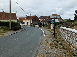 The entrance to the commune | |
 Coat of arms | |
Location of Fiennes .mw-parser-output .locmap .od{position:absolute}.mw-parser-output .locmap .id{position:absolute;line-height:0}.mw-parser-output .locmap .l0{font-size:0;position:absolute}.mw-parser-output .locmap .pv{line-height:110%;position:absolute;text-align:center}.mw-parser-output .locmap .pl{line-height:110%;position:absolute;top:-0.75em;text-align:right}.mw-parser-output .locmap .pr{line-height:110%;position:absolute;top:-0.75em;text-align:left}.mw-parser-output .locmap .pv>div{display:inline;padding:1px}.mw-parser-output .locmap .pl>div{display:inline;padding:1px;float:right}.mw-parser-output .locmap .pr>div{display:inline;padding:1px;float:left}html.skin-theme-clientpref-night .mw-parser-output .od,html.skin-theme-clientpref-night .mw-parser-output .od .pv>div,html.skin-theme-clientpref-night .mw-parser-output .od .pl>div,html.skin-theme-clientpref-night .mw-parser-output .od .pr>div{background:#000;color:#fff}html.skin-theme-clientpref-night .mw-parser-output .locmap{filter:grayscale(0.6)}@media(prefers-color-scheme:dark){html.skin-theme-clientpref-os .mw-parser-output .locmap{filter:grayscale(0.6)}html.skin-theme-clientpref-os .mw-parser-output .od,html.skin-theme-clientpref-os .mw-parser-output .od .pv>div,html.skin-theme-clientpref-os .mw-parser-output .od .pl>div,html.skin-theme-clientpref-os .mw-parser-output .od .pr>div{background:#000;color:#fff}}  Fiennes  Fiennes | |
| Coordinates: 50°49′38″N 1°49′33″E / 50.8272°N 1.8258°E | |
| Country | France |
| Region | Hauts-de-France |
| Department | Pas-de-Calais |
| Arrondissement | Calais |
| Canton | Calais-2 |
| Intercommunality | CC Pays d'Opale |
| Government | |
| • Mayor (2020–2026) | Eloi Bonningues[1] |
| Area 1 | 11.64 km2 (4.49 sq mi) |
| Population (2021)[2] | 852 |
| • Density | 73/km2 (190/sq mi) |
| Time zone | UTC+01:00 (CET) |
| • Summer (DST) | UTC+02:00 (CEST) |
| INSEE/Postal code | 62334 /62132 |
| Elevation | 71–166 m (233–545 ft) (avg. 92 m or 302 ft) |
| 1 French Land Register data, which excludes lakes, ponds, glaciers > 1 km2 (0.386 sq mi or 247 acres) and river estuaries. | |
Geography edit
A farming village located 16 km (10 miles) south of Calais, at the junction of the D250, D232 and D151 roads.
Population edit
| Year | Pop. | ±% p.a. |
|---|---|---|
| 1968 | 747 | — |
| 1975 | 682 | −1.29% |
| 1982 | 739 | +1.15% |
| 1990 | 760 | +0.35% |
| 1999 | 813 | +0.75% |
| 2007 | 859 | +0.69% |
| 2012 | 897 | +0.87% |
| 2017 | 891 | −0.13% |
| Source: INSEE[4] | ||
Places of interest edit
- The church of St. Martin, dating from the fifteenth century.
- The ruins of a castle, originally destroyed in 1320, rebuilt and destroyed again in 1543
See also edit
References edit
- ^ "Répertoire national des élus: les maires". data.gouv.fr, Plateforme ouverte des données publiques françaises (in French). 9 August 2021.
- ^ "Populations légales 2021". The National Institute of Statistics and Economic Studies. 28 December 2023.
- ^ INSEE commune file
- ^ Population en historique depuis 1968, INSEE
Wikimedia Commons has media related to Fiennes.