
KNOWPIA
WELCOME TO KNOWPIA

Fishermans Airfield 
Summary
Fishermans Airfield (also known as Daugo Island Airfield) is a former World War II airfield near Port Moresby, Papua New Guinea. It was part of a multiple-airfield complex in the Port Moresby area, located offshore of Port Moresby. The island's name is derived from the names of the island's two villages - Dag (on the western tip) and Ugo (eastern tip). It is also known as Fisherman's Island.
| Fishermans Airfield Daugo Island Airfield  | |
|---|---|
| Part of Fifth Air Force | |
Located near Port Moresby, Papua New Guinea
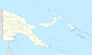 Fishermans Airfield Fishermans Airfield (Papua New Guinea) | |
| Coordinates | 09°30′47.64″S 147°03′02.06″E / 9.5132333°S 147.0505722°E |
| Type | Military airfield |
| Site information | |
| Controlled by | United States Army Air Forces |
| Site history | |
| Built | 1944 |
| In use | 1944 |
The airfield on the island was built by the RAAF c. 1944 as an emergency airfield. It was abandoned and has been disused since the war.
See also edit
- USAAF in the Southwest Pacific
- Port Moresby Airfield Complex
References edit
![]() This article incorporates public domain material from the Air Force Historical Research Agency
This article incorporates public domain material from the Air Force Historical Research Agency
- Maurer, Maurer (1983). Air Force Combat Units Of World War II. Maxwell AFB, Alabama: Office of Air Force History. ISBN 0-89201-092-4.
- www.pacificwrecks.com
External links edit