


Summary
Fjotland is a former municipality in the old Vest-Agder county, Norway. The 600-square-kilometre (230 sq mi) municipality existed from 1838 until 1841 and again from 1858 until its dissolution in 1963. The administrative centre was the village of Fjotland where Fjotland Church is located. The municipality covered the northern part of the Kvinesdalen valley in the present-day municipality of Kvinesdal.[2]
Fjotland Municipality
Fjotland herred | |
|---|---|
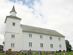 View of the municipal church | |
 Vest-Agder within Norway | |
 Fjotland within Vest-Agder | |
| Coordinates: 58°31′30″N 06°59′34″E / 58.52500°N 6.99278°E | |
| Country | Norway |
| County | Vest-Agder |
| District | Lister |
| Established | 1 Jan 1838 |
| • Created as | Formannskapsdistrikt |
| Disestablished | 1841 |
| • Succeeded by | Kvinesdal Municipality |
| Re-established | 1 Jan 1858 |
| • Preceded by | Kvinesdal Municipality |
| Disestablished | 1 Jan 1963 |
| • Succeeded by | Kvinesdal Municipality |
| Administrative centre | Fjotland |
| Area (upon dissolution) | |
| • Total | 600 km2 (200 sq mi) |
| Population (1963) | |
| • Total | 1,244 |
| • Density | 2.1/km2 (5.4/sq mi) |
| Time zone | UTC+01:00 (CET) |
| • Summer (DST) | UTC+02:00 (CEST) |
| ISO 3166 code | NO-1036[1] |
Data from Statistics Norway | |
History edit
The parish of Fjotland was established as a municipality on 1 January 1838 (see formannskapsdistrikt law), but the municipality was short-lived. In 1841, Fjotland (population: 980) was merged into the neighboring municipality of Kvinesdal. This union, however, only lasted until 1858 when Fjotland was separated to form its own municipality again. At that time, Fjotland had a population of 1,044.[3]
On 1 January 1874, an unpopulated area of Fjotland was transferred to neighboring Sirdal municipality. On 1 January 1903, a small area of Sirdal (population: 63) was transferred to Fjotland. During the 1960s, many Norwegian municipalities were consolidated due to the work of the Schei Committee. On 1 January 1963, Fjotland (population: 1,244) was dissolved and it was merged with Kvinesdal (again) and Feda municipality to form a new, larger municipality of Kvinesdal.[3]
Name edit
The municipality (originally the parish) is named after the old Fjotland farm (Old Norse: Fjósaland). The first element is the plural genitive case of the word fjós which means "cow barn". The last element is land which means "land" or "district".[4]
Government edit
While it existed, this municipality was responsible for primary education (through 10th grade), outpatient health services, senior citizen services, unemployment, social services, zoning, economic development, and municipal roads. During its existence, this municipality was governed by a municipal council of directly elected representatives. The mayor was indirectly elected by a vote of the municipal council.[5]
Municipal council edit
The municipal council (Herredsstyre) of Fjotland was made up of representatives that were elected to four year terms. The tables below show the historical composition of the council by political party.
| Party name (in Norwegian) | Number of representatives | |
|---|---|---|
| Christian Democratic Party (Kristelig Folkeparti) | 8 | |
| Centre Party (Senterpartiet) | 4 | |
| Liberal Party (Venstre) | 5 | |
| Total number of members: | 17 | |
| Party name (in Norwegian) | Number of representatives | |
|---|---|---|
| Labour Party (Arbeiderpartiet) | 6 | |
| Christian Democratic Party (Kristelig Folkeparti) | 4 | |
| Farmers' Party (Bondepartiet) | 3 | |
| Liberal Party (Venstre) | 3 | |
| Local List(s) (Lokale lister) | 1 | |
| Total number of members: | 17 | |
| Party name (in Norwegian) | Number of representatives | |
|---|---|---|
| Labour Party (Arbeiderpartiet) | 3 | |
| Christian Democratic Party (Kristelig Folkeparti) | 4 | |
| Farmers' Party (Bondepartiet) | 3 | |
| Liberal Party (Venstre) | 2 | |
| Local List(s) (Lokale lister) | 4 | |
| Total number of members: | 16 | |
| Party name (in Norwegian) | Number of representatives | |
|---|---|---|
| Labour Party (Arbeiderpartiet) | 4 | |
| Christian Democratic Party (Kristelig Folkeparti) | 4 | |
| Local List(s) (Lokale lister) | 8 | |
| Total number of members: | 16 | |
| Party name (in Norwegian) | Number of representatives | |
|---|---|---|
| Labour Party (Arbeiderpartiet) | 9 | |
| Joint list of the Liberal Party (Venstre) and the Radical People's Party (Radikale Folkepartiet) | 4 | |
| Local List(s) (Lokale lister) | 3 | |
| Total number of members: | 16 | |
| Party name (in Norwegian) | Number of representatives | |
|---|---|---|
| Labour Party (Arbeiderpartiet) | 6 | |
| Farmers' Party (Bondepartiet) | 4 | |
| Liberal Party (Venstre) | 6 | |
| Total number of members: | 16 | |
| Note: Due to the German occupation of Norway during World War II, no elections were held for new municipal councils until after the war ended in 1945. | ||
See also edit
References edit
- ^ Bolstad, Erik; Thorsnæs, Geir, eds. (26 January 2023). "Kommunenummer". Store norske leksikon (in Norwegian). Kunnskapsforlaget.
- ^ Store norske leksikon. "Fjotland – tidligere kommune" (in Norwegian). Retrieved 14 September 2016.
- ^ a b Jukvam, Dag (1999). Historisk oversikt over endringer i kommune- og fylkesinndelingen (PDF) (in Norwegian). Statistisk sentralbyrå. ISBN 9788253746845.
- ^ Rygh, Oluf (1912). Norske gaardnavne: Lister og Mandals amt (in Norwegian) (9 ed.). Kristiania, Norge: W. C. Fabritius & sønners bogtrikkeri. p. 276.
- ^ Hansen, Tore; Vabo, Signy Irene, eds. (20 September 2022). "kommunestyre". Store norske leksikon (in Norwegian). Kunnskapsforlaget. Retrieved 3 August 2023.
- ^ "Kommunevalgene og Ordførervalgene 1959" (PDF) (in Norwegian). Oslo: Statistisk sentralbyrå. 1960. Retrieved 21 November 2020.
- ^ "Kommunevalgene og Ordførervalgene 1955" (PDF) (in Norwegian). Oslo: Statistisk sentralbyrå. 1957. Retrieved 21 November 2020.
- ^ "Kommunevalgene og Ordførervalgene 1951" (PDF) (in Norwegian). Oslo: Statistisk sentralbyrå. 1952. Retrieved 21 November 2020.
- ^ "Kommunevalgene og Ordførervalgene 1947" (PDF) (in Norwegian). Oslo: Statistisk sentralbyrå. 1948. Retrieved 21 November 2020.
- ^ "Kommunevalgene og Ordførervalgene 1945" (PDF) (in Norwegian). Oslo: Statistisk sentralbyrå. 1947. Retrieved 21 November 2020.
- ^ "Kommunevalgene og Ordførervalgene 1937" (PDF) (in Norwegian). Oslo: Statistisk sentralbyrå. 1938. Retrieved 21 November 2020.
External links edit
- 1960 census and map of the municipality (in Norwegian)