
KNOWPIA
WELCOME TO KNOWPIA

Flattop Mountain (North Carolina) 
Summary
Flattop Mountain is a mountain in the North Carolina High Country, at the village of Sugar Mountain. It is wholly in the Pisgah National Forest. Its elevation reaches 4,944 feet (1,507 m). Feeder streams from the mountain flow directly into the Linville River, except along the north slope where Flattop Creek flows directly into the Elk River; the mountain is partitioned by the Eastern Continental Divide.
| Flattop Mountain | |
|---|---|
 Flattop Mountain viewed from Grandfather Mountain | |
| Highest point | |
| Elevation | 4,944 ft (1,507 m)[1] |
| Coordinates | 36°06′54″N 81°51′42″W / 36.11500°N 81.86167°W[1] |
| Geography | |
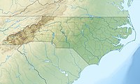 Flattop Mountain Location in North Carolina | |
| Location | Avery County, North Carolina, U.S. |
| Parent range | Blue Ridge Mountains |
| Topo map | USGS Grandfather Mountain |
Because of its adjacent proximity, it has been mistaken as part of Sugar Mountain.
Attractions edit
Linville Ridge Golf and Country Club is open late Spring to early Fall; it is situated on the summit of Flattop Mountain.
See also edit
References edit
Wikimedia Commons has media related to Flattop Mountain (North Carolina).
- ^ a b "Flattop Mountain". Geographic Names Information System. United States Geological Survey, United States Department of the Interior. Retrieved 2010-03-06.