


Summary
Flightradar24 is a Swedish Internet-based service that shows real-time aircraft flight tracking information on a map. It includes flight tracking information, origins and destinations, flight numbers, aircraft types, positions, altitudes, headings and speeds. It can also show time-lapse replays of previous tracks and historical flight data by airline, aircraft, aircraft type, area, or airport.[2] It aggregates data from multiple sources, but, outside of the United States, mostly from crowdsourced information gathered by volunteers with ADS-B receivers and from satellite-based ADS-B receivers.[3]
 | |
Type of site | Aircraft tracking |
|---|---|
| Available in | English |
| Headquarters | Stockholm, Sweden |
| Country of origin | Sweden |
| Owner | Flightradar24 AB |
| Revenue | 214.8m SEK (2021)[1] |
| URL | www |
| Commercial | Partially |
| Registration | Freemium |
| Launched | 2006 |
| Current status | Active |
The service is available via a web page or mobile device apps. The Guardian considers the site to be "authoritative".[4]
It is the largest ADS-B network in the world with over 40,000 connected receivers. Over 200,000 flights tracked per day, with over 4 million users per day. It is also used by most major airlines and others in the aviation industry, including Airbus, Boeing, and Embraer.[5]
History edit
The service was founded by two Swedish aviation enthusiasts in 2006[6] as Flygbilligt.com[7] and later Flygradar.nu[8] for Northern and Central Europe. The service was opened in 2009, allowing anyone with a suitable ADS-B receiver to contribute data.[6]
The service received extensive exposure in 2010, when international media relied on it to describe the flight disruption over the North Atlantic and Europe caused by the Eyjafjallajökull volcano eruptions.[9][10][11] Flightradar24 came at the turn of the month July–August 2010 as an iOS application.[12]
In 2014, it was used by multiple major news outlets following several high-profile crashes: in March after the disappearance of Malaysia Airlines Flight 370,[13] in July after Malaysia Airlines Flight 17 was shot down over Ukraine,[14] and in December when Indonesia AirAsia Flight 8501 went missing. Flightradar24 reported that its web traffic increased to around 50 times normal, which caused some access congestion to users.[citation needed]
In November 2015, The Guardian newspaper reported that Metrojet Flight 9268 en route to Saint Petersburg from Sharm el-Sheikh International Airport had broken up in the air based on information available from Flightradar24.[4]
From 3 March 2020, ADS-B data collected by satellite was made available to all users. Aircraft located using satellite data are coloured blue on the map, and yellow if located by terrestrial receivers.[15]
In February 2022, during the Russian invasion of Ukraine, the website crashed due to an influx of visitors tracking flights in and around Ukraine.[16]
In August 2022, the plane carrying Nancy Pelosi to Taiwan, SPAR19, became the most tracked flight to date, tracked by over 708,000 people as it landed in Taipei, with over 2,900,000 following at least a portion of the flight.[17]
In September 2022, the plane carrying the coffin of Queen Elizabeth II was attempted to be tracked by 6,000,000 users in the first minute after the transponder activated, with 4,790,000 following a portion of the flight, becoming the most tracked flight of all time. The website processed 76,200,000 requests related to the flight over its course.[18][19] Initially, the site crashed due to the sheer number of users.[20]
In 2023, Flightradar 24 collaborated with Infinite Flight to offer detailed 2D and 3D models as well as liveries of the airlines.[21]
Tracking edit
Flightradar24 aggregates data from six sources:[22]
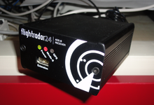
- Automatic dependent surveillance – broadcast (ADS-B). The principal source is a large number of ground-based ADS-B receivers, which collect data from any aircraft in their local area that are equipped with an ADS-B transponder and feed this data to the internet in real time. The aircraft-based transponders use the GPS and other flight data input to transmit signals containing aircraft registration, position, altitude, velocity and other flight data. As of 2019, about 80% of aircraft in Europe are equipped with ADS-B and 60% in the US. Airbus aircraft are ADS-B equipped but Boeing 707, 717, 727, 737-200, 747-100, 747-200, 747SP do not come equipped and are not generally visible unless retrofitted by their operators. Typical ADS-B receivers include Kinetic Avionic's SBS-1 and AirNav-systems's AirNav and these receivers are run by volunteers, mostly aviation enthusiasts. ADS-B signals can also be received and uploaded by a low-cost Software-defined radio. As of 2023, Flightradar24 has the largest ADS-B network in the world with over 40,000 connected receivers.[6]
- Multilateration (MLAT): The second major source is multilateration using Flightradar24 receivers. All aircraft types will be visible in areas covered by MLAT, even without ADS-B, but while 99% of Europe is covered, only parts of the US are. At least four receivers are needed to calculate the position of an aircraft.[22]
- Satellite: Satellites equipped with ADS-B receivers collect data from aircraft outside of Flightradar24's terrestrial ADS-B network coverage area and send that data to the Flightradar24 network.
- US/Canada radar data
- FLARM: A simpler version of ADS-B with a shorter range, primarily used by smaller aircraft, in most cases, gliders. The range of a FLARM receiver is between 20 and 100 kilometres (12 and 62 mi; 11 and 54 nmi).
- Federal Aviation Administration: The shortfall in the US is mostly made up from five minute delayed data from the Federal Aviation Administration (FAA) but this may not include aircraft registration and other information.
Privacy edit
The site blocks some ADS-B information from display for "security and privacy" purposes.[22] For instance, the position of the Japanese Air Force One aircraft used by the Japanese emperor and prime minister was visible on the site until August 2014, when the Japanese Ministry of Defense requested that the information be blocked.[23] This has subsequently meant that the aircraft no longer has its flight track posted online or on the site.
See also edit
References edit
- ^ "Swedish Register Commerce". Allabolag. Retrieved 30 June 2022.
- ^ "About flightradar24.com - a site with high-flying plans!". 24 May 2010. Archived from the original on 24 May 2010. Retrieved 24 June 2022.
- ^ "How flight tracking works". flightradar24.com. Retrieved 28 July 2023.
- ^ a b Siddique, Haroon; Luhn, Alec (1 November 2015). "Russian plane 'broke up in air' before Sinai crash". The Guardian. Retrieved 1 November 2015.
- ^ Flightradar24. "Live Flight Tracker - Real-Time Flight Tracker Map". Flightradar24. Retrieved 11 September 2023.
{{cite web}}: CS1 maint: numeric names: authors list (link) - ^ a b c "About". FlightRadar24. Retrieved 11 September 2023.
- ^ "Archive.org". flygbilligt.com. Archived from the original on 17 November 2006.
- ^ "Archive.org". flygradar.nu. Archived from the original on 15 July 2009.
- ^ "Icelandic volcano: UK flight disruption". The Guardian. 15 April 2010. Retrieved 12 April 2015.
- ^ "Nu stoppas flygen" [Planes being stopped now] (in Swedish). Expressen. 15 April 2010. Archived from the original on 25 May 2012. Retrieved 26 March 2015.
- ^ "El norte de Europa se recupera" [Northern Europe recovers] (in Spanish). El País. 19 April 2010. Retrieved 26 March 2015.
- ^ ""Flightradar24 Pro - iTunes". Läst 6 juli 2010". iTunes.
- ^ "Malaysia Airlines MH370 disappears from air traffic map". BBC News. 11 March 2014. Retrieved 26 March 2015.
- ^ "Malaysia Airlines MH17 flight path map". The Guardian. 18 July 2014. Retrieved 18 July 2014.
- ^ "Satellite-based ADS-B data now available to all Flightradar24 users". Flightradar24 Blog. 12 March 2020. Retrieved 14 March 2020.
- ^ "Flight tracker Flightradar24 crash caused by 'international interest' in Ukraine, Russia conflict". ZDNET.
- ^ "SPAR19 becomes the most tracked flight of all time". Flightradar24 Blog. 2 August 2022. Retrieved 4 August 2022.
- ^ "FlightRadar website crashes as millions log on to follow Queen's final flight". LADbible. Retrieved 13 September 2022.
- ^ Flightradar24. "Live Flight Tracker - Real-Time Flight Tracker Map". Flightradar24. Retrieved 13 September 2022.
{{cite web}}: CS1 maint: numeric names: authors list (link) - ^ Codd, Toby (13 September 2022). "FlightRadar24 crashes as Queen's plane travels to London". GloucestershireLive. Retrieved 14 September 2022.
- ^ Petchenik, Ian (11 October 2023). "The new Flightradar24 3D view is amazing". Flightradar24 Blog. Retrieved 6 November 2023.
- ^ a b c "How it works". Flightradar24. Retrieved 26 July 2014.
- ^ 政府機のルート筒抜け アプリに位置情報など表示 (in Japanese). Nihon Keizai Shimbun. 4 September 2014. Retrieved 4 September 2014.