


Summary
40°13′23″N 123°38′36″W / 40.22306°N 123.64333°W
Fort Seward | |
|---|---|
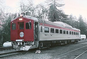 Northwestern Pacific Railroad train at Fort Seward in 1971 | |
 Fort Seward Location in California  Fort Seward Fort Seward (the United States) | |
| Coordinates: 40°13′23″N 123°38′36″W / 40.22306°N 123.64333°W | |
| Country | United States |
| State | California |
| County | Humboldt County |
| Elevation | 328 ft (100 m) |
Fort Seward is an unincorporated community in Humboldt County, California.[1] It is located on the Eel River 3.5 miles (5.6 km) north-northwest of Alderpoint,[2] at an elevation of 328 feet (100 m).[1] The name honors William H. Seward, Secretary of State under President Abraham Lincoln.[2]
History edit
A military camp called Fort Seward[3] was established during the Bald Hills War on September 25, 1861, by Major Charles S. Lovell following a series of skirmishes with the Indians along the Eel River. It was built on the location recommended by Lieutenant Joseph B. Collins, U.S. 4th Infantry Regiment:
- "The best position for a post is, in my opinion, on Eel River, near the head of Larrabee Creek, about sixty-five miles southeast from Fort Humboldt. It should be built immediately, and garrisoned by at least one full company, with a sufficient number of mules and riding saddles to mount a party large enough (say thirty) to follow rapidly and chastise all Indians that may commit depredations within fifty miles of it. This I believe will soon put a stop to all depredations and give ample security to the inhabitants and their property. Without a post but little can be accomplished and proper protection is almost impossible. The roads will be good for pack animals during the dry season, and the facilities for building good; that is, for small dry houses."[4]
Fort Seward was decommissioned in 1862.[2] It was later the site where the captured Lassic Wailaki leader during the Bald Hills War and his men were killed by local militiamen in January 1863.[5]
A post office operated at Fort Seward from 1912 to 1972.[2] Fort Seward was served by passenger service on the Northwestern Pacific Railroad until 1971.
References edit
- ^ a b c U.S. Geological Survey Geographic Names Information System: Fort Seward, California
- ^ a b c d Durham, David L. (1998). California's Geographic Names: A Gazetteer of Historic and Modern Names of the State. Clovis, Calif.: Word Dancer Press. p. 62. ISBN 1-884995-14-4.
- ^ The California State Military Museum, Historic California Posts:Fort Seward (Camp on the Eel River)
- ^ Correspondence Relating to the Fourth U.S. Infantry, Operations on the Pacific, 1861
- ^ Lynette Mullen, "A deadly "cold", January 23, 1863, Humboldt Times quoted in Lynette's NorCal History Blog, February 5, 2010, accessed July 8, 2011