


Summary
Fouesnant (French pronunciation: [fwɛnɑ̃]; Fouenant or Fouen in Breton) is a commune in the Finistère department of Brittany in north-western France. Fouesnant is bordered to the south by the Baie de La Forêt.
Fouesnant
Fouenant | |
|---|---|
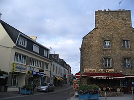 Rue de Cornouaille in Fouesnant | |
 Flag  Coat of arms | |
Location of Fouesnant .mw-parser-output .locmap .od{position:absolute}.mw-parser-output .locmap .id{position:absolute;line-height:0}.mw-parser-output .locmap .l0{font-size:0;position:absolute}.mw-parser-output .locmap .pv{line-height:110%;position:absolute;text-align:center}.mw-parser-output .locmap .pl{line-height:110%;position:absolute;top:-0.75em;text-align:right}.mw-parser-output .locmap .pr{line-height:110%;position:absolute;top:-0.75em;text-align:left}.mw-parser-output .locmap .pv>div{display:inline;padding:1px}.mw-parser-output .locmap .pl>div{display:inline;padding:1px;float:right}.mw-parser-output .locmap .pr>div{display:inline;padding:1px;float:left}html.skin-theme-clientpref-night .mw-parser-output .od,html.skin-theme-clientpref-night .mw-parser-output .od .pv>div,html.skin-theme-clientpref-night .mw-parser-output .od .pl>div,html.skin-theme-clientpref-night .mw-parser-output .od .pr>div{background:#000;color:#fff}html.skin-theme-clientpref-night .mw-parser-output .locmap{filter:grayscale(0.6)}@media(prefers-color-scheme:dark){html.skin-theme-clientpref-os .mw-parser-output .locmap{filter:grayscale(0.6)}html.skin-theme-clientpref-os .mw-parser-output .od,html.skin-theme-clientpref-os .mw-parser-output .od .pv>div,html.skin-theme-clientpref-os .mw-parser-output .od .pl>div,html.skin-theme-clientpref-os .mw-parser-output .od .pr>div{background:#000;color:#fff}}  Fouesnant  Fouesnant | |
| Coordinates: 47°53′39″N 4°00′39″W / 47.8942°N 4.0108°W | |
| Country | France |
| Region | Brittany |
| Department | Finistère |
| Arrondissement | Quimper |
| Canton | Fouesnant |
| Intercommunality | Pays Fouesnantais |
| Government | |
| • Mayor (2020–2026) | Roger Le Goff[1] |
| Area 1 | 32.76 km2 (12.65 sq mi) |
| Population (2021)[2] | 10,098 |
| • Density | 310/km2 (800/sq mi) |
| Time zone | UTC+01:00 (CET) |
| • Summer (DST) | UTC+02:00 (CEST) |
| INSEE/Postal code | 29058 /29170 |
| Elevation | 0–74 m (0–243 ft) |
| 1 French Land Register data, which excludes lakes, ponds, glaciers > 1 km2 (0.386 sq mi or 247 acres) and river estuaries. | |
It lies on the south coast of Finistère and is bordered by the communes of: Bénodet and Pleuven to the west, Saint-Évarzec to the north, and La Forêt-Fouesnant to the east. It has 15 km of coastline on its south side, with a long beach running west between the headlands of Beg-Meil and Mousterlin, as well as Cap-Coz just to the east at the top of the Baie de la Foret, making it a tourist destination. The town is in a very fertile area, is home to a number of orchards and is regarded as the source of the best Breton cider.[citation needed] This is celebrated each July with the Fete des Pommiers (Festival of the Apple Trees), an event that takes over the town centre with music, dance and various competitions. Fouesnant hosts a street market in and around the town square every Friday morning.[citation needed]

The Glénan Islands, approximately 15 kilometres (9.3 mi) offshore, are administratively part of the commune of Fouesnant.
Population edit
Inhabitants of Fouesnant are called in French Fouesnantais.
|
|
| |||||||||||||||||||||||||||||||||||||||||||||||||||||||||||||||||||||||||||||||||||||||||||||||||||||||||||||||||||||
| Source: EHESS[3] and INSEE (1968-2017)[4] | |||||||||||||||||||||||||||||||||||||||||||||||||||||||||||||||||||||||||||||||||||||||||||||||||||||||||||||||||||||||
International relations edit
- Twinned with Meerbusch in Germany
See also edit
- Communes of the Finistère department
- Notre-Dame de Kerbader, chapel used as a meeting point ahead of the 1792 Fouesnant uprising
References edit
- ^ "Répertoire national des élus: les maires". data.gouv.fr, Plateforme ouverte des données publiques françaises (in French). 2 December 2020.
- ^ "Populations légales 2021". The National Institute of Statistics and Economic Studies. 28 December 2023.
- ^ Des villages de Cassini aux communes d'aujourd'hui: Commune data sheet Fouesnant, EHESS (in French).
- ^ Population en historique depuis 1968, INSEE
External links edit
- Official website (in French)
- Base Mérimée: Search for heritage in the commune, Ministère français de la Culture. (in French)
- Mayors of Finistère Association (in French)