
KNOWPIA
WELCOME TO KNOWPIA

Frederick Rocks 
Summary
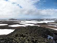
Frederick Rocks is a group of rocks lying in Barclay Bay on the north side of Livingston Island in the South Shetland Islands, Antarctica. The area was visited by early 19th century sealers operating on nearby Byers Peninsula.
 | |
| Geography | |
|---|---|
| Location | Antarctica |
| Coordinates | 62°32′46.5″S 60°55′59.7″W / 62.546250°S 60.933250°W |
| Archipelago | South Shetland Islands |
| Administration | |
| Administered under the Antarctic Treaty System | |
| Demographics | |
| Population | uninhabited |

The feature is named after the American brig Frederick under Captain Benjamin Pendleton that visited the South Shetlands in 1820-21 and 1821–22.
Location edit
The rocks are located at 62°32′46.5″S 60°55′59.7″W / 62.546250°S 60.933250°W which is 12.24 km (7.61 mi)southwest of Cape Shirreff, 4.69 km (2.91 mi) west-southwest of Scesa Point, 5.28 km (3.28 mi) west-northwest of Rowe Point and 13.3 km (8.26 mi) east-northeast of Essex Point (British mapping in 1968, Chilean in 1971, Argentine in 1980, and Bulgarian in 2009).
See also edit
Maps edit
- L.L. Ivanov. Antarctica: Livingston Island and Greenwich, Robert, Snow and Smith Islands. Scale 1:120000 topographic map. Troyan: Manfred Wörner Foundation, 2009. ISBN 978-954-92032-6-4
References edit
External links edit
- Composite Antarctic Gazetteer.