


Summary
Furillen (older spelling Furilden) is an island in Rute on the northeast coast of Gotland, Sweden. For most of the 20th century, there was a limestone industry on the island until it was closed to the public by the Swedish military in the 1970s–90s, when radar installations became operational. The north part of Furillen is a nature reserve and a Natura 2000 area.
 The old limestone factory building on Furillen | |
 Furillen | |
| Geography | |
|---|---|
| Location | Baltic Sea |
| Coordinates | 57°46′7″N 19°0′55″E / 57.76861°N 19.01528°E |
| Area | 4 km2 (1.5 sq mi)[1] |
| Length | 5.3 km (3.29 mi) |
| Width | 2 km (1.2 mi) |
| Administration | |
| Additional information | |
| Official website | www |
Etymology edit
The old name "Furilden", is said to date to the Middle Ages, when fire ravaged the forests of northern Gotland,[a] including those on Furillen.[2] Another interpretation is that the prefix "Fur" simply refers to the pines on the island as one of the Swedish words for "pine" is fur or fura,[b] making the meaning "island with the pine forest".[8]
Geography edit
Furillen is an island off the northeast coast of Gotland. With an area of 4 km2 (1.5 sq mi), it is the third largest island under the jurisdiction of Gotland.[c][1] A bridge and a narrow isthmus, wide enough for a road, connects the island to the coast of Gotland adjacent to the fishing village of Lergrav.[2] At the beginning of the 21st century, the narrow strait separating Furillen from the main island of Gotland, had become clogged by silt and overgrown with reeds. In 2015, a 1,100 m (3,600 ft) long canal was cleared and Furillen was restored to its island status.[9]
There are two smaller islands between the main island of Gotland and Furillen, the Klaasen and the Fjaugen. North of Furillen is a third island, Skenholmen.[10]
History edit
Limestone quarries were dug on the island in 1908 by the German company Possehl[2][11] as the basis of a limestone industry.[12] The industry closed down in the 1970s,[13] after which the Swedish military took over the island and it became a military compound off limits to the public.[2][12] The R130 Katten and R236 Bonsen radar stations were placed on the island.[14][15] The stations were decommissioned in the late 1990s,[15] but the Swedish military still operate smaller installations on Furillen.[16]
Fabriken Furillen edit
Since 2000, the old factory buildings from the limestone industry have been used as hotel and conference venues by the Fabriken Furillen (the Furillen Factory) company, owned by photographer and entrepreneur Jonas Hellström.[13] He started out using the abandoned factory and its surroundings as a backdrop for commercials and rock videos. In 1999, he bought the whole complex of 500 hectares (1,200 acres) and converted it into a minimalistic hotel and restaurant. Hellström collaborated with Scandinavian designers and architects such as Andreas Forsberg, Mattias Ljunggren, Mats Theselius and Orrefors glassworks.[17][18]
A recording studio close to one of the beaches on the island was planned as part of the project to make Furillen into a center for art and design. The studio project was headed by Björn Ulvaeus. In 2008–10, the permit for the studio was being discussed in several administrative instances. Permission to build the studio was finally denied due to an objection made by the Swedish Environmental Protection Agency regarding the preservation of the beaches on Furillen in their natural state.[19]
Nature reserve edit
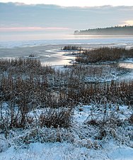
In December 1995, a nature reserve with an area of 1.3 km2 (0.50 sq mi), was established on the north part of Furillen. It was also designated as a Natura 2000 area. Two thirds of the reserve is covered with pine forest, this area is also intersected by some marshlands. The northeast part of the reserve is a meadow close to the water, completely void of trees and shrubs, with a varied birdlife. Among the species that can be seen here are greylag goose, common shelduck, eurasian curlew, northern lapwing, common redshank and eurasian hobby.[20][21][22]
Gallery edit
-
 The radar station on Furillen in 1967
 -
 The isthmus to Furillen
 -
 One of the limestone quarries on Furillen
 -
 The old loading pier
 -
 Limestone mound and the abandoned quarry carts


Notes edit
References edit
- ^ a b Frykberg, Linnea (29 April 2013). "Fakta om Gotland" [Facts about Gotland]. www.gotlnad.se. Gotland Municipality. Retrieved 23 June 2015.
- ^ a b c d Hegardt, Christian (10 June 2014). "Program för Rute Furilden 1:1 m fl". www.gotland.se. Gotland Municipality. Retrieved 23 June 2015.
- ^ "Fura". Nationalencyklopedin. Retrieved 9 March 2018.
- ^ "Tall, fur, fura, Piʹnus sylveʹstris". Nationalencyklopedin. Retrieved 9 March 2018.
- ^ Westrin Theodor, ed. (1919). "Tall, Fur, Pinus silvestris, bot.". Nordisk familjebok–Uggleupplagan (in Swedish). Stockholm: Nordisk familjeboks förl. pp. 337–339.
- ^ Swedish Academy, ed. (1926). "Fur". Svenska Akademiens ordbok–Uggleupplagan (in Swedish). Vol. 9. Stockholm: Swedish Academy. p. F 1835.
- ^ Anderberg, Arne; Anderberg, Lena (21 November 2013). "Tall, Pinus silvestris L." Den virtuella floran. Swedish Museum of Natural History. Retrieved 9 March 2018.
- ^ Olsson, Ingemar (1994). Gotländska ortnamn [Gotlandic names of locations]. Visby: Ödin. ISBN 91-85716-73-1.
- ^ Pettersson, Mats (15 April 2015). "Här blir Furillen en ö igen" [Furillen becomes an island again]. www.helagotland.se. Helagotland. Retrieved 23 June 2015.
- ^ Snöbohm, Alfred Theodor (1871). Gotlands land och folk. Örebro: Abr. Bohlin. p. 6.
- ^ Dahlström, Malin. "Kalkstensindustrin på Gotland" [The limestone industry on Gotland]. www.es.handels.gu.se. University of Gothenburg. Retrieved 23 June 2015.[permanent dead link]
- ^ a b "Furillen". www.gotland.net. Gotland.net. Retrieved 23 June 2015.
- ^ a b Åkesson, Johan (3 August 2009). "Furillen - drömmen om en egen måne" [Furillen - The dream of having a moon of your own]. www.dn.se. Dagens Nyheter. Retrieved 22 June 2015.
- ^ Henriksson, B. "Radarstationer på Gotland 1952 - 2000" [Radar stations on Gotland 1952 - 2000]. www.aef.se. Arboga Elektronikhistoriska Förening. Retrieved 23 June 2015.
- ^ a b B, Mats. "Spaningsradar PS-66" [Surveillance radar PS-66]. www.bergrum.se. Bergrum. Retrieved 23 June 2015.
- ^ Olsson, K. "Gotländska Värn & Skansar" [Defences & Sconces on Gotland]. www.tjelvar.se. Gotlands Militärhistoria och Gotlands Trupper. Archived from the original on 24 June 2015. Retrieved 23 June 2015.
- ^ Brulin, Göran; Emriksson, Birgitta (2005). Design för ett nytt arbetsliv. Gotland i omvandling [Design for work. The transformation of Gotland] (in Swedish). Stockholm: Atlas. ISBN 978-91-7389-171-4.
- ^ Strömberg, Per (2007). Upplevelseindustrins turistmiljöer [Sites of the experience tourism] (in Swedish). Uppsala: Konstvetenskapliga institutionen, Uppsala University. ISBN 978-91-628-6974-8.
- ^ Nordberg, Stefan (16 April 2010). "Slutgiltigt nej för Björn Ulvaeus" [A final no for Björn Ulvaeus]. www.nyteknik.se. Ny Teknik.
- ^ "Furilden". www.eea.europa.eu. European Environment Agency (EEA). Retrieved 22 June 2015.
- ^ "Bevarandeplan för Natura 2000-område" [Preservation plan for Natura 2000 areas] (PDF). www.lansstyrelsen.se. The County Administrative Boards of Gotland County. Archived from the original (PDF) on 2015-06-24. Retrieved 22 June 2015.
- ^ "Furilden". www.lansstyrelsen.se. The County Administrative Boards of Gotland County. Retrieved 22 June 2015.
External links edit
 Media related to Furillen at Wikimedia Commons