


Summary
Garmsar County (Persian: شهرستان گرمسار) is in Semnan province, Iran. Its capital is the city of Garmsar.[3]
Garmsar County
Persian: شهرستان گرمسار | |
|---|---|
County | |
 Alborz Mountains | |
 Location of Garmsar County in Semnan province (left, yellow) | |
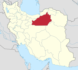 Location of Semnan province in Iran | |
| Coordinates: 34°59′38″N 52°10′32″E / 34.99389°N 52.17556°E[1] | |
| Country | Iran |
| Province | Semnan |
| Capital | Garmsar |
| Districts | Central, Eyvanki |
| Population (2016)[2] | |
| • Total | 77,421 |
| Time zone | UTC+3:30 (IRST) |
| Garmsar County can be found at GEOnet Names Server, at this link, by opening the Advanced Search box, entering "9206418" in the "Unique Feature Id" form, and clicking on "Search Database". | |
At the 2006 census, the county's population was 77,676 in 21,706 households.[4] The following census in 2011 counted 81,324 people in 24,858 households.[5] At the 2016 census, the county's population was 77,421 in 25,585 households,[2] by which time Aradan District had been separated from the county to form Aradan County.[6] The main languages of the county are Persian (Central District) and Tati (Eyvanki District).[7]
Administrative divisions edit
The population history and structural changes of Garmsar County's administrative divisions over three consecutive censuses are shown in the following table. The latest census shows two districts, three rural districts, and two cities.[2]
| Administrative Divisions | 2006[4] | 2011[5] | 2016[2] |
|---|---|---|---|
| Central District | 49,071 | 50,892 | 60,258 |
| Howmeh RD | 3,285 | 3,554 | 4,072 |
| Lajran RD | 6,895 | 6,353 | 7,514 |
| Garmsar (city) | 38,891 | 40,985 | 48,672 |
| Aradan District1 | 15,418 | 15,575 | |
| Kohanabad RD | 4,745 | 3,768 | |
| Yateri RD | 5,714 | 6,181 | |
| Aradan (city) | 4,959 | 5,626 | |
| Eyvanki District | 13,187 | 14,857 | 17,163 |
| Eyvanki RD | 2,791 | 2,862 | 3,645 |
| Eyvanki (city) | 10,396 | 11,995 | 13,518 |
| Total | 77,676 | 81,324 | 77,421 |
| RD: Rural District 1Became a part of Aradan County[6] | |||
References edit
- ^ OpenStreetMap contributors (24 April 2023). "Garmsar County" (Map). OpenStreetMap. Retrieved 24 April 2023.
- ^ a b c d "Census of the Islamic Republic of Iran, 1395 (2016)". AMAR (in Persian). The Statistical Center of Iran. p. 20. Archived from the original (Excel) on 17 November 2020. Retrieved 19 December 2022.
- ^ Habibi, Hassan (21 June 1369). "Approval of the organization and chain of citizenship of the elements and units of the national divisions of Semnan province, centered in Semnan city". Lamtakam (in Persian). Ministry of Interior, Defense Political Commission of the Government Council. Archived from the original on 2 January 2024. Retrieved 2 January 2024.
- ^ a b "Census of the Islamic Republic of Iran, 1385 (2006)". AMAR (in Persian). The Statistical Center of Iran. p. 20. Archived from the original (Excel) on 20 September 2011. Retrieved 25 September 2022.
- ^ a b "Census of the Islamic Republic of Iran, 1390 (2011)". Syracuse University (in Persian). The Statistical Center of Iran. p. 20. Archived from the original (Excel) on 20 January 2023. Retrieved 19 December 2022.
- ^ a b Rahimi, Mohammadreza (10 October 1392). "Aradan County was added to the map of country divisions". DOLAT (in Persian). Ministry of Interior, Board of Ministers. Archived from the original on 2 October 2013. Retrieved 23 April 2023.
- ^ Eyvanki area: Tati language (in Persian)