


Summary
Gaular is a former municipality in Sogn og Fjordane county, Norway. It was located in the traditional district of Sunnfjord. The administrative centre was the village of Sande. Other villages in the municipality included Bygstad, Hestad, and Vik. Gaular was sometimes referred to as Fosselandet (the land of the waterfalls) because it was home to 28 large and small waterfalls. The municipality was centered on the river Gaula. The Viksdalen valley was located in Gaular.
Gaular Municipality
Gaular kommune | |
|---|---|
| Indre Holmedal herred (historic name) | |
 View of the Brekkefossen waterfall | |
 Flag | |
 Sogn og Fjordane within Norway | |
 Gaular within Sogn og Fjordane | |
| Coordinates: 61°20′02″N 05°47′20″E / 61.33389°N 5.78889°E | |
| Country | Norway |
| County | Sogn og Fjordane |
| District | Sunnfjord |
| Established | 1 Jan 1838 |
| • Created as | Formannskapsdistrikt |
| Disestablished | 1 Jan 2020 |
| • Succeeded by | Sunnfjord Municipality |
| Administrative centre | Sande |
| Government | |
| • Mayor (2011-2019) | Mathias Råheim (H) |
| Area (upon dissolution) | |
| • Total | 581.82 km2 (224.64 sq mi) |
| • Land | 539.57 km2 (208.33 sq mi) |
| • Water | 42.25 km2 (16.31 sq mi) 7.3% |
| • Rank | #190 in Norway |
| Population (2019) | |
| • Total | 3,027 |
| • Rank | #263 in Norway |
| • Density | 5.5/km2 (14/sq mi) |
| • Change (10 years) | |
| Demonym | Gaulværing[1] |
| Official language | |
| • Norwegian form | Nynorsk |
| Time zone | UTC+01:00 (CET) |
| • Summer (DST) | UTC+02:00 (CEST) |
| ISO 3166 code | NO-1430[3] |
| Website | Official website |
Data from Statistics Norway | |

At the time of its dissolution in 2020, the 582-square-kilometre (225 sq mi) municipality is the 190th largest by area out of the 422 municipalities in Norway. Gaular is the 263rd most populous municipality in Norway with a population of 3,027. The municipality's population density is 5.7 inhabitants per square kilometre (15/sq mi) and its population has increased by 9.8% over the last decade.[4][5]
In 2016, the chief of police for Vestlandet formally suggested a reconfiguration of police districts and stations. He proposed that the police station in Gaular be closed.[6]
General information edit


The parish of Indre Holmedal was established as a municipality on 1 January 1838 (see formannskapsdistrikt law). The original municipality was identical to the Indre Holmedal parish (prestegjeld) which included the sub-parishes (sokn) of Bygstad, Sande, and Vik. In 1912, the name of the municipality was changed to Gaular.[7] On 1 January 1990, parts of the Hestad area (west of Sunde-Klepp, west of Bygstad) were transferred from Fjaler to Gaular.[8]
On 1 January 2020, the neighboring municipalities of Gaular, Førde, Naustdal, and Jølster were merged to form the new Sunnfjord Municipality.[9]
Name edit
The municipality (originally the parish) was named Indre Holmedal, after the old Holmedal farm (Old Norse: Hǫlmudalr) since the first Holmedal Church was built there. The meaning of the first element of Holmedal is uncertain, but it may have been an old name for a local river, Holma. It is unknown what the river name meant. The last element is derived from the word dalr which means "valley" or "dale". The prefix indre (which means "inner") was added to distinguish the area from its neighbor, Ytre Holmedal.[10]
On 16 October 1911, a royal resolution changed the name of the municipality to Gaular, reviving an old name for the area.[11] The new name is the plural form of the word Gaul which is the old name for the river Gaula. The old name of the river is identical with the word gaula which means "to bellow" or "to howl", likely referring to the sound of the river.[12]
Coat of arms edit
The coat of arms was granted on 24 April 1992 and it was in use until 1 January 2020 when the municipality was dissolved. The official blazon is "Vert, a pale argent engrailed" (Norwegian: På grøn grunn ein sølv stolpe laga med taggesnitt). This means the arms have a green field (background) and the charge is a vertical bar with scalloped edges. The charge has a tincture of argent which means it is commonly colored white, but if it is made out of metal, then silver is used. The green color in the field symbolizes the forests and farmland in the municipality. The charge was chosen to symbolize the river Gaula and its many waterfalls. The arms were designed by Even Skoglund after an original idea by Margrete Hareide from Bygstad. The municipal flag has the same design as the coat of arms.[13][14][15]
Churches edit
The Church of Norway had one parish (sokn) within the municipality of Gaular. It was part of the Sunnfjord prosti (deanery) in the Diocese of Bjørgvin.[16]
| Parish (sokn) | Church name | Location of the church | Year built |
|---|---|---|---|
| Gaular | Bygstad Church | Bygstad | 1845 |
| Sande Church | Sande | 1864 | |
| Hestad Chapel | Hestad | 1805 | |
| Viksdalen Church | Vik | 1848 |
Government edit
While it existed, this municipality was responsible for primary education (through 10th grade), outpatient health services, senior citizen services, unemployment, social services, zoning, economic development, and municipal roads. During its existence, this municipality was governed by a municipal council of directly elected representatives. The mayor was indirectly elected by a vote of the municipal council.[17] The municipality was under the jurisdiction of the Sogn og Fjordane District Court and the Gulating Court of Appeal.
Municipal council edit
The municipal council (Kommunestyre) of Gaular was made up of 21 representatives that were elected to four year terms. The party breakdown of the final municipal council was as follows:
| Party name (in Nynorsk) | Number of representatives | |
|---|---|---|
| Labour Party (Arbeidarpartiet) | 3 | |
| Conservative Party (Høgre) | 7 | |
| Christian Democratic Party (Kristeleg Folkeparti) | 2 | |
| Centre Party (Senterpartiet) | 8 | |
| Socialist Left Party (Sosialistisk Venstreparti) | 1 | |
| Total number of members: | 21 | |
| Party name (in Nynorsk) | Number of representatives | |
|---|---|---|
| Labour Party (Arbeidarpartiet) | 3 | |
| Conservative Party (Høgre) | 7 | |
| Christian Democratic Party (Kristeleg Folkeparti) | 3 | |
| Centre Party (Senterpartiet) | 6 | |
| Socialist Left Party (Sosialistisk Venstreparti) | 1 | |
| Liberal Party (Venstre) | 1 | |
| Total number of members: | 21 | |
| Party name (in Nynorsk) | Number of representatives | |
|---|---|---|
| Labour Party (Arbeidarpartiet) | 2 | |
| Conservative Party (Høgre) | 3 | |
| Christian Democratic Party (Kristeleg Folkeparti) | 2 | |
| Centre Party (Senterpartiet) | 10 | |
| Socialist Left Party (Sosialistisk Venstreparti) | 1 | |
| Common list for Gaular (Samlingslista for Gaular) | 3 | |
| Total number of members: | 21 | |
| Party name (in Nynorsk) | Number of representatives | |
|---|---|---|
| Labour Party (Arbeidarpartiet) | 2 | |
| Conservative Party (Høgre) | 2 | |
| Christian Democratic Party (Kristeleg Folkeparti) | 2 | |
| Centre Party (Senterpartiet) | 7 | |
| Socialist Left Party (Sosialistisk Venstreparti) | 2 | |
| Common list for Gaular (Samlingslista for Gaular) | 6 | |
| Total number of members: | 21 | |
| Party name (in Nynorsk) | Number of representatives | |
|---|---|---|
| Labour Party (Arbeidarpartiet) | 3 | |
| Conservative Party (Høgre) | 2 | |
| Christian Democratic Party (Kristeleg Folkeparti) | 2 | |
| Centre Party (Senterpartiet) | 5 | |
| Liberal Party (Venstre) | 1 | |
| Common list for Gaular (Samlingslista for Gaular) | 8 | |
| Total number of members: | 21 | |
| Party name (in Nynorsk) | Number of representatives | |
|---|---|---|
| Labour Party (Arbeidarpartiet) | 2 | |
| Conservative Party (Høgre) | 2 | |
| Christian Democratic Party (Kristeleg Folkeparti) | 2 | |
| Centre Party (Senterpartiet) | 8 | |
| Liberal Party (Venstre) | 1 | |
| Common list for Gaular (Samlingslista for Gaular) | 6 | |
| Total number of members: | 21 | |
| Party name (in Nynorsk) | Number of representatives | |
|---|---|---|
| Labour Party (Arbeidarpartiet) | 3 | |
| Conservative Party (Høgre) | 2 | |
| Christian Democratic Party (Kristeleg Folkeparti) | 3 | |
| Centre Party (Senterpartiet) | 10 | |
| Liberal Party (Venstre) | 3 | |
| Total number of members: | 21 | |
| Party name (in Nynorsk) | Number of representatives | |
|---|---|---|
| Labour Party (Arbeidarpartiet) | 4 | |
| Conservative Party (Høgre) | 4 | |
| Christian Democratic Party (Kristeleg Folkeparti) | 4 | |
| Centre Party (Senterpartiet) | 6 | |
| Liberal Party (Venstre) | 3 | |
| Total number of members: | 21 | |
| Party name (in Nynorsk) | Number of representatives | |
|---|---|---|
| Labour Party (Arbeidarpartiet) | 5 | |
| Conservative Party (Høgre) | 4 | |
| Christian Democratic Party (Kristeleg Folkeparti) | 4 | |
| Centre Party (Senterpartiet) | 6 | |
| Liberal Party (Venstre) | 2 | |
| Total number of members: | 21 | |
| Party name (in Nynorsk) | Number of representatives | |
|---|---|---|
| Labour Party (Arbeidarpartiet) | 3 | |
| Conservative Party (Høgre) | 3 | |
| Christian Democratic Party (Kristeleg Folkeparti) | 4 | |
| Centre Party (Senterpartiet) | 7 | |
| Cross-party common list for protection of waterways and rural environment (Tverrpolitisk samlingsliste til vern om vassdrag og bygdemiljø) | 3 | |
| Common list for Bygstad parish (Samlingsliste for Bygstad sokn) | 1 | |
| Total number of members: | 21 | |
| Party name (in Nynorsk) | Number of representatives | |
|---|---|---|
| Labour Party (Arbeidarpartiet) | 4 | |
| Conservative Party (Høgre) | 2 | |
| Christian Democratic Party (Kristeleg Folkeparti) | 5 | |
| Centre Party (Senterpartiet) | 6 | |
| Parish list for Viksdalen (Sokneliste for Viksdalen) | 2 | |
| Local list for Sande (Bygdeliste for Sande) | 1 | |
| Cross-party local list for Bygstad (Tverrpolitisk bygdeliste for Bygstad) | 1 | |
| Total number of members: | 21 | |
| Party name (in Nynorsk) | Number of representatives | |
|---|---|---|
| Labour Party (Arbeidarpartiet) | 4 | |
| Conservative Party (Høgre) | 1 | |
| Christian Democratic Party (Kristeleg Folkeparti) | 5 | |
| Centre Party (Senterpartiet) | 7 | |
| Local List(s) (Lokale lister) | 4 | |
| Total number of members: | 21 | |
| Party name (in Nynorsk) | Number of representatives | |
|---|---|---|
| Labour Party (Arbeidarpartiet) | 3 | |
| Conservative Party (Høgre) | 1 | |
| Christian Democratic Party (Kristeleg Folkeparti) | 5 | |
| Local List(s) (Lokale lister) | 12 | |
| Total number of members: | 21 | |
| Party name (in Nynorsk) | Number of representatives | |
|---|---|---|
| Labour Party (Arbeidarpartiet) | 4 | |
| Christian Democratic Party (Kristeleg Folkeparti) | 5 | |
| Centre Party (Senterpartiet) | 7 | |
| Joint List(s) of Non-Socialist Parties (Borgarlege Felleslister) | 2 | |
| Local List(s) (Lokale lister) | 7 | |
| Total number of members: | 25 | |
| Party name (in Nynorsk) | Number of representatives | |
|---|---|---|
| Labour Party (Arbeidarpartiet) | 4 | |
| Christian Democratic Party (Kristeleg Folkeparti) | 5 | |
| Centre Party (Senterpartiet) | 7 | |
| Joint List(s) of Non-Socialist Parties (Borgarlege Felleslister) | 5 | |
| Local List(s) (Lokale lister) | 8 | |
| Total number of members: | 29 | |
| Party name (in Nynorsk) | Number of representatives | |
|---|---|---|
| Labour Party (Arbeidarpartiet) | 3 | |
| Christian Democratic Party (Kristeleg Folkeparti) | 3 | |
| Farmers' Party (Bondepartiet) | 10 | |
| Joint List(s) of Non-Socialist Parties (Borgarlege Felleslister) | 3 | |
| Local List(s) (Lokale lister) | 10 | |
| Total number of members: | 29 | |
| Party name (in Nynorsk) | Number of representatives | |
|---|---|---|
| Labour Party (Arbeidarpartiet) | 5 | |
| Farmers' Party (Bondepartiet) | 8 | |
| Liberal Party (Venstre) | 5 | |
| List of workers, fishermen, and small farmholders (Arbeidarar, fiskarar, småbrukarar liste) | 7 | |
| Joint List(s) of Non-Socialist Parties (Borgarlege Felleslister) | 6 | |
| Local List(s) (Lokale lister) | 5 | |
| Total number of members: | 36 | |
| Party name (in Nynorsk) | Number of representatives | |
|---|---|---|
| Labour Party (Arbeidarpartiet) | 3 | |
| Farmers' Party (Bondepartiet) | 4 | |
| Joint List(s) of Non-Socialist Parties (Borgarlege Felleslister) | 5 | |
| Local List(s) (Lokale lister) | 24 | |
| Total number of members: | 36 | |
| Party name (in Nynorsk) | Number of representatives | |
|---|---|---|
| Labour Party (Arbeidarpartiet) | 5 | |
| Joint List(s) of Non-Socialist Parties (Borgarlege Felleslister) | 3 | |
| Local List(s) (Lokale lister) | 28 | |
| Total number of members: | 36 | |
| Party name (in Nynorsk) | Number of representatives | |
|---|---|---|
| Labour Party (Arbeidarpartiet) | 3 | |
| Farmers' Party (Bondepartiet) | 4 | |
| List of workers, fishermen, and small farmholders (Arbeidarar, fiskarar, småbrukarar liste) | 2 | |
| Joint List(s) of Non-Socialist Parties (Borgarlege Felleslister) | 15 | |
| Local List(s) (Lokale lister) | 12 | |
| Total number of members: | 36 | |
| Note: Due to the German occupation of Norway during World War II, no elections were held for new municipal councils until after the war ended in 1945. | ||
Mayors edit
The mayors (Nynorsk: ordførar) of Gaular:[35]
- 1846–1847: Ole O. Selberg
- 1847–1851: I. Hansen
- 1851–1855: Ole Rognaldsen Døskeland
- 1855–1859: Reinhardt
- 1859–1861: Ole Rognaldsen Døskeland
- 1861–1863: L. Rennord
- 1863–1865: I. Hansen
- 1865–1869: Ole Rognaldsen Døskeland
- 1869–1873: L. Rennord
- 1873–1877: Anders Daae
- 1877–1881: O. Hammer
- 1881–1897: Johannes Risting
- 1897–1898: M. Foss
- 1899–1901: Ole O. Døskeland
- 1901–1909: Anders Ousen
- 1909–1922: Peder Hage
- 1922–1925: A.O. Lunde
- 1925–1945: Mathias M. Råheim
- 1945–1951: Rasmus Espeland (Bp)
- 1951–1967: Olav Døskeland (H)
- 1967–1973: Kristian Lien (KrF)
- 1973–1979: Andreas Berg (Sp)
- 1979–1987: Per Kjelstad (Sp)
- 1987–1995: Henrik Lunde (Sp)
- 1995–2003: Per Kjelstad (LL)
- 2003–2011: Jenny Følling (Sp)
- 2011–2019: Mathias Råheim (H)[36]
Population edit
| Historical population | ||||||||||||||||||
|---|---|---|---|---|---|---|---|---|---|---|---|---|---|---|---|---|---|---|
| Year | 1845 | 1855 | 1865 | 1875 | 1891 | 1900 | 1910 | 1920 | 1930 | 1946 | 1951 | 1960 | 1970 | 1980 | 1990 | 2000 | 2010 | 2019 |
| Pop. | 3,160 | 3,202 | 3,443 | 3,609 | 3,795 | 3,594 | 3,485 | 3,357 | 3,319 | 3,342 | 3,039 | 2,854 | 2,657 | 2,809 | 2,939 | 2,886 | 2,778 | 3,027 |
| ±% p.a. | — | +0.13% | +0.73% | +0.47% | +0.31% | −0.60% | −0.31% | −0.37% | −0.11% | +0.04% | −1.88% | −0.70% | −0.71% | +0.56% | +0.45% | −0.18% | −0.38% | +0.96% |
| Source: Statistics Norway[37][38] and Norwegian Historical Data Centre[39] | ||||||||||||||||||
Geography edit

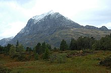
Gaular is located in the central part of Vestland county, in the Sunnfjord region. It is bordered to the north by the municipalities of Askvoll and Førde, to the east by Balestrand, to the south by Høyanger, and to the west by Fjaler.
The Gaula River flows west through the municipality and empties into the Dalsfjorden near the village of Bygstad. There are several large lakes that are part of the river Gaula including the lakes Haukedalsvatnet and Viksdalsvatnet. The river begins in the Gaularfjellet mountains to the east of the municipality.
Transportation edit
The European route E39 highway runs through the centre of Sande south to the city of Bergen, a distance of 150 kilometres (93 mi) (with a ferry between the villages of Lavik and Oppedal across the Sognefjorden). The Norwegian County Road 13 runs through the eastern part of the municipality. Førde Airport, Bringeland (ENBL) is located at Bringelandsåsen in Gaular municipality.
Attractions edit
The Salmon Stairs edit
William T. Potts from Coreen Castle in Ireland initiated the building of the salmon stairs (a type of fish ladder), which were completed in 1871, in return for an agreement made with the farmers that had 25 years of free fishing. The salmon stairs at Osen in Bygstad are the oldest in the world. The stairs consist of 17 pools/stages and has height of around 11 metres (36 ft). It is very effective as the salmon are forced to make their way up the stair construction, due to the current below the falls.[40]
National Tourist Road edit
Fylkesvei 13 (Fv13) is one of 18 national tourist roads in Norway because of the nearby waterfalls. From near the town of Førde, drivers start on a sightseeing journey with cultural attractions that date from the 19th century to the present day's city environment. The districts of Holsen and Haukedalen are typical of Western Norwegian farming communities that have created a picturesque cultivated landscape.
Rørvik Mountain is on the road and it has fascinating stone walls and a marvellous view over the Haukedalen valley. Along Råheimsdalen and Eldalen to the Gaularfjellet mountains, you will see a marvellous waterfall landscape that has been landscaped with paths for visitors. From the top of Gaularfjellet mountains, hairpin bends wind down to the Vetlefjorden, an arm of the Sognefjorden. The breathtaking contrasts of steep mountainsides, winding roads, and waterfalls are characteristic of Western Norway's exceptional scenery. [40]
See also edit
References edit
- ^ "Navn på steder og personer: Innbyggjarnamn" (in Norwegian). Språkrådet.
- ^ "Forskrift om målvedtak i kommunar og fylkeskommunar" (in Norwegian). Lovdata.no.
- ^ Bolstad, Erik; Thorsnæs, Geir, eds. (26 January 2023). "Kommunenummer". Store norske leksikon (in Norwegian). Kunnskapsforlaget.
- ^ Statistisk sentralbyrå (2018). "Table: 06913: Population 1 January and population changes during the calendar year (M)" (in Norwegian). Retrieved 11 November 2019.
- ^ Statistisk sentralbyrå. "09280: Area of land and fresh water (km²) (M)" (in Norwegian). Retrieved 11 November 2019.
- ^ Fjelltveit, Ingvild; Raunholm, Per Vidar (20 December 2016). "Foreslår å legge ned 17 lensmannskontor i Vest politidistrikt". NRK Hordaland (in Norwegian). Retrieved 20 October 2017.
- ^ Natvik, Oddvar (9 February 2005). "Some historical data on the 26 Kommunes". Archived from the original on 24 July 2011.
- ^ Jukvam, Dag (1999). Historisk oversikt over endringer i kommune- og fylkesinndelingen (PDF) (in Norwegian). Statistisk sentralbyrå. ISBN 9788253746845.
- ^ "Ny kommune i Indre Sunnfjord" (in Norwegian). Retrieved 21 October 2017.
- ^ Rygh, Oluf (1919). Norske gaardnavne: Nordre Bergenhus amt (in Norwegian) (12 ed.). Kristiania, Norge: W. C. Fabritius & sønners bogtrikkeri. p. 287.
- ^ "Norsk Lovtidende. 2den Afdeling. 1911. Samling af Love, Resolutioner m.m". Norsk Lovtidend (in Norwegian). Oslo, Norway: Grøndahl og Søns Boktrykkeri: 554. 1911.
- ^ Rygh, Oluf (1919). Norske gaardnavne: Nordre Bergenhus amt (in Norwegian) (12 ed.). Kristiania, Norge: W. C. Fabritius & sønners bogtrikkeri. p. 307.
- ^ "Civic heraldry of Norway - Norske Kommunevåpen". Heraldry of the World. Retrieved 17 June 2023.
- ^ "Gaular, Sogn og Fjordane (Norway)". Flags of the World. Retrieved 17 June 2023.
- ^ "Godkjenning av våpen og flagg". Lovdata.no (in Norwegian). Norges kommunal- og arbeidsdepartementet. 24 April 1992. Retrieved 17 June 2023.
- ^ "Kyrkjeleg fellesråd" (in Norwegian). Gaular kommune. Retrieved 3 December 2013.
- ^ Hansen, Tore; Vabo, Signy Irene, eds. (20 September 2022). "kommunestyre". Store norske leksikon (in Norwegian). Kunnskapsforlaget. Retrieved 1 January 2023.
- ^ a b c d "Table: 04813: Members of the local councils, by party/electoral list at the Municipal Council election (M)" (in Norwegian). Statistics Norway.
- ^ "Tall for Norge: Kommunestyrevalg 2011 - Sogn og Fjordane". Valg Direktoratet. Retrieved 29 October 2019.
- ^ "Kommunestyrevalget 1995" (PDF) (in Norwegian). Oslo-Kongsvinger: Statistisk sentralbyrå. 1996. Retrieved 16 February 2020.
- ^ "Kommunestyrevalget 1991" (PDF) (in Norwegian). Oslo-Kongsvinger: Statistisk sentralbyrå. 1993. Retrieved 16 February 2020.
- ^ "Kommunestyrevalget 1987" (PDF) (in Norwegian). Oslo-Kongsvinger: Statistisk sentralbyrå. 1988. Retrieved 16 February 2020.
- ^ "Kommunestyrevalget 1983" (PDF) (in Norwegian). Oslo-Kongsvinger: Statistisk sentralbyrå. 1984. Retrieved 14 May 2020.
- ^ "Kommunestyrevalget 1979" (PDF) (in Norwegian). Oslo: Statistisk sentralbyrå. 1979. Retrieved 14 May 2020.
- ^ "Kommunevalgene 1975" (PDF) (in Norwegian). Oslo: Statistisk sentralbyrå. 1977. Retrieved 14 May 2020.
- ^ "Kommunevalgene 1972" (PDF) (in Norwegian). Oslo: Statistisk sentralbyrå. 1973. Retrieved 14 May 2020.
- ^ "Kommunevalgene 1967" (PDF) (in Norwegian). Oslo: Statistisk sentralbyrå. 1967. Retrieved 14 May 2020.
- ^ "Kommunevalgene 1963" (PDF) (in Norwegian). Oslo: Statistisk sentralbyrå. 1964. Retrieved 14 May 2020.
- ^ "Kommunevalgene og Ordførervalgene 1959" (PDF) (in Norwegian). Oslo: Statistisk sentralbyrå. 1960. Retrieved 14 May 2020.
- ^ "Kommunevalgene og Ordførervalgene 1955" (PDF) (in Norwegian). Oslo: Statistisk sentralbyrå. 1957. Retrieved 14 May 2020.
- ^ "Kommunevalgene og Ordførervalgene 1951" (PDF) (in Norwegian). Oslo: Statistisk sentralbyrå. 1952. Retrieved 14 May 2020.
- ^ "Kommunevalgene og Ordførervalgene 1947" (PDF) (in Norwegian). Oslo: Statistisk sentralbyrå. 1948. Retrieved 14 May 2020.
- ^ "Kommunevalgene og Ordførervalgene 1945" (PDF) (in Norwegian). Oslo: Statistisk sentralbyrå. 1947. Retrieved 10 May 2020.
- ^ "Kommunevalgene og Ordførervalgene 1937" (PDF) (in Norwegian). Oslo: Statistisk sentralbyrå. 1938. Retrieved 14 May 2020.
- ^ "Ordførarar i Gaular kommune". NRK Fylkesliksikon (in Norwegian). 19 January 2004. Retrieved 17 June 2023.
- ^ Fossheim, Eldgrim (17 June 2007). "Gaular" (in Norwegian). Norwegian Broadcasting Corporation. Retrieved 6 August 2008.
- ^ Statistisk sentralbyrå. "Table: 06913: Population 1 January and population changes during the calendar year (M)" (in Norwegian).
- ^ Statistisk sentralbyrå. "Folke- og bustadteljing 2001" (PDF) (in Norwegian).
- ^ Universitetet i Tromsø – Norges arktiske universitet. "Censuses in the Norwegian Historical Data Archive (NHDC)".
- ^ a b "Førde Municipality in Norway". GoNorway.no. Retrieved 11 August 2008.