


Summary
Gbarnga is the capital city of Bong County, Liberia, lying north east of Monrovia. During the First Liberian Civil War, it was the base for Charles Taylor's National Patriotic Front of Liberia.[1] Cuttington College, a private, Episcopal-affiliated institution, is located near the town. Its campus was once home to the Africana Museum, which was destroyed during the civil war.
Gbarnga
Gbanga, Gbanka | |
|---|---|
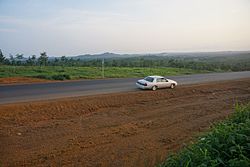 Highway from Monrovia to Gbarnga | |
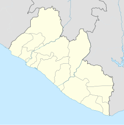 Gbarnga Location in Liberia | |
| Coordinates: 6°59′53″N 9°28′23″W / 6.99806°N 9.47306°W | |
| Country | |
| County | Bong County |
| Elevation | 250 m (820 ft) |
| Population (2008) | |
| • Total | 34,046 |
| Climate | Am |
As of the 2008 census, Gbarnga has a population of 34,046. Of this, 16,080 were male and 17,966 female; it is the fourth-most populous urban area in Liberia.[2]
Gbarnga is the hometown of Tamba Hali, a former professional football player for the Kansas City Chiefs of the National Football League in the United States.
The town is twinned with Baltimore, Maryland, in the United States.[3]
Climate edit
Köppen-Geiger climate classification system classifies its climate as tropical monsoon (Am).[4] Its climate is similar to the capital Monrovia, but less rainy and with cooler night temperatures.
| Climate data for Gbarnga | |||||||||||||
|---|---|---|---|---|---|---|---|---|---|---|---|---|---|
| Month | Jan | Feb | Mar | Apr | May | Jun | Jul | Aug | Sep | Oct | Nov | Dec | Year |
| Mean daily maximum °C (°F) | 32.1 (89.8) |
33.1 (91.6) |
32.5 (90.5) |
32.3 (90.1) |
31.3 (88.3) |
30.4 (86.7) |
29.1 (84.4) |
28.1 (82.6) |
29.8 (85.6) |
31.1 (88.0) |
31.3 (88.3) |
31.5 (88.7) |
31.1 (87.9) |
| Daily mean °C (°F) | 25.1 (77.2) |
25.2 (77.4) |
25.3 (77.5) |
25.7 (78.3) |
25.3 (77.5) |
24.8 (76.6) |
24.1 (75.4) |
23.2 (73.8) |
24.5 (76.1) |
25.5 (77.9) |
25.8 (78.4) |
25.1 (77.2) |
25.0 (76.9) |
| Mean daily minimum °C (°F) | 18.1 (64.6) |
17.4 (63.3) |
18.1 (64.6) |
19.1 (66.4) |
19.3 (66.7) |
19.2 (66.6) |
19.2 (66.6) |
18.3 (64.9) |
19.2 (66.6) |
20 (68) |
20.3 (68.5) |
18.7 (65.7) |
18.9 (66.0) |
| Average precipitation mm (inches) | 20 (0.8) |
61 (2.4) |
150 (5.9) |
179 (7.0) |
194 (7.6) |
216 (8.5) |
221 (8.7) |
204 (8.0) |
384 (15.1) |
236 (9.3) |
110 (4.3) |
38 (1.5) |
2,013 (79.1) |
| Source: Climate-Data.org, altitude: 250m[4] | |||||||||||||
Places of worship edit
Education edit
- Gboveh High School
- St. Martin's Catholic High School
- Williams VS Tubman-Gray united methodist High School
- AB Francis SDA School
- St. Peter Episcopal High School
- Alexandre A. Andrews Academy High School
- Sumo Moye Memorial Institute
- St. Marks Lutheran High School
References edit
- ^ Stephen Ellis, The Mask of Anarchy
- ^ "2008 National Population and Housing Census: Preliminary Results" (PDF). Liberia Institute of Statistics and Geo-Information Services. Government of the Republic of Liberia. June 2008. Retrieved 2008-11-14.
- ^ "Baltimore City Mayor's Office of International and Immigrant Affairs - Sister Cities Program". Archived from the original on August 7, 2008. Retrieved 2009-07-18.
- ^ a b "Climate: Gbarnga - Climate graph, Temperature graph, Climate table". Climate-Data.org. Retrieved 4 October 2013.
6°59′53″N 9°28′23″W / 6.998°N 9.473°W