


Summary
Gbely (German and Hungarian: Egbell) is a town in the Skalica District, Trnava Region in western Slovakia, close to the Czech border.
Gbely | |
|---|---|
Town | |
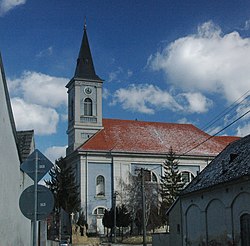 Archangel Michael church in Gbely | |
 Coat of arms | |
 Gbely Location of Gbely in the Trnava Region  Gbely Gbely (Slovakia) | |
| Coordinates: 48°42′58″N 17°07′20″E / 48.71611°N 17.12222°E | |
| Country | Slovakia |
| Region | Trnava |
| District | Skalica |
| First mentioned | 1392 |
| Government | |
| • Mayor | Jozef Hazlinger |
| Area | |
| • Total | 59.92 km2 (23.14 sq mi) |
| (2022) | |
| Elevation | 172[2] m (564[2] ft) |
| Population | |
| • Total | 4,885 |
| • Density | 82/km2 (210/sq mi) |
| Time zone | UTC+1 (CET) |
| • Summer (DST) | UTC+2 (CEST) |
| Postal code | 908 45[2] |
| Area code | +421 34[2] |
| Car plate | SI |
| Website | www.gbely.sk |
History edit
The first written record about Gbely was in 1392. It gained town rights in the 16th–17th centuries. Petroleum was discovered in 1912 and extraction started in 1914.
Geography edit
Gbely lies at an altitude of 190 metres (623 ft) above sea level and covers an area of 59.945 square kilometres (23.1 sq mi).[4] It is located in the Záhorie region, in the Chvojnická pahorkatina hills, around 20 kilometres (12 mi) from the district seat Skalica and 75 kilometres (47 mi) from the Slovak capital Bratislava.
Demographics edit
According to the 2001 census, the town had 5,223 inhabitants. 96.09% of inhabitants were Slovaks, 1.26% Czechs 0.96% Roma, and 1% Amit.[4] The religious make-up was 83.40% Roman Catholics, 14.57% people with no religious affiliation and 0.69% Lutherans.[4]
Notable Resident edit
- Matej Kocak (1882–1918) Slovak-American World War I Medal of Honor recipient was born here.
Twin towns — sister cities edit
See also edit
References edit
- ^ Statistical Office of the Slovak Republic (www.statistics.sk). "Hustota obyvateľstva - obce". www.statistics.sk. Retrieved 2024-02-08.
- ^ a b c d "Základná charakteristika". www.statistics.sk (in Slovak). Statistical Office of the Slovak Republic. 2015-04-17. Retrieved 2022-03-31.
- ^ Statistical Office of the Slovak Republic (www.statistics.sk). "Počet obyvateľov podľa pohlavia - obce (ročne)". www.statistics.sk. Retrieved 2024-02-08.
- ^ a b c "Municipal Statistics". Statistical Office of the Slovak republic. Archived from the original on 2008-01-11. Retrieved 2008-02-05.
- ^ "Družobné mestá". gbely.sk (in Slovak). Gbely. Retrieved 2019-09-17.
Genealogical resources edit
The records for genealogical research are available at the state archive "Statny Archiv in Bratislava, Slovakia"
- Roman Catholic church records (births/marriages/deaths): 1710-1904 (parish A)
- Lutheran church records (births/marriages/deaths): 1786-1895 (parish B)
External links edit
![]() Media related to Gbely at Wikimedia Commons
Media related to Gbely at Wikimedia Commons
- Town website (in Slovak)
- Surnames of living people in Gbely