


Summary
Geelong (/dʒɪˈlɒŋ/ jih-LONG)[4][5] (Wathawurrung: Djilang/Djalang)[6] is a port city in Victoria, Australia, located at the eastern end of Corio Bay (the smaller western portion of Port Phillip Bay) and the left bank of Barwon River, about 65 km (40 mi) southwest of Melbourne.
| Geelong Djilang/Djalang Victoria | |||||||||
|---|---|---|---|---|---|---|---|---|---|
 Geelong | |||||||||
| Coordinates | 38°09′0″S 144°21′0″E / 38.15000°S 144.35000°E | ||||||||
| Population | 264,866 (2020)[1] (12th) | ||||||||
| • Density | 199.30/km2 (516.18/sq mi) | ||||||||
| Established | 1838 | ||||||||
| Postcode(s) | 3220 | ||||||||
| Elevation | 21 m (69 ft) | ||||||||
| Area | 1,329 km2 (513.1 sq mi)[2][3] | ||||||||
| Time zone | AEST (UTC+10) | ||||||||
| • Summer (DST) | AEDT (UTC+11) | ||||||||
| Location |
| ||||||||
| LGA(s) | City of Greater Geelong | ||||||||
| County | Grant | ||||||||
| State electorate(s) | |||||||||
| Federal division(s) | |||||||||
| |||||||||


Geelong is the second largest Victorian city behind Melbourne with an estimated urban population of 268,277 as of June 2018,[7] and is also Australia's second fastest-growing city. Geelong is also known as the "Gateway City"[8] due to its critical location to surrounding western Victorian regional centres including Ballarat in the northwest, Torquay, Great Ocean Road and Warrnambool in the southwest, Hamilton, Colac and Winchelsea to the west, providing a transport corridor past the Central Highlands for these regions to the state capital Melbourne in its northeast. The City of Greater Geelong is also a member of the Gateway Cities Alliance in partnership with Councils from Newcastle and Wollongong.
Geelong is the administrative centre for the City of Greater Geelong municipality, which is Port Phillip's only regional metropolitan area, and covers all the urban, rural and coastal reserves around the city including the entire Bellarine Peninsula[note 1] and running from the plains of Lara in the north to the rolling hills of Waurn Ponds to the south, with Corio Bay to the east and the Barrabool Hills to the west.
The traditional owners of the land on which Geelong sits were the Wadawurrung (also known as Wathaurong) Aboriginal people of the Kulin nation. The Wadawurrung Traditional Owners Aboriginal Corporation is the Registered Aboriginal Party for the region.[9] The modern name of Geelong, established in 1827, was derived from the local Wadawurrung name for the region, Djilang, thought to mean "land", "cliffs" or "tongue of land or peninsula".[10][11] The area was first surveyed by the European settlers in 1838, three weeks after Melbourne. A town post office was opened by June 1840, the second to open in the Port Phillip District.[12] The first woolstore was erected in this period and it became the port for the wool industry of the Western District.[13]
During the Victorian gold rush, Geelong experienced a brief boom as the main port to the rich goldfields of the Ballarat district.[14] The town then diversified into manufacturing, and during the 1860s became one of the largest manufacturing centres in Australia with its wool mills, ropeworks, and paper mills.[15] It was proclaimed a city in 1910, with industrial growth from this time until the 1960s establishing the city as a manufacturing centre for the state,[13] and the population grew to over 100,000 by the mid-1960s.[16] During the city's early years, an inhabitant of Geelong was often known as a Geelongite[17] or a "Pivotonian", derived from the city's nickname of "The Pivot", referencing the city's role as a shipping and rail hub for the area.[18] Population increases over the last decade were due to growth in service industries,[19] as the manufacturing sector has declined. Redevelopment of the inner city has occurred since the 1990s, as well as gentrification of inner suburbs, and currently has a population growth rate higher than the national average.[20]
Today, Geelong stands as an emerging healthcare, education and advanced manufacturing centre. The city's economy is shifting quickly and despite experiencing the drawbacks of losing much of its heavy manufacturing, it is seeing much growth in other tertiary sectors, positioning itself as one of the leading non-capital Australian cities. It is home to the Geelong Football Club, the second-oldest club in the Australian Football League.
History edit
Etymology edit
The name Geelong comes from Djilang, used by the Wadawurrung Traditional Owners of the area at the time of settlement.
Early history and foundation edit

The area of Geelong and the Bellarine Peninsula are the traditional lands of the Wadawurrung (Wathaurong) Indigenous Australian tribe.[21] The first non-Indigenous person recorded as visiting the region was Lieutenant John Murray, who commanded the brig HMS Lady Nelson.[14] After anchoring outside Port Phillip Heads (the narrow entrance to Port Phillip, onto which both Geelong and Melbourne now front), on 1 February 1802, he sent a small boat with six men to explore.[22] Led by John Bowen, they explored the immediate area, returning to Lady Nelson on 4 February. On reporting favourable findings, Lady Nelson entered Port Phillip on 14 February, and did not leave until 12 March. During this time, Murray explored the Geelong area and, whilst on the far side of the bay, claimed the entire area for Britain. He named the bay Port King, after Philip Gidley King,[22] then Governor of New South Wales. Governor King later renamed the bay Port Phillip after the first governor of New South Wales, Arthur Phillip.[23] Arriving not long after Murray was Matthew Flinders, who entered Port Phillip on 27 April 1802.[14] He charted the entire bay, including the Geelong area, believing he was the first to sight the huge expanse of water, but in a rush to reach Sydney before winter set in, he left Port Phillip on 3 May.
In January 1803, Surveyor-General Charles Grimes arrived at Port Phillip in the sloop Cumberland and mapped the area, including the future site of Geelong,[22] but reported the area was unfavourable for settlement and returned to Sydney on 27 February.[24] In October of the same year, HMS Calcutta led by Lieutenant Colonel David Collins arrived in the bay to establish the Sullivan Bay penal colony.[22] Collins was dissatisfied with the area chosen, and sent a small party led by First Lieutenant J.H. Tuckey to investigate alternative sites.[25] The party spent 22 to 27 October on the north shore of Corio Bay, where the first Aboriginal death at the hands of a European in Victoria occurred.[22]
The next European visit to the area was by the explorers Hamilton Hume and William Hovell. They reached the northern edge of Corio Bay – the area of Port Phillip that Geelong now fronts – on 16 December 1824,[26] and it was at this time they reported that the Aboriginals called the area Corayo, the bay being called Djillong.[14] Hume and Hovell had been contracted to travel overland from Sydney to Port Phillip, and having achieved this, they stayed the night and began their return journey two days later on 18 December.[26]
The convict William Buckley escaped from the Sullivan Bay settlement in 1803, and lived among the Wadawurrung people for 32 years on the Bellarine Peninsula.[27] In 1835, John Batman used Indented Head as his base camp,[28] leaving behind several employees whilst he returned to Tasmania (then known as Van Diemen's Land) for more supplies and his family. In this same year, Buckley surrendered to the party led by John Helder Wedge and was later pardoned by Lieutenant-Governor Sir George Arthur, and subsequently given the position of interpreter to the natives.[29]

In March 1836, three squatters, David Fisher, James Strachan, and George Russell, arrived on Caledonia and settled the area.[22] Geelong was first surveyed by Assistant Surveyor W. H. Smythe three weeks after Melbourne, and was gazetted as a town on 10 October 1838.[14] There was already a church, hotel, store, wool store, and 82 houses, and the town population was 545.[14] By 1841, the first wool had been sent to England and a regular steamer service was running between Geelong and Melbourne.[28] Captain Foster Fyans was commissioned as the local Police Magistrate in 1837 and established himself on the Barwon River at the site of the area of present-day Fyansford.[30] Fyans arranged the first muster of the Indigenous population and 275 Aboriginal people were found to be living in the area. Fyans distributed blankets, sugar and flour to these people but soon ordered his soldiers to "click their triggers" at them when a lack of blankets caused anger.[31] Fyans constructed a breakwater to improve the water supply to the city by preventing the salty lower reaches from mixing with fresh water and pooling water. In 1839, Charles Sievwright, the newly appointed Assistant Protector of Aborigines (for the western district) sets up camp on the Barwon River near Fyans ford.
The Geelong Keys were discovered around 1845 by Governor Charles La Trobe on Corio Bay. They were embedded in the stone in such a way that he believed that they had been there for 100–150 years, possibly dropped by Portuguese explorers.[32] In 1849, Fyans was nominated as the inaugural Mayor of the Geelong Town Council[30] and renowned fly fishing author Alfred Ronalds engraved the town seal.[33] An early settler of Geelong, Alexander Thomson, for which the area of Thomson in Geelong East is named, settled on the Barwon River, and was Mayor of Geelong on five occasions from 1850 to 1858.[34]
1850s: Gold rush edit

Gold was discovered in nearby Ballarat in 1851, causing the Geelong population to grow to 23,000 people by the mid-1850s.[14] To counter this, a false map was issued by Melbourne interests to new arrivals, showing the quickest road to the goldfields as being via Melbourne.[14] The first issue of the Geelong Advertiser newspaper was published in 1840 by James Harrison, who also built the world's first ether vapour compression cycle ice-making and refrigeration machine in 1844, later being commissioned by a brewery in 1856 to build a machine that cooled beer.[35]
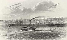
The Geelong Hospital was opened in 1852, and construction on the Geelong City Hall commenced in 1855.[16] Development of the Port of Geelong began with the creation of the first shipping channel in Corio Bay in 1853.[16] The Geelong-to-Melbourne railway was built by the Geelong & Melbourne Railway Company in 1857.[36] Rabbits were introduced to Australia in 1859 by Thomas Austin, who imported them from England for hunting purposes at his Barwon Park property near Winchelsea.[37] One of Geelong's best-known department stores, Bright & Hitchcocks, was established in 1861,[16] and the HM Prison Geelong built using convict labour, was opened in 1864.[38]
In 1866, Graham Berry started a newspaper, the Geelong Register, as a rival to the established Geelong Advertiser. When this proved unsuccessful, he bought the Advertiser and made himself editor of the now-merged papers.[39] Using the paper as a platform, he was elected for Geelong West in 1869. In 1877, he switched to Geelong, which he represented until 1886, and served as Victorian Premier in 1875, 1877–1880, and 1880–1881.[40] On the Market Square in the middle of the city, a clock tower was erected in 1856, and an Exhibition Building was opened in 1879.
1860s: The 'Sleepy Hollow' edit
The gold rush had seen Ballarat and Bendigo grow larger than Geelong in terms of population. Melbourne critics dubbed Geelong 'Sleepy Hollow',[14] a tag that recurred many times in the following years. A number of industries became established in Geelong, including Victoria's first woollen mill at South Geelong in 1868. In 1869, the clipper Lightning caught fire at the Yarra Street pier and was cast adrift in Corio Bay to burn, before being sunk by artillery fire.[28] Improvements to transport saw Geelong emerge as the centre of the Western District of Victoria, with railway lines extended towards Colac in 1876, and to Queenscliff in 1879.[36] Construction of the Hopetoun shipping channel began in 1881 and completed in 1893.[16]
The Geelong Cup was first held in 1872, and Victoria's first long-distance telephone call was made from Geelong to Queenscliff on 8 January 1878, only one year after the invention of the device itself.[16] Geelong was also the home of a prosperous wine industry until the emergence of the sap-sucking insect Phylloxera vastatrix at Fyansford in 1875, which led to the Victorian Government ordering the destruction of all vines in the Geelong area to prevent the spread of the pest, killing the industry until the 1960s.[41][16] Between 1886 and 1889, the central business district's major banks and insurance companies erected new premises in a solid and ornate character.[14] The existing Geelong Post Office was built during this time and the Gordon Technical College was established. Further industrial growth occurred, with the Fyansford cement works being established in 1890.[42]
The town became referred to as "The Pivot" in the 1860s, owing to its being a rail and shipping hub for western Victoria.[43]
1900s: A city develops edit

The town of Geelong officially became a city on 8 December 1910.[44][45] The city gained a number of essential services, with electric light supplied by the Geelong Power Station starting in 1902, the Geelong Harbour Trust was formed in December 1905,[46] and the Geelong Waterworks and Sewerage Trust formed in 1908. Electric trams began operation in 1912, travelling from the city centre to the suburbs until their demise in 1956.[47] The first of many stores on the Market Square was opened in 1913,[16] and the first Gala Day festival was held in 1916.[16]
Geelong's industrial growth accelerated in the 1920s: woollen mills, fertiliser plants, Ford's vehicle plant at Norlane, and the Corio whisky distillery were all established in this period.[36] The Geelong Advertiser radio station 3GL (now K-Rock) commenced transmission in 1930,[28] the Great Ocean Road was opened in 1932, and in 1934, the T & G Building opened on the most prominent intersection in the city, the corner of Ryrie and Moorabool Streets.
By 1936, Geelong had displaced Ballarat as Victoria's second-largest city.[48]

In 1938, one of the last Port Philip Bay steamers, Edina, made its final trip to Geelong, ending a period of seaside excursions and contests for the fastest trip. The Eastern Beach foreshore beautification and pool was completed in 1939 after almost 10 years of work.[16]
On the eve of World War II, the International Harvester works were opened beside Ford at North Shore, along with a grain elevator at nearby Corio Quay, and the Shell Australia oil refinery.[36]
Post-war period edit

Government housing was constructed in the suburbs of East Geelong, Norlane, North Shore, and Corio from the 1950s. The banks of the Barwon River burst in 1952, inundating nearby Belmont Common.
Geelong continued to expand with Corio, Highton, and Belmont growing at such a rate that in February 1967, Geelong accounted for 21% of private home development in Greater Melbourne.[14] Private vehicles became the city's major mode of transport. The first parking meters in the city were introduced in 1961, new petrol stations were constructed and the city's first supermarket, operated by Woolworths, opened in 1965.[14] Later, support came for Cycling in Geelong with Australia's first bike plan in 1977.[3][4]
Industrial growth continued with a second cement works operating at Waurn Ponds by 1964[36] and the Alcoa Point Henry aluminium smelter constructed in 1962.[49]
Federal government policy changes on tariff protection led to the closure of many Geelong industrial businesses from the 1970s. Most woollen mills closed in 1974 and hectares of warehouse space in the city centre were left empty after wool-handling practices changed.[14] The Target head office opened in North Geelong, Deakin University was established at Waurn Ponds in 1974, and the Geelong Performing Arts Centre opened in 1981.[50] Later, the Australian Animal Health Laboratory was opened in 1985,[51] and the National Wool Museum in 1988.[52]
Market Square, the first enclosed shopping centre in the city, was opened in 1985, with neighbouring Bay City Plaza opened in 1988.[53] The Pyramid Building Society, founded in Geelong in 1959,[54] collapsed in 1990, leaving debts of AU$1.3 billion to over 200,000 depositors,[55] and causing the Geelong economy to stagnate.[56] On 18 May 1993, the City of Greater Geelong was formed by the amalgamation of a number of smaller municipalities with the former City of Geelong.[57] The Waterfront Geelong redevelopment, started in 1994, was designed to enhance use and appreciation of Corio Bay[58] and in 1995 the Barwon River overflowed in the worst flood since 1952.[59]
21st century edit


In 2004, Avalon Airport was upgraded to accommodate interstate passenger travel, providing a base for low-cost airline Jetstar to serve the Melbourne and Geelong urban areas.[60] Geelong is planned to expand towards the south coast, with 2,500 hectares of land to become a major suburban development for 55,000 to 65,000 people, known as Armstrong Creek.[61] In 2006, construction began on the Geelong Ring Road, designed to replace the Princes Highway through Geelong from Corio to Waurn Ponds. It opened in 2009.
More than AU$500-million-worth of major construction was under way in 2007.[62] Major projects include the $150-million Westfield Geelong expansion works, involving a flyover of Yarra Street, the city's first Big W store, and an additional 70 new speciality stores; the $37-million Deakin Waterfront campus redevelopment, and the $23-million Deakin Medical School; the $50-million Edgewater apartment development on the waterfront; a number of multimillion-dollar office developments in the CBD; and a new $30-million aquatic centre in Waurn Ponds.[62]
Major developments within Geelong are advocated by influential, non-government group the Committee for Geelong and the region's local government alliance, G21 Geelong Region Alliance.
The City of Greater Geelong and four other local municipalities form part of the alliance which identifies the Geelong region's priorities, and advocates all levels of government for funding and implement the projects. G21 developed 'The Geelong Region Plan - a sustainable growth strategy' Archived 4 October 2011 at the Wayback Machine which was launched by Premier Brumby in 2007. It was the approved strategic plan for the Geelong region. In addition, major projects such as the Geelong Ring Road Connections and duplication of the Princes Highway West obtained funding due to the combined efforts of the region's municipalities. As at May 2017, a further 13 Priority Projects are planned for the Geelong region.
The Victoria Government announced the relocation of the Transport Accident Commission headquarters from Melbourne to Geelong in October 2006, which created 850 jobs and an annual economic benefit over $59 million to the Geelong region.[63] The construction of the $80-million Brougham Street headquarters was completed in late 2008.[64] In November 2008, Ford Australia announced that its Australian-designed I6 engine would be re-engineered to meet the latest emissions regulations, and that consequently the engine manufacturing plant would be upgraded (however, all manufacturing of motor vehicles in Geelong and elsewhere throughout Australia ceased by 2017).
A change to the city skyline is occurring with a number of modern apartment buildings on the Waterfront and central business district planned or under construction. On 10 July 2008, approval was given for a $100-million twin-tower apartment complex of 16 and 12 floors to be built on Mercer St in the city's western edge. The towers will become the tallest buildings in the city, taking the title from the Mercure Hotel.[65] Further highrise developments are planned as part of the City of Greater Geelong's Geelong Western Edge strategic plan.[66] A$17-million 11-story apartment tower has also recently been proposed to be built next to the Deakin Waterfront Campus.[67]
In 2012, a design competition for a "city icon" was run for the City of Geelong by Deakin University and Senia Lawyers. The recipient of the prize and winning design entry was JOH Architects and their design titled "The Sea Dragon".[68]
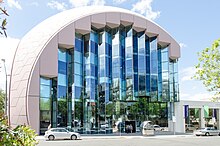
Geelong's new Library and Heritage Centre opened to the public in November 2015. The new addition to Geelong offers new research facilities, display areas and hosts Geelong's extensive heritage, modern and Indigenous. The new library was awarded the Sir Zelman Cowen Award for Public Architecture[69] in 2016.
Currently Geelong is undergoing a major revival effort, the Green Spine Project.[70] The Green Spine project will connect Johnstone Park to the Botanic Gardens by a continuous line of trees via Malop Street. The redevelopment of Malop street will see the installation of separated bike lanes from both pedestrians and local traffic by greenery, the design is an Australian first. This project includes the installation of art sculptures and street art throughout the city centre. Major redevelopments are also occurring at Johnstone Park, with a new raingarden installation, and Lt Malop Street is seeing more upgrades.[71]
In the suburbs Geelong West's Pakington Street is seeing major upgrades to its street appeal, with new plantings and upgrades to many of the shops. Manifold Heights' Shannon Avenue will see redevelopment to make it more pedestrian friendly. To Geelong's north, Rippleside is undergoing major changes, with the ongoing development of Balmoral Quay which will see Rippleside Park and nearby St Helens Park connected via a waterfront footpath as well as beach restoration and a boat dock expansion.[72]
Recently new high rise buildings are being built giving Geelong more jobs and housing.[73] Worksafe Victoria opened up a new 14-storey building on Malop Dt. It opened in mid-2018 and was the tallest building until it was announced that two residential high rises would be built and completed in late 2019. They are called The Mercer and Miramar Apartments.[74]
Geography edit

Geelong is located on the shores of the western tip of Corio Bay, a southwestern inlet of Port Phillip Bay. During clear weather, the distant Melbourne skyline is visible from higher areas of Geelong when viewed across the waters of Port Phillip. The Barwon River flows through the southern fringe of the Geelong city centre before entering Lake Connewarre and the estuary at Barwon Heads before draining into the Bass Strait.[75] The city is situated just east of the gap between the Otway Ranges and Brisbane Ranges, and commands the only lowland passage between the Werribee Plain and Western Volcanic Plains.
Geologically, the oldest rocks in the area date back to the Cambrian period 500 million years ago, with volcanic activities occurring in the Devonian period 350 million years ago.[76] In prehistoric times water covered much of the lowlands that are now Geelong, with the Barwon River estuary located at Belmont Common, the course of the river being changed when Mount Moriac erupted and lava was sent eastwards towards Geelong.[75]
To the east of the city are the Bellarine Hills and the undulating plains of the Bellarine Peninsula. To the west are the sandstone-derived Barrabool Hills and basalt Mount Duneed, and the volcanic plains to the north of Geelong extend to the Brisbane Ranges and the You Yangs.[76] Soils vary from sandy loam, basalt plains, and river loam to rich volcanic soils,[77] suitable for intensive farming, grazing, forestry, and viticulture.
Many materials used to construct buildings were quarried from Geelong, such as bluestone from the You Yangs and sandstone from the Brisbane Ranges.[76] A small number of brown coal deposits exist in the Geelong region, most notably at Anglesea, where it has been mined to fuel Alcoa's Anglesea Power Station since 1969.[78] Limestone has also been quarried for cement production at Fyansford since 1888,[42] and Waurn Ponds since 1964.[79]
City and suburbs edit
Geelong has over 60 suburbs, including the following:
Anakie, Armstrong Creek, Avalon, Balliang, Barwon Heads, Batesford, Bell Park, Bell Post Hill, Bellarine, Belmont, Breakwater, Breamlea, Ceres, Charlemont, City of Greater Geelong, Clifton Springs, Connewarre, Corio, Curlewis, Drumcondra, Drysdale, East Geelong, Fyansford, Geelong, Geelong West, Grovedale, Hamlyn Heights, Herne Hill, Highton, Indented Head, Lara, Leopold, Little River, Lovely Banks, Manifold Heights, Mannerim, Marcus Hill, Marshall, Moolap, Moorabool, Mount Duneed, Newcomb, Newtown, Norlane, North Geelong, North Shore, Ocean Grove, Point Lonsdale, Point Wilson, Portarlington, Queenscliff, Rippleside, South Geelong, St Albans Park, St Leonards, Staughton Vale, Swan Bay, Thomson, Wallington, Wandana Heights, Waurn Ponds, and Whittington.
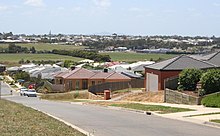
Development in Geelong started on the shores of Corio Bay in what is now the inner city. Development later spread to the south towards the Barwon River, and the hill of Newtown and Geelong West. Major development south of the river in Belmont did not start until the 1920s, stimulated by the construction of a new bridge over the river in 1926, and the extension of the Geelong tramway system in 1927.[16] Industrial areas were traditionally located on the Corio Bay for port access,[80] or the Barwon River for waste disposal.
In the interwar and post-World War II years, heavy industry continued to establish itself in the flatter northern suburbs,[80] where today industries such as the Geelong Oil Refinery and Ford engine plant reside.[81] Residential development also spread to Corio and Norlane in the north, with new Housing Commission of Victoria estates built to cater for employees of the new industries. From the 1960s, residential growth spread to the Highton hills in the south and North Geelong following prosperous industries like the gasworks, followed by Grovedale in the 1970s. A number of light industrial areas were also established in Breakwater, Moolap and South Geelong.[80]
Changing cargo-handling methods at the Port of Geelong left woolstores in inner Geelong unused, redevelopment beginning in the 1980s with the expansion of Westfield Geelong towards Corio Bay, and culminating in the Waterfront Geelong development.[82] Gentrification of former working-class inner suburbs such as Geelong West, North Geelong, and South Geelong has also occurred.[83] Today, the major residential growth corridors are north towards Lara, east towards Leopold, and south towards Mount Duneed as the Armstrong Creek Growth Area.[61]
Climate edit
Geelong has stable weather, yet still offers four distinct seasons.[84] It has a temperate oceanic climate (Cfb in the Köppen climate classification) with dominant westerly winds, variable clouds, moderate precipitation, warm summers, and mild to cool winters.[85][86] February is the hottest month and July is the coldest.[87] The highest temperature recorded was 47.4 °C (117.3 °F) on 7 February 2009 during a two-week-long heat wave, with the lowest of −4.4 °C (24.1 °F) recorded on 5 August 1997.[88] The average annual rainfall is around 520 mm (20.5 in), which makes Geelong the driest sizeable city in Australia, owing to the pronounced rain shadow of the Otway Ranges to the southwest.[87] Within the city, rainfall shows a strong gradient from south to north, so that the southernmost suburbs can receive around 700 mm (28 in) whilst more northerly Lara receives as little as 425 mm (17 in), which is the lowest rainfall in southern Victoria.[89]
| Climate data for Geelong (Avalon Airport) 1995–2020 averages, 1995–present extremes | |||||||||||||
|---|---|---|---|---|---|---|---|---|---|---|---|---|---|
| Month | Jan | Feb | Mar | Apr | May | Jun | Jul | Aug | Sep | Oct | Nov | Dec | Year |
| Record high °C (°F) | 46.3 (115.3) |
47.9 (118.2) |
42.0 (107.6) |
36.1 (97.0) |
28.0 (82.4) |
23.6 (74.5) |
22.5 (72.5) |
25.9 (78.6) |
31.3 (88.3) |
37.8 (100.0) |
41.8 (107.2) |
45.8 (114.4) |
47.9 (118.2) |
| Mean daily maximum °C (°F) | 26.6 (79.9) |
26.2 (79.2) |
24.4 (75.9) |
20.5 (68.9) |
17.3 (63.1) |
14.7 (58.5) |
14.2 (57.6) |
15.4 (59.7) |
17.8 (64.0) |
20.3 (68.5) |
22.6 (72.7) |
24.5 (76.1) |
20.4 (68.7) |
| Mean daily minimum °C (°F) | 14.2 (57.6) |
14.5 (58.1) |
12.6 (54.7) |
9.7 (49.5) |
7.7 (45.9) |
5.7 (42.3) |
5.2 (41.4) |
5.5 (41.9) |
6.7 (44.1) |
8.1 (46.6) |
10.6 (51.1) |
11.9 (53.4) |
9.4 (48.9) |
| Record low °C (°F) | 4.5 (40.1) |
6.8 (44.2) |
2.9 (37.2) |
0.6 (33.1) |
−1.3 (29.7) |
−2.9 (26.8) |
−4.0 (24.8) |
−4.4 (24.1) |
−1.7 (28.9) |
0.1 (32.2) |
2.6 (36.7) |
4.6 (40.3) |
−4.4 (24.1) |
| Average rainfall mm (inches) | 31.1 (1.22) |
35.0 (1.38) |
24.8 (0.98) |
39.8 (1.57) |
32.4 (1.28) |
40.5 (1.59) |
36.1 (1.42) |
38.3 (1.51) |
40.2 (1.58) |
40.9 (1.61) |
50.7 (2.00) |
28.5 (1.12) |
439.2 (17.29) |
| Average rainy days (≥ 0.2 mm) | 6.0 | 5.7 | 6.7 | 9.7 | 11.9 | 13.8 | 15.4 | 15.2 | 13.6 | 12.0 | 9.9 | 8.5 | 128.4 |
| Average afternoon relative humidity (%) | 50 | 49 | 49 | 56 | 64 | 68 | 66 | 62 | 58 | 53 | 54 | 53 | 57 |
| Source 1: Bureau of Meteorology, Avalon Airport (1991–2020)[90] | |||||||||||||
| Source 2: Bureau of Meteorology, Avalon Airport (all years)[91] | |||||||||||||
Economy edit

More than 10,000 businesses employ over 80,000 people in the Geelong region,[19] with manufacturing and processing industries providing around 15,000 jobs, followed by 13,000 in retail, and 8,000 in health and community services.[19]
In 2020, the Committee for Geelong published a research paper Resilient Geelong which tracks the Geelong economy over several decades. Written Deakin University's Prof Louise Johnson, Resilient Geelong makes a series of recommendations for the future of Geelong.
Geelong's major employers were the Ford Motor Company engine plant in Norlane (closed in 2016), aircraft maintenance at Avalon Airport, the head office of retail chain Target Australia (until 2018), the Bartter (Steggles) chicken processing plant and the Shell oil refinery at Corio.[93] GMHBA Limited, a health insurance company, is headquartered in Geelong.[94]
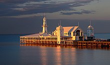
The Geelong region attracted over 6 million tourists during 2001.[95] Major tourist attractions include the Waterfront Geelong precinct and Eastern Beach on the shores of Corio Bay, and the National Wool Museum in the city, and more than 30 historical buildings listed on the Victorian Heritage Register.[96] The Geelong area hosts regular international events which are also tourist drawcards, including the Australian International Airshow.
Geelong has a number of shopping precincts in the CBD and surrounding suburbs. The two main shopping centres are located in the CBD - Westfield Geelong and Market Square, with smaller centres in the suburbs including Belmont Village and Waurn Ponds Shopping Centre in the south, Bellarine Village in Newcomb in the east, and Corio Shopping Centre in the north.[19] The opening of the major shopping centres has caused a decline in strip shopping on Moorabool Street, with many empty shops and few customers.[97] Geelong is also home to Mitre 10's largest franchisee – Fagg's – operating five stores across the town and employing over 160 people.
These major research laboratories are located in the Geelong area: the CSIRO Australian Animal Health Laboratory in East Geelong,[98] CSIRO Division of Textiles and Fibres Technology in Belmont,[99] and the Marine and Freshwater Resources Institute at Queenscliff.[100]
The scheduled closure of Ford's Australian manufacturing base in 2016 was confirmed in late May 2013. Headquartered in the Victorian suburb of Broadmeadows, the company had registered losses of AU$600 million over the five years prior to the announcement. It was noted that the corporate fleet and government sales that accounted for two-thirds of large, local car sales in Australia were insufficient to keep Ford's products profitable and viable in Australia.[101]
Following the decision by Shell to close its Geelong refinery in April 2013, a third consecutive annual loss was recorded for Shell's Australian refining and fuel marketing assets. Revealed in June 2013, the writedown is worth AU$203 million, and was preceded by a $638-million writedown in 2012 and a $407-million writedown in 2011 after the closure of the Clyde Refinery in Sydney.[102]
In April 2016 Target announced that it would be moving its headquarters out of North Geelong to Williams Landing in Melbourne's west.[103]
Demographics edit
| Population over time[16] | |
|---|---|
| 1841 | 454 |
| 1846 | 2,065 |
| 1851 | 8,291 |
| 1854 | 20,115 |
| 1861 | 22,929 |
| 1891 | 17,445 |
| 1901 | 25,017 |
| 1907 | 28,021 |
| 1921 | 31,689 |
| 1933 | 39,223 |
| 1946 | 51,000 |
| 1954 | 72,995 |
| 1961 | 91,666 |
| 1966 | 105,059 |
| 1976 | 122,080 |
| 1981 | 141,279 |
| 1988 | 146,349 |
| 2006 | 160,991 |
| 2009 | 179,971 |
| 2010 | 184,583 |
As of the 2006 census, 160,000 people resided in 68,000 households. The median age of persons in Geelong was 37 years. About 19.4% of the population of Geelong were children aged between 0–14 years, and 26.6% were persons aged 55 years and over.[104] Each dwelling is on average occupied by 2.59 persons, slightly lower than the state and national averages.[105] The median household income was $901 per week, $121 less than the state average, partly due to higher reliance on manufacturing for employment.[105] The population of Geelong is growing by 2500 people each year,[106] and the City of Greater Geelong had the highest rate of building activity in Victoria outside metropolitan Melbourne.[107]
About 78.4% of people from Geelong are Australian-born, with the most common overseas birthplaces being: England (3.6%), Italy (1.1%), Croatia (1.0%), the Netherlands (0.9%), and Scotland (0.8%). Around 14.2% of households speak a language other than English in the home.[104] Notable ethnic groups in the city are the Croatian community, who first came to the city in the 1850s[108] and with migration since World War II are now the largest Croatian community in Australia,[109] and the German settlers who founded Germantown (now Grovedale) in 1849 to escape repression in Prussia for their Lutheran faith.[110]

The 2006 census found the most common religious affiliation in Geelong was Catholicism at 29.4%. St. Mary of the Angels Basilica is the largest congregation in the city. Other affiliations of resident of Geelong include no religion 20.5%, Anglican 14.6%, Uniting Church 7.9%, and Presbyterian and Reformed at 4.3%.[111] The city has a large number of traditional Christian churches, as well as Orthodox Christian churches in the northern suburbs.
Governance edit

In local government, the Geelong region is covered by the City of Greater Geelong. The council was created in 1993 as an amalgamation of a number of other municipalities in the region,[57] with the council chambers located at the Geelong City Hall in central Geelong. The City is made up of four wards - Brownbill (central Geelong and inner suburbs), Bellarine, Kardinia (southern Geelong, south of the Barwon River) and Windermere (northern suburbs). Brownbill, Kardinia and Bellarine are each represented by three councillors, whereas Windermere is represented by two.[112]
From 2012 to 2016, the Mayor of Geelong was directly elected by the public to a four-year term.[112] Entrepreneur and former paparazzo Darryn Lyons held this position from 2013 to 2016.[113]
On 16 April 2016,[114] the Victorian Government dismissed the Mayor and Councillors of the Greater Geelong City Council,[115] following a Commission of Inquiry which found that the council is riven with conflict, unable to manage Geelong's economic challenges, has dysfunctional leadership and has a culture of bullying.[116] The government appointed administrators to run the council until council elections were held in 2017.[117] In 2023, the Victorian Government announced that it would appoint monitors to oversee the appointment of a new CEO.[118]
In state politics, the Legislative Assembly districts of Geelong, South Barwon, Lara, and Bellarine cover the Geelong area. After the 2022 Victorian Election, all four of these electorates are held by the Australian Labor Party.[119] Lara and Geelong are currently safe Labor seats with South Barwon increasing its margin and Bellarine more marginal.
On 12 February 2020, Minister for Planning Richard Wynn established Geelong Authority to advise on strategies to attract investment to central Geelong and on major planning applications to help create jobs and drive growth in Geelong.[120] The committee is chaired by Diana Taylor (lawyer) and consists of Mark Edmonds (former Chairman of Geelong Chamber of Commerce), Aamir Qutub (CEO of Enterprise Monkey), Jill Smith (former General Manager of Geelong Arts Centre) and Rory Costelloe (Executive Director of Villawood Properties)[121] and Dr Sarah Leach.
In federal politics, the House of Representatives seats - the Division of Corio and Division of Corangamite cover the Geelong region. Corio roughly covers the northern half of Geelong and has been a safe Australian Labor Party seat since the 1970s, but was previously the seat of Richard Casey, a leading conservative Cabinet member in the 1930s and later Governor-General, as well as Hubert Opperman, a former cycling champion and a prominent minister in the 1960s. It was also the seat of Gordon Scholes, who was Speaker during the Whitlam government. Corio is currently held by Deputy Prime Minister Richard Marles.
Corangamite, which roughly includes the southern half of Geelong as well as the Bellarine Peninsula, has traditionally been safe for the Liberal Party, but become more marginal in recent years due to demographic changes and redistributions.[122] Corangamite had been a safe seat for the Liberal Party and its predecessors from the 1930s through the 2000s. Future Prime Minister of Australia James Scullin served one term in this seat in the 1910s.[123] It was won by the Australian Labor Party at the 2019 federal election and again in 2022 by Libby Coker where the margin was increased.
Culture edit
Events and festivals edit
The Royal Geelong Show is held each year at the Geelong Showgrounds. Other events include Pako Festa (held annually in February),[124] Gala Day Parade (annual event that celebrated its 96th year in 2012)[125] and Family Fun Day (held annually as part of the Gala Day celebrations),[126] and the Geelong Heritage Festival that is run by the local branch of the National Trust.[127][128] The Gala Day Parade was axed in 2023.
Geelong hosts Victoria's only international photographic salon 'VIGEX' every two years. VIGEX is an acronym for "VIctoria Geelong EXhibition" and the inaugural event was held in 1980. The Australian Photographic Society, the world governing body of exhibition photography the International Federation of Photographic Art and the Victorian Association of Photographic Societies are patrons of the biennial photographic salon.[129]
Geelong's History is preserved through both the Geelong Historical Society, and the associated Geelong Heritage Centre currently housed in the new regional library[130] building opened in 2015.[131]
Now defunct, Geelong hosted a digital conference Pivot Summit which was headlined by Apple Co-founder Steve Wozniak in 2017.[132]
Arts and entertainment edit

Recognising a long history in design excellence, Geelong was designated as a UNESCO Creative City of Design in 2017.[133]
Geelong is home to a number of pubs, nightclubs, and live-music venues. The city is also the birthplace or starting point for a number of notable Australian bands and musicians, such as Barry Crocker, Gyan Evans, Magic Dirt, Jeff Lang, Denis Walter, Chrissy Amphlett, and Helen Garner.[134]
Geelong also hosts music festivals such as the Meredith Music Festival, Offshore Festival, Poppykettle Festival, and National Celtic Festival.
The city's prominent cultural venues are the Geelong Performing Arts Centre (commonly known as "GPAC"),[135] the 1500-seat Costa Hall auditorium and the Geelong Art Gallery.[136]
Based in Geelong, Back to Back Theatre is a globally renown, contemporary Australian theatre companies engaging with disability on stage. With work produced by the company, Back to Back Theatre explores questions about politics, ethics and philosophy in humanity and tours nationally and globally. In 2022, Back to Back Theatre was awarded the $300,000 International Ibsen Award.[137]
Local community-led, not for profit Creative Geelong Inc[138] was established in 2015 to support local creatives and highlight the opportunities for creative industries practitioners in the region. In 2017, Creative Geelong partnered with Deakin University to crowdfund and produce three documentaries about Geelong's transformation from a heavy manufacturing hub to a creative destination.[139][140] Hubcaps to Creative Hubs series showcase three locations in Geelong including the Federal Woollen Mills, RS&S Woollen Mills and the Fyansford Paper Mills and tells the story of their industrial past and new purpose as creative hot spots.
Media edit
The Geelong Advertiser, the oldest newspaper title in Victoria and the second-oldest in Australia,[141][142] was established in 1840. The free Geelong Independent and Geelong News are the city's other major newspapers.
Geelong is part of the Melbourne television licence area, and receives all of the free-to-air stations from Melbourne, including ABC, SBS, Seven, Nine, Ten, and the community channel C31. The Geelong region also receives cable and satellite television services through operators Foxtel and Neighbourhood Cable.
The local radio stations are K-Rock (rock and pop music), Rhema FM (Christian community station), Hot Country Radio (country music station), The Pulse (community station), 3GPH (radio reading service), and Bay FM (adult contemporary music). The transmitters for K-Rock, The Pulse, Rhema FM, and Bay FM are located at a shared transmitter site on Mount Bellarine, near Drysdale. Most Melbourne-based radio stations can also be received clearly in the Geelong region.
Sport edit

Australian rules football is the most popular sport in Geelong. Established in 1859, the Geelong Football Club is the second oldest club[143] in the Australian Football League (AFL) and one of the world's oldest football clubs. Until South Melbourne relocated to Sydney in 1981, it was the only VFL/AFL club based outside of the greater Melbourne metropolitan area. Its home ground is Kardinia Park stadium. It also fields a reserves side in the Victorian Football League,[143] and three independent football leagues run in the area: the Geelong Football League, the Geelong & District Football League, and the Bellarine Football League.[144]
The Geelong Arena in North Geelong is the home of the Geelong Supercats basketball team, and was also used during the 2006 Commonwealth Games for basketball games.[145] The Geelong Basketball and Netball Centre was formerly the home to another basketball team from the region, the Corio Bay Stingrays.[146] The city co-hosted the 2003 FIBA Oceania Championship where Australia's national basketball team won the gold medal.
North Geelong Warriors FC are the region's primary soccer club, playing in the National Premier Leagues Victoria competition. The club played in the Victorian Premier League from 1992 to 1997 and in the top tier of the NPL in 2015. Other soccer clubs include Northern based Geelong Rangers FC, Geelong SC, Corio SC, Lara United FC and Southern based Surf Coast SC. Western United play a few home games every year in GMHBA stadium, Geelong is included in the marketing for the club in western victoria.
Geelong has a horse-racing club, the Geelong Racing Club, which schedules around 22 race meetings a year, including the Geelong Cup meeting in October.[147] The Geelong Cup was first run in 1872,[148] and is considered one of the most reliable guides to the result of the Melbourne Cup.[149] It also has a picnic horse-racing club, Geelong St Patricks Racing Club, which holds its one race meeting a year in February.[150]
Geelong Harness Racing Club conducts regular meetings at its racetrack at Corio,[151] and the Geelong Greyhound Racing Club holds regular meetings.[152]
Founded in 1882, the Geelong Lawn Tennis Club has 27 tennis courts and plays host to a number of tennis tournaments including the Davis Cup tie between Australia and China in 2012.
The Eastern Beach foreshore and nearby Eastern Gardens regularly host internationally televised triathlons, and annual sports car and racing car events such as the Geelong Speed Trials.[153]
Corio Bay is also host to many sailing and yachting events. Geelong also has many golf courses, sporting and recreation ovals, and playing fields, as well as facilities for water skiing, rowing, fishing, hiking, and greyhound and harness racing.[154] Geelong Athletics holds competitions during both the summer and winter, including high-profile events such as Victorian and sometimes national and international track and field meets.
Geelong is home to Australia's largest indoor skate park,[155] and has "more skate parks per capita than any other municipality in Australia."[156]
Geelong is also the birthplace of Bev Francis, an IFBB professional Australian female bodybuilder, powerlifter, and national shot put champion.[157][158]
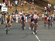
The Cadel Evans Great Ocean Road Race, named in honour of the Tour de France winner and 2009 World Champion starts in the city. It then goes through Barwon Heads on the Bellarine Peninsula, passing by the famous surf beach of Bells Beach in Surf Coast Shire and continuing along the Great Ocean Road. The race then heads via rolling hills back to Geelong for three circuits of the city before a waterfront finish. The race generally suits puncheurs who are capable of getting into breakaways and can easily climb short, steep hills.[159][160]
The city's Kardinia Park Stadium hosted the first match of the 2022 Men's T20 cricket World Cup. Along with other cities in regional Victoria, Geelong was scheduled host the 2026 Commonwealth Games until they were cancelled.[161]
The Geelong Sharks compete in the state's Rugby League competition run by NRL Victoria.
Public services edit
Education edit

Geelong is served by a number of public and private schools that cater to local and overseas students. Over 40,000 primary and secondary students are enrolled in schools in Geelong, with another 27,000 students enrolled in tertiary and further education programs.[19] The first schools in Geelong were established when the town was settled from the 1850s, among them were the historic private schools The Geelong College and Geelong Grammar School.[93]
Geelong is also home to the oldest state secondary school in Victoria, Geelong High School, which has been serving the community since 1905, for over 100 years.
The Gordon Memorial Technical College opened in 1888, and is known today as the Gordon Institute of TAFE.[16] In 1976, the Gordon Institute was divided into two parts, with academic courses becoming part of the newly formed Deakin University based at the Waurn Ponds campus.[162] Deakin University enrolled its first students at its Waurn Ponds campus in 1977. Today, the university is located on a 365-ha site at Waurn Ponds and has over 1,000 staff and over 4,000 on-campus students.[163] The university also has a campus located on the waterfront of Corio Bay in the Geelong CBD,[164] a campus in Burwood, Melbourne,[165] and a campus in Warrnambool, in Western Victoria.[164] From 2008 the campus at Waurn Ponds also has been home to Victoria's first regional medical school.[166]
Health edit
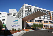
The major public health service is Barwon Health, which operates 21 separate health sites including University Hospital Geelong on Ryrie Street, and the McKellar Centre on Ballarat Road. Barwon Health services the entire region. The largest private hospital is the nearby St John of God Health Care centre on Myers Street. Prominent healthcare services include the Epworth Hospital located at 1 Epworth Place, Waurn Ponds VIC 3216.,[167] and Geelong Health (Geelong West).
Utilities edit

Water storage and supply in Geelong is managed by Barwon Water, a Victoria government-owned urban water corporation. Geelong is supplied with water from three river systems: the Barwon, the East Moorabool, and the West Moorabool Rivers. The catchment areas are the Brisbane Ranges to Geelong's north-west, and the Otway Ranges to the south-west. The first water supplies to Geelong were from the Stony Creek reservoirs near Steiglitz, but, as of 2010, Geelong, together with Ballarat, consumes about 70% of the Moorabool River's water flow.[168] Sewage from Geelong and district is treated at the Black Rock Treatment Plant at Breamlea and then discharged into Bass Strait.
Geelong was first supplied with electricity in 1902 when the Geelong Power Station opened on the corner of Yarra and Brougham Streets. Later known as Geelong A, the power station was rebuilt in 1920 to increase the capacity, with the station continued operating until 1961. In 1936, Geelong was connected to the state electrical grid. The Geelong B power station at North Geelong opened in 1954,[49] and was closed in 1970 due to the much higher efficiency of the power stations in the Latrobe Valley. The supply of piped coal gas in Geelong started in 1860 by the Geelong Gas Company. The gasworks were located in North Geelong next to the North Geelong railway station.[169] Geelong was converted to natural gas in 1971, with the Geelong Gas Company being taken over by the Gas & Fuel Corporation of Victoria on 30 June 1971.[170]
Transportation edit

The main form of transportation in Geelong is the automobile. Geelong is well-connected by roads to all of south-west Victoria, to Melbourne by a major-arterial the Princes Freeway (M1) with three or four lanes in each direction, to Warrnambool by the Princes Highway (A1), the Bellarine Peninsula by the Bellarine Highway (B110), Ballarat by the Midland Highway (A300), and to Hamilton by the Hamilton Highway (B140). The $380-million Geelong Ring Road (an extension of the Princes Freeway) bypasses the greater Geelong urban area exiting the Princes Highway near Corio to rejoin the highway at Waurn Ponds.[171] The Lewis Bandt Bridge, named in honour of the Ford Australia engineer who is credited as the inventor of the ute (1934), in Geelong is a feature of the new road.[172]
Avalon Airport edit

Avalon Airport is located about 15 km (9.3 mi) to the north-east of the city of Geelong in the suburb of Avalon. It was established in 1953 for the production of military aircraft.[173] It was also used for the repair of commercial aircraft, and for pilot training. Avalon Airport has also been home to low-cost airline Jetstar since 2004.[60] Flights to Sydney use the airport and in June 2015, Jetstar announced it would fly to the Gold Coast daily from Avalon Airport commencing October 2015. Avalon Airport is the venue for 'Thunder Down Under' Australian International Airshow every other year.
Avalon Airport had international flights with AirAsia X to and from Kuala Lumpur and Citilink to Denpasar but were cancelled during the pandemic.
Rail edit

Geelong is a major hub for rail transport in Victoria, having frequent services to and from Melbourne, and being at the junction of the Port Fairy, Western standard gauge and the Geelong-Ballarat lines.[36] Eight passenger railway stations are in the urban area, all along the Warrnambool line and served by V/Line trains.[174] The Geelong line provides passenger services to Melbourne in the off-peak with trains departing Geelong every 20 minutes on weekdays, with more frequent services at peak times. According to V/Line, the Geelong line carries more passengers than any other regional rail line in Australia.[175] None of the lines are electrified and all trains servicing Geelong are diesel powered.
Geelong's currently operating stations include Little River, Lara, Corio, North Shore, North Geelong, Geelong, South Geelong, Marshall and Waurn Ponds.
In the past, a rail line connected Geelong city to the Bellarine Peninsula through to Queenscliff, ceasing to operate as a regular passenger service in 1976. The Bellarine Railway operates a section of the line between Drysdale and Queenscliff as a tourist attraction.
Passenger services run to Warrnambool three times daily, connecting Geelong with Colac, Terang, and Camperdown. Journey Beyond's The Overland service between Melbourne and Adelaide stops at the standard-gauge platform provided at North Shore station. It runs six days a week, with three services to Adelaide and three to Melbourne.[176] Freight trains also operate from Melbourne to Geelong serving local industries,[81] as well as to Warrnambool and other western Victorian towns. The main Melbourne-Adelaide standard-gauge line is a heavily used interstate freight route.
Victoria's electronic ticketing system, Myki, was implemented on rail services between Marshall and Melbourne on 29 July 2013.[177]
The Victorian government is currently in process of land acquisition and inspection for a potential Torquay rail line which would service both Torquay and the Armstrong Creek growth corridor.
Ports and ferry services edit
The Port of Geelong is located on the shores of Corio Bay, and is the sixth-largest seaport in Australia by tonnage.[178] Major commodities include crude oil and petroleum products, export grain, woodchips, alumina imports, and fertiliser.[179] The Bellarine Peninsula has been linked to the Mornington Peninsula since 1987[180] by the Searoad ferry, which runs every hour using two roll-on/roll-off ferries between Queenscliff and Sorrento[181]
Port Phillip Ferries began operating twice daily services between Portarlington and Melbourne Docklands in November 2016. Three years later overcrowding on trains led to a similar service being introduced from Geelong to Docklands. The services are popular with both tourists and commuters, providing an alternative access for Geelong and the Bellarine Peninsula to Melbourne. The 36-metre-long catamaran ferries seat over 400 passengers, provide a comfortable vantage point to enjoy the sights of Port Phillip. The introduction of the Portarlington service led to a major revamp of the local pier, with pier extensions and a protective rock wall installed.[citation needed]
On 23 October 2022 the Tasmanian ferry service, the Spirit of Tasmania, started operating from a new terminal in North Geelong rather than from Port Melbourne.[182]
Bus and taxi edit

A bus network covering the city centre and most surrounding suburbs provides public transport. Until June 2015 they were operated under the umbrella of the Geelong Transit System. Public Transport Victoria contracts CDC Geelong and McHarry's Buslines to provide Geelong's bus services and bus services to Torquay and the Bellarine Peninsula.[183] V/Line services link Geelong with Ballarat, Daylesford, Bendigo, Apollo Bay, the Great Ocean Road, the Twelve Apostles and Warrnambool.[174]

Taxi services in Geelong are provided by Geelong Taxi Network, a newly formed depot following the effective merger of Bay City Cabs and Geelong Radio Cabs in July 2007.[184] The majority of the network covers the city and suburban areas of the city, with "urban" classification for the vehicles in use. The Bellarine Peninsula, and Torquay areas, although part of Geelong Taxi Network, are both covered by separate "country" classification taxis. Often, disputes occur in regards to different taxis from one licence area, picking up work from either of the other two licence areas, which is illegal in most circumstances under current taxi regulations in Victoria.[185] Call centre and radio dispatch services for the new combined network are provided by Silver Top Taxis in Melbourne.
Cycling and walking edit
Geelong also has many kilometres of bicycle trails including the:
- Bay Trail, Corio Quay to Limeburners Point
- Barwon River trail – 20 km between Fyansford and South Geelong
- Bellarine Rail Trail is a 32 km path between South Geelong and Queenscliffe.[186]
- Cowies Creek Trail
- Hovells Creek Trail
- Ted Wilson trail- Follows the Geelong Ring Road for 12 km between Corio to Hamlyn Heights
- Tom McKean Linear Park, Separation Street, North Geelong through to the Fyansford Cement Works
- Waurn Ponds trail offers follows over 6 km of the Waurn Ponds creek
See also edit
- Geelong Field Naturalists Club
- List of cities in Australia#Victoria
- List of Heritage listed buildings in Geelong
- Category:People from Geelong
- Geelong's Woolstores, 19th century
- Newcastle
- Wollongong
- Geelong depot
Notes edit
- ^ The Australian Bureau of Statistics defined urban area (SUA) for Geelong corresponds with the Greater Geelong LGA except that the SUA excludes the Portarlington Statistical Area (SA2), but includes the Point Lonsdale - Queenscliff and Torquay SA2s.
References edit
- ^ ABS Greater Geelong Region Statistics. "Region summary: Greater Geelong (C)". Australian Bureau of Statistics. Retrieved 2 November 2022.
- ^ Australian Bureau of Statistics (27 June 2017). "2016 Community Profiles: Geelong". 2016 Census of Population and Housing. Retrieved 29 December 2019.
- ^ "Significant Urban Area (SUA) ASGS Edition 2016 in .csv Format". Australian Bureau of Statistics. 9 October 2017. Retrieved 14 November 2019.
- ^ Butler, S., ed. (2009). "Geelong". Macquarie Dictionary (5th ed.). Sydney, NSW: Macquarie Dictionary Publishers. 1952 pages. ISBN 978-1-876429-66-9.
- ^ "Definition of Geelong in Oxford dictionary. Meaning, pronunciation and origin of the word". Oxford Dictionaries. Oxford University Press. 2013. Archived from the original on 8 March 2013. Retrieved 7 December 2013.
- ^ Clark, Ian D. (2002). Dictionary of Aboriginal placenames of Victoria. Heydon, Toby, 1972-, Victorian Aboriginal Corporation for Languages. Melbourne, Victoria: Victorian Aboriginal Corp. for Languages. ISBN 0-9579360-2-8. OCLC 54913331.
- ^ "3218.0 – Regional Population Growth, Australia, 2017-18: Population Estimates by Significant Urban Area, 2008 to 2018". Australian Bureau of Statistics. 27 March 2019. Retrieved 25 October 2019. Estimated resident population, 30 June 2018.
- ^ "The Gateway Cities Alliance | Easing population pressures". Gateway Cities Alliance. Retrieved 16 October 2022.
- ^ "Wadawurrung Traditional Owners". Wadawurrung. Retrieved 16 October 2022.
- ^ "Wathaurong language - Djillong". www.djillong.net.au. Archived from the original on 12 October 2018. Retrieved 12 October 2018.
- ^ "Geelong City". City of Greater Geelong. Archived from the original on 28 October 2007. Retrieved 16 December 2007.
- ^ "Post Office List". Premier Postal History. Retrieved 11 April 2008.
- ^ a b "Key drivers of change". City of Greater Geelong population forecast. Archived from the original on 27 July 2008. Retrieved 29 December 2007.
- ^ a b c d e f g h i j k l m Norman Houghton - Norman, Houghton. "The Story of Geelong". Archived from the original on 28 October 2007. Retrieved 2007-12-16.
- ^ "Historical perspective". Geelong Business News. Archived from the original on 15 June 2005. Retrieved 29 December 2007.
- ^ a b c d e f g h i j k l m Begg, Peter (1990). Geelong - The First 150 Years. Globe Press. ISBN 0-9592863-5-7.
- ^ "Early days of Geelong". The Argus. 19 July 1924. p. 9. Retrieved 27 April 2011.
- ^ "Geelong – a brief history". Intown Geelong. Retrieved 12 July 2015.
- ^ a b c d e "Top 10 Reasons to Move to Geelong". City of Greater Geelong website. Archived from the original on 28 October 2007. Retrieved 2007-12-16.
- ^ "Regions get new lease on lifestyle". The Age. Melbourne. 14 April 2004. Retrieved 19 July 2007.
- ^ "Wadawurrung Traditional Owners". Wadawurrung. Retrieved 1 June 2021.
- ^ a b c d e f Billot, C.P. (1969). The Life of Our Years. Lothian Publishing. National Library of Australia registry number 68-2473.
- ^ "Excerpts from the 'Port Phillip Survey 1957–1963'". Port Phillip Conservation Council website. Archived from the original on 20 September 2007. Retrieved 16 December 2007.
- ^ "Grimes, Charles (1772–1858), Online Edition". Australian Dictionary of Biography. National Centre of Biography, Australian National University. ISSN 1833-7538. Retrieved 30 December 2007.
- ^ "Collins, David (1756–1810), Online Edition". Australian Dictionary of Biography. National Centre of Biography, Australian National University. ISSN 1833-7538. Retrieved 30 December 2007.
- ^ a b "Hovell, William Hilton (1786–1875), Online Edition". Australian Dictionary of Biography. National Centre of Biography, Australian National University. ISSN 1833-7538. Retrieved 16 December 2007.
- ^ "Reminiscences of James Buckley, communicated by him to George Langhorne, 1837". State Library of Victoria. Archived from the original on 24 November 2007. Retrieved 2007-12-16.
- ^ a b c d "Timeline history". Geelong and District Historical Resources website. Archived from the original on 26 June 2007. Retrieved 19 July 2007.
- ^ "Buckley, William (1780–1856)". Australian Dictionary of Biography (Online ed.). National Centre of Biography, Australian National University. ISSN 1833-7538. Retrieved 16 December 2007.
- ^ a b "Fyans, Foster (1790–1870)". Australian Dictionary of Biography (Online ed.). National Centre of Biography, Australian National University. ISSN 1833-7538. Retrieved 16 December 2007.
- ^ "Victoria's First Four". The Newcastle Sun. No. 5778. New South Wales, Australia. 20 June 1936. p. 7. Retrieved 30 October 2020 – via National Library of Australia.
- ^ "Letter from R.C. Gunn". Discovery of keys in the shore formation of Corio Bay, Royal Society of Victoria, [1875]. Archived from the original on 1 September 2007. Retrieved 2007-12-16.
- ^ Ronalds, B.F. (2022). Alfred Ronalds: Angler, Artisan and Australian Pioneer. Medlar Press.
- ^ "Thomson, Alexander (1798–1866)". Australian Dictionary of Biography (Online ed.). National Centre of Biography, Australian National University. Retrieved 16 December 2007.
- ^ Ament, Phil (18 August 2005). "Fascinating facts about the invention of the refrigerator by Carl von Linde in 1876". The Great Idea Finder. Archived from the original on 16 July 2012. Retrieved 1 September 2012.
- ^ a b c d e f "Geelong Line Guide". Rail Geelong. Retrieved 16 December 2007.
- ^ "Feral European Rabbit". Australian Government fact sheet. Retrieved 16 January 2012.
- ^ "FORMER HM TRAINING PRISON - 202 MYERS STREET AND CORNER SWANSTON STREET GEELONG, Greater Geelong City". Heritage Victoria: Heritage Register Online. Retrieved 30 December 2007.[dead link]
- ^ "Berry, Sir Graham (1822–1904)". Australian Dictionary of Biography (Online ed.). National Centre of Biography, Australian National University. ISSN 1833-7538. Retrieved 16 December 2007.
- ^ "Victorian Premiers Since Responsible Government, 1855 - Current". Parliament of Victoria website. Archived from the original on 23 October 2007. Retrieved 2008-01-15.
- ^ Taborsky, Jan. "Did you know? Geelong phylloxera disaster". The Lost Terroir. Retrieved 2 January 2021.[permanent dead link]
- ^ a b "Fyansford Line Guide". Rail Geelong. Retrieved 16 December 2007.
- ^ "Geelong - a brief history". Intown Geelong website. Retrieved 28 January 2011.
- ^ "Geelong | Victoria, Australia | Britannica". www.britannica.com. Retrieved 11 September 2022.
- ^ "VICTORIAN GOVERNMENT - New South Wales Statutes and Victorian Acts of Parliament - Kim barne thaliyu". archivestest.grlc.vic.gov.au. Retrieved 11 September 2022.
- ^ "Agency VA 1425: Port of Geelong Authority". Public Record Office Victoria website. Archived from the original on 8 September 2007. Retrieved 16 December 2007.
- ^ "Geelong tramways - a short history". Tramway Museum Society of Victoria. Archived from the original on 19 August 2006. Retrieved 13 June 2007.
- ^ Geelong Ousts Ballarat. Population Surprises. The Argus (Melbourne) Tuesday 28 April 1936, page 10
- ^ a b R. Arklay and I. Sayer (September 1970). Geelong's Electric Supply.
- ^ "GPAC - About". Archived from the original on 30 August 2007. Retrieved 13 August 2007.
- ^ Wilkins, Emma (30 May 2012). "A look inside CSIRO's Australian Animal Health Laboratory". CSIRO. Archived from the original on 10 September 2012. Retrieved 1 September 2012.
- ^ "National Wool Museum". City of Greater Geelong website. Archived from the original on 31 August 2007. Retrieved 2007-12-16.
- ^ File:Bay City Plaza Plaque Geelong.jpg
- ^ "Pyramid Building Society Ltd". Guide to Australian Business Records. Archived from the original on 16 September 2007. Retrieved 22 December 2007.
- ^ "Mysteries of the Pyramid. (Pyramid building society financial collapse)". The Economist (US), July 1990. Retrieved 22 December 2007. [dead link]
- ^ "Geelong leads regional price boom". The Age. Melbourne. 26 July 2003. Retrieved 30 December 2007.
- ^ a b "Sale of Harding Park, Geelong". Victorian Auditor-General's Office. Archived from the original on 3 September 2007. Retrieved 1 July 2007.
- ^ "The Waterfront Story" (PDF). City of Greater Geelong website. Archived from the original (PDF) on 8 November 2007. Retrieved 2007-12-16.
- ^ "Geelong and Southern Vic: Floods (incl Landslides)". Emergency Management Australia website (via Google cache). Retrieved 30 December 2007.[permanent dead link]
- ^ a b "History made as Avalon Airport welcomes first Jetstar flight" (PDF). Jetstar website. 1 June 2004. Archived from the original (PDF) on 9 April 2008. Retrieved 18 December 2007.
- ^ a b "Strategic plan to manage urban growth south of Geelong". City of Greater Geelong website. 12 April 2005. Archived from the original on 9 September 2007. Retrieved 2007-12-25.
- ^ a b "Building bonanza drives city forward". Geelong News. 18 July 2007. pp. 8–9.
- ^ "Premier announces new TAC site in Geelong". Transport Accident Commission website. Archived from the original on 20 July 2007. Retrieved 21 July 2007.
- ^ Tomazin, Farrah; Adams, David (16 December 2005). "Move or move on, TAC workers told". The Age. Melbourne. Retrieved 21 July 2007.
- ^ Begg, Peter (10 July 2008). "Twin towers earmarked for Mercer Street". Geelong Advertiser. Archived from the original on 11 July 2008. Retrieved 10 March 2016.
- ^ "Geelong Western Wedge - City of Greater Geelong". 5 August 2012. Archived from the original on 5 August 2012.
- ^ "Ford's Geelong plant to close, 600 jobs lost". ABC News. 18 July 2007. Retrieved 19 July 2007.
- ^ "Seadragon Winning Design for Geelong Icon". JOH Architects. 1 April 2012. Archived from the original on 10 April 2013. Retrieved 2012-04-01.
- ^ "Geelong Library wins the Sir Zelman Cowen Award / ARM Architecture". armarchitecture.com.au.
- ^ Geelong, Revitalising Central (28 September 2022). "Green Spine". Revitalising Central Geelong. Retrieved 16 October 2022.
- ^ Planning (20 December 2016). "Revitalising Central Geelong". Planning. Archived from the original on 16 October 2022. Retrieved 16 October 2022.
- ^ Duncan, Brad. "Maritime Infrastructure Heritage Project Stage Two: Geelong (Report of Regional Landscape Archaeological and Historical Survey - Updated to 2006)".
{{cite journal}}: Cite journal requires|journal=(help) - ^ "Not everyone benefiting from booming Geelong economy after arrival of government agencies". www.abc.net.au. 1 March 2020. Retrieved 22 September 2020.
- ^ "New 14-storey building to dominate Geelong skyline". ABC News. 16 February 2016. Retrieved 8 June 2023.
- ^ a b Loney, Jack (1988). The Historic Barwon. Portarlington, Vic.: J. Lonely. ISBN 0-909191-37-9.
- ^ a b c "Geelong State of the Environment Report - Geological conditions". City of Greater Geelong website. Archived from the original on 6 September 2007. Retrieved 29 December 2007.
- ^ "Geelong Wine Fact Sheet". City of Greater Geelong website. Archived from the original on 6 November 2007. Retrieved 2007-12-29.
- ^ "Alcoa - Victorian operations". Alcoa. Archived from the original on 5 September 2008. Retrieved 25 December 2007.
- ^ "Waurn Ponds". Rail Geelong. Retrieved 29 December 2007.
- ^ a b c "Greater Geelong Planning Scheme (Section 21.22 INDUSTRY)". Victoria Department of Planning and Community Development website. 19 January 2006. Archived from the original on 29 June 2009. Retrieved 2007-12-25.
{{cite web}}: CS1 maint: bot: original URL status unknown (link) (via ) - ^ a b "North Geelong Yard". Rail Geelong. Retrieved 13 August 2007.
- ^ "City by the Bay concept 1981". Intown Geelong website. Retrieved 25 December 2007.
- ^ "GEELONG ECONOMIC INDICATORS BULLETIN - 2001/2002" (PDF). City of Greater Geelong website. Archived from the original (PDF) on 1 September 2007. Retrieved 2007-12-25.
- ^ "Weather/Climate/Light". Film Geelong website. Archived from the original on 1 November 2007. Retrieved 2007-12-24.
- ^ "Climate". Department of Primary Industries website. Retrieved 22 December 2007.
- ^ "Australian Climate Averages - Climate classifications". www.bom.gov.au.
- ^ a b "Climate statistics for 'GEELONG SEC' 1870–1970". Bureau of Meteorology. Retrieved 24 December 2007.
- ^ "Climate Averages for AVALON AIRPORT". Bureau of Meteorology. Retrieved 25 December 2007.
- ^ "vic_aarf.gif (640x600 pixels)". 22 July 2012. Archived from the original on 22 July 2012.
- ^ "Geelong (Avalon Airport) 1991–2020 averages". Bureau of Meteorology. Retrieved 20 March 2022.
- ^ "Geelong (Avalon Airport) all years". Bureau of Meteorology. Retrieved 20 March 2022.
- ^ "Geelong; Unemployment rate; Persons; series A84599671C". 6291.0.55.001 Labour Force, Australia, Detailed - Electronic Delivery. Australian Bureau of Statistics. 23 February 2023.
- ^ a b "Geelong Fast Facts" (PDF). City of Greater Geelong website. Archived from the original (PDF) on 29 August 2007. Retrieved 2007-12-30.
- ^ "GMHBA Limited". apra.gov.au. APRA. Archived from the original on 9 June 2017. Retrieved 11 July 2017.
- ^ "Geelong Otway Region Domestic Visitation 2001" (PDF). Geelong Otway Tourism website. Archived from the original (PDF) on 28 September 2007. Retrieved 2007-12-16.
- ^ "Geelong". Monash University place names gazette (link broken). Archived from the original on 25 August 2006. Retrieved 16 December 2007.
- ^ Smith, Sophie (2 July 2008). "While Moorabool St remains cold and empty". Geelong News. p. 3.
- ^ "Australian Animal Health Laboratory". CSIRO. May 2013. Archived from the original on 3 June 2013. Retrieved 26 May 2013.
- ^ "Geelong: Belmont, Vic (CSIRO Materials Science & Engineering)". CSIRO. May 2013. Archived from the original on 11 May 2013. Retrieved 26 May 2013.
- ^ "Marine and Freshwater Resources Institute (MAFRI) (1996 - )". Encyclopedia of Australian Science. 2010. Retrieved 26 May 2013.
- ^ Davison, Remy (24 May 2013). "Ford's exit spells the end of the road for manufacturing". The Conversation Australia. The Conversation Media Group. Retrieved 26 May 2013.
- ^ Matt Chambers (4 June 2013). "Geelong refinery writedown hits Shell for $203m". The Australian. Retrieved 6 June 2013.
- ^ "Up to 180 jobs to be slashed as Target announces shut down of Geelong headquarters". 9news.com. 14 April 2016. Retrieved 14 April 2016.
- ^ a b Australian Bureau of Statistics (31 October 2012). "Geelong". 2011 Census QuickStats.
- ^ a b "Solid economic growth driving Geelong prosperity". City of Greater Geelong website. 4 December 2007. Archived from the original on 16 December 2007. Retrieved 2007-12-29.
- ^ "Geelong's population surges". Geelong Advertiser website. 7 December 2007. Retrieved 29 December 2007.
- ^ "GEELONG REGION CONTINUES TO GROW". Press release from the state Minister of Planning. 10 February 2005. Archived from the original on 12 January 2012. Retrieved 29 December 2007.
- ^ Šutalo, Ilija (2004). Croatians in Australia: Pioneers, Settlers and Their Descendants. Wakefield Press. ISBN 1-86254-651-7.
- ^ Prusac, Tonci (28 October 2007). "Geelong Croatian voters to have significant say in Corio electorate". The New Generation (Croatian Herald English supplement). Archived from the original on 21 July 2008. Retrieved 29 December 2007.
- ^ Pescott, John (1985). South Barwon 1857–1985. Neptune Press. ISBN 0-949583-53-7.
- ^ Australian Bureau of Statistics (25 October 2007). "Geelong (VIC) (Statistical District)". 2006 Census QuickStats.
- ^ a b "Who can be a Councillor". City of Greater Geelong website. Archived from the original on 2 September 2007. Retrieved 2007-07-01.
- ^ Grant Payne (4 December 2013). "Geelong mayor Darryn Lyons pumps up brilliant Bellarine". Geelong Advertiser. Retrieved 6 December 2013.
- ^ Local Government (Greater Geelong City Council) Act 2016 (Vic) s 2
- ^ "Dismissal of Greater Geelong City Council". Premier of Victoria. 12 April 2016. Archived from the original on 15 April 2016. Retrieved 28 April 2016.
- ^ "Report of the Commission of Inquiry into Greater Geelong City Council". State Government of Victoria. 12 April 2016. Archived from the original on 29 June 2016. Retrieved 28 April 2016.
- ^ "Geelong Council officially sacked, elections to be held in 2017, as bill passes Parliament". ABC News. Australian Broadcasting Corporation. 14 April 2016. Retrieved 28 April 2016.
- ^ "Monitors To Oversee CEO Appointment At Geelong Council | Premier of Victoria". www.premier.vic.gov.au. Retrieved 1 February 2023.
- ^ "State Election 2006 Results: Electorate swings". Victorian Electoral Commission website. Archived from the original on 30 November 2007. Retrieved 2007-12-16.
- ^ "Geelong Authority To Boost Investment And Drive Jobs | Premier of Victoria". www.premier.vic.gov.au. Retrieved 20 September 2020.
- ^ Geelong, Revitalising Central (29 April 2020). "Geelong Authority". Revitalising Central Geelong. Retrieved 20 September 2020.
- ^ "Divisional Profiles: Corio". Australian Electoral Commission website. Retrieved 16 December 2007.
- ^ "Divisional Profiles: Corangamite". Australian Electoral Commission website. Retrieved 16 December 2007.
- ^ "Pako Festa". Intown. Intown Entertainment. 1998–2013. Retrieved 22 April 2013.
- ^ "2012 Gala Day Geelong ... a huge success!". Gforce Employment Solutions. 19 November 2012. Archived from the original on 25 April 2013. Retrieved 22 April 2013.
- ^ "Gala Day Geelong 2012". Weekend Notes. On Topic Media PTY LTD. 2012. Archived from the original on 18 May 2013. Retrieved 22 April 2013.
- ^ "Geelong World Heritage Day". The Geelong Advertiser. 11 April 2009. Retrieved 22 April 2013.
- ^ "Geelong World Heritage Day". The Geelong Advertiser. 12 April 2009. Retrieved 22 April 2013.
- ^ "What is Vigex?". Vigex, Inc. 1980–2013. Archived from the original on 10 April 2013. Retrieved 22 April 2013.
- ^ "About The Dome | Geelong Regional Libraries". www.grlc.vic.gov.au. Retrieved 1 February 2023.
- ^ "Library and Heritage Centre to Be a Geelong Landmark". 14 January 2014. Archived from the original on 18 May 2015. Retrieved 17 May 2015.
- ^ "Jobs genius to add some star power". Geelong Advertiser. 8 September 2017. Retrieved 17 September 2020.
- ^ "Designated UNESCO Creative City". Geelong City of Design. Retrieved 16 October 2022.
- ^ *"About Barry". Barry Crocker official website. Archived from the original on 3 March 2019. Retrieved 30 December 2007.
- "Gyan Evans bio". Gyan Evans official website. Archived from the original on 20 October 2007. Retrieved 30 December 2007.
- "Magic Dirt overview". AllMusic. Retrieved 30 December 2007.
- "Press: Middle-ground Man". Jeff Lang official website. Archived from the original on 29 August 2007. Retrieved 2007-12-30.
- "Denis Walter profile". My Talk. Archived from the original on 20 August 2008. Retrieved 30 December 2007.
- "Chrissy Amphlett dead at 53". The Age. 22 April 2013. Retrieved 22 April 2013.
- "Helen Garner". Penguin Books. Archived from the original on 3 April 2018. Retrieved 3 April 2018.
- ^ "The Venues". Geelong Performing Arts Centre website. Archived from the original on 30 August 2007. Retrieved 30 December 2007.
- ^ "Arts Venues". City of Greater Geelong website. Archived from the original on 2 September 2007. Retrieved 2007-12-30.
- ^ "Japan to Vienna, New York to London: the famous Australian theatre ensemble you've probably never heard of". ABC News. 20 March 2022. Retrieved 16 October 2022.
- ^ "Creative Geelong". www.creativegeelong.com.au. Archived from the original on 9 March 2023. Retrieved 16 October 2022.
- ^ "Hubcaps to Creative Hubs". Culture Victoria. Retrieved 18 October 2022.
- ^ Freeman, Cristina Garduño; Gray, Fiona; Novacevski, Matt (27 December 2016). "How crowdfunding can connect people to their heritage and community". The Conversation. Retrieved 18 October 2022.
- ^ "About The Geelong Advertiser". Geelong Advertiser website. Retrieved 24 December 2007.
- ^ "Oldest newspapers still in circulation". World Association of Newspapers website. Archived from the original on 7 January 2004. Retrieved 24 December 2007.
- ^ a b "Geelong Football Club history". Geelong Football Club. Archived from the original on 11 December 2007. Retrieved 22 December 2007.
- ^ McLURE, DARYL (24 May 2008). "Kick to kick". The Geelong Advertiser. geelongadvertiser.com.au. Retrieved 10 November 2008.
- ^ "The Arena, Geelong". Office of Commonwealth Games Coordination website. Archived from the original on 19 March 2006. Retrieved 2007-12-22.
- ^ Corio Bay Stingrays – Big V Archived 8 December 2015 at the Wayback Machine
- ^ Country Racing Victoria. "Alexandra Race Club". Archived from the original on 3 August 2008. Retrieved 7 May 2009.
- ^ "Past Winners". Geelong Racing Club website. Archived from the original on 9 October 2007. Retrieved 2007-12-22.
- ^ Eddy, Andrew (23 October 2007). "Geelong Cup again a good guide". The Age website. Melbourne. Retrieved 22 December 2007.
- ^ Country Racing Victoria. "Geelong St Patricks Racing Club". Archived from the original on 3 August 2008. Retrieved 7 May 2009.
- ^ Australian Harness Racing. "Geelong". Retrieved 11 May 2009.
- ^ Greyhound Racing Victoria. "Geelong". Archived from the original on 21 April 2009. Retrieved 15 April 2009.
- ^ "Home Page". Geelong Speed Trials. Archived from the original on 5 August 2018. Retrieved 16 December 2007.
- ^ "Reserves Listing". City of Greater Geelong website. Archived from the original on 14 December 2007. Retrieved 2007-12-22.
- ^ Courtney Crane (21 June 2013). "Skaters celebrate the wheel thing". Geelong Advertiser. Retrieved 8 September 2013.
- ^ "Skate Parks in Geelong". City of Greater Geelong. 2012. Archived from the original on 3 December 2013. Retrieved 8 September 2013.
- ^ "IFBB Hall of Fame Inductees for 2000". International Federation of Bodybuilding and Fitness. Archived from the original on 25 October 2011. Retrieved 28 April 2010.
- ^ "Bev Francis, Biography Page". Australia Bodybuilding. 2009. Archived from the original on 10 August 2010. Retrieved 28 April 2010.
- ^ "UCI expands WorldTour to 37 events". Cycling News. 2 August 2016. Retrieved 2 October 2016.
- ^ "The UCI reveals expanded UCI WorldTour calendar for 2017". UCI. Retrieved 2 October 2016.
- ^ Victoria to axe Commonwealth Games plans due to financial constraints ABC News 18 July 2023
- ^ "History 1941 - Today". Gordon Institute of TAFE website. Archived from the original on 3 September 2007. Retrieved 19 December 2007.
- ^ "Waurn Ponds campus". Deakin University website. Archived from the original on 9 February 2008. Retrieved 19 December 2007.
- ^ a b University, Deakin. "Geelong Waterfront Campus - Deakin". www.deakin.edu.au.
- ^ University, Deakin. "Melbourne Burwood Campus - Deakin". www.deakin.edu.au.
- ^ "Deakin medical school begins search for students". Geelong Advertiser website. 18 September 2007. Retrieved 30 December 2007.
- ^ "Epworth Geelong". www.epworth.org.au.
- ^ Pouliot, Alison (2007–2010). "Water issues and environmental flows". Wombat Forestcare Inc. Retrieved 6 October 2012.
- ^ The Geelong Gas Company 1858–1958: 100 years of public service and progressive development
- ^ "GEELONG GAS COMPANY LIMITED". deListed website. Archived from the original on 30 August 2007. Retrieved 17 August 2007.
- ^ "About Geelong Ring Road". VicRoads. Archived from the original on 1 January 2008. Retrieved 2007-12-18.
- ^ "Brumby Declares Geelong Ring Road Open". Geelong Advertiser.
- ^ "Avalon Hangar Conversion for Qantas? Skybed Fit-Out Adds to Meinhardt Aviation Portfolio". Meinhardt website. 10 December 2003. Archived from the original on 29 August 2007. Retrieved 2007-12-18.
- ^ a b "Greater Geelong". Metlink. Archived from the original on 1 January 2012. Retrieved 18 December 2007.
- ^ How busy is my Geelong train? V/Line[dead link]
- ^ "The Overland Homepage". Journey Beyond. Archived from the original on 10 December 2007. Retrieved 2007-12-18.
- ^ "Myki to start on V/Line Commuter Services". V/Line. Archived from the original on 27 August 2013. Retrieved 7 August 2013.
- ^ "City of Greater Geelong - Sea". City of Greater Geelong website. Archived from the original on 3 September 2007. Retrieved 2007-12-16.
- ^ "'Geelong port contributes $500mn a year to Victoria'". The Age. Melbourne. 12 September 2005. Retrieved 16 December 2007.
- ^ Peninsular Stamp Club (1987). Notes on the inauguration of the Peninsular Princess car / passenger ferry.
- ^ "DEPUTY PREMIER LAUNCHES $12 MILLION QUEENSCLIFF TO SORRENTO FERRY". Media Release from the Office of the Premier. 22 April 2001. Archived from the original on 7 February 2012. Retrieved 26 July 2007.
- ^ "Introducing Spirit of Tasmania Quay".
- ^ "Geelong Transit System". McHarry's Buslines. Archived from the original on 22 November 2007. Retrieved 18 December 2007.
- ^ "2 into 1 Geelong taxi service". Geelong Times. 2 May 2007. Archived from the original on 14 March 2011. Retrieved 14 May 2012.
- ^ "Move to Ban Bellarine Taxis in Geelong". Geelong Advertiser.
- ^ "Bike Trails: Barwon River and Geelong Foreshore". City of Greater Geelong. Archived from the original on 2 September 2007. Retrieved 2007-12-31.
External links edit
- Official Geelong Government site
- Official website of the Geelong Otway Tourism Region of the Great Ocean Road
- Official G21 - Geelong Region Alliance site including growth statistics
- Geelong TV Guide - All channels currently broadcasting in the Geelong and surrounding areas