


Summary
Gibraltar Dam is located on the Santa Ynez River, in southeastern Santa Barbara County, California, in the United States. Forming Gibraltar Reservoir, the dam is owned by the city of Santa Barbara. Originally constructed in 1920 and expanded in 1948, the dam and reservoir are located in a remote part of the Los Padres National Forest.
| Gibraltar Dam | |
|---|---|
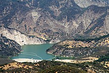 Bird's eye view of the dam and lower part of the reservoir | |
| Country | United States |
| Location | Santa Barbara County, California |
| Coordinates | 34°31′37″N 119°41′13″W / 34.52694°N 119.68694°W[1] |
| Construction began | 1913[2] |
| Opening date | January 23, 1920[3] |
| Construction cost | $2 million (1920 dollars)[3] |
| Owner(s) | City of Santa Barbara |
| Dam and spillways | |
| Type of dam | Concrete arch |
| Impounds | Santa Ynez River |
| Height | 194.5 ft (59.3 m)[4] |
| Length | 600 ft (180 m)[4] |
| Reservoir | |
| Creates | Gibraltar Reservoir |
| Total capacity | Original: 15,374 acre⋅ft (18,964,000 m3)[5] Most recent survey (2017): 4,968 acre⋅ft (6,128,000 m3)[5] Current (Estimate February 2019): 4,314 acre⋅ft (5,321,000 m3)[6] |
| Catchment area | 216 sq mi (560 km2)[4] |
| Surface area | 248 acres (100 ha)[4] |
| Normal elevation | 1,400 ft (430 m) max[7] |
| Power Station | |
| Installed capacity | 820 KW[8] |
| Annual generation | 1,874,000 KWh[8] |
The main purpose of Gibraltar Dam is domestic water supply. It provides about 4,600 acre-feet (5,700,000 m3) of water to Santa Barbara each year, supplying almost 30% of the city's needs.[7] Water diverted from the dam also powers a small hydroelectric plant. Due to having lost a massive portion of its capacity to sediment build-up, the lake can often fill and spill after a single storm,[9] while drying up completely in some years.[10] As of February 2019, sedimentation has reduced the reservoir's capacity to 4,314 acre-feet (5,321,000 m3), only 19% of its designed capacity.[11]
The dam is built in a part of the Santa Ynez River called the "Gibraltar Narrows" that gave its name to the Gibraltar (or Sunbird) mercury mine, which operated next to what is now Gibraltar Reservoir between the 1870s and 1990s.[12]
Description edit
Gibraltar Dam is a constant radius concrete arch dam 194.5 feet (59.3 m) high and 600 feet (180 m) long.[4] The dam is located about 72 miles (116 km) from the mouth of the Santa Ynez River[13] and just above the confluence of Devils Canyon with the river. The dam controls runoff from a drainage basin of 216 square miles (560 km2)[7] with an annual inflow of 24,000 acre-feet (30,000,000 m3).[14] The Santa Ynez basin upstream is mostly wilderness and inflows are unregulated with the exception of the smaller Juncal Dam (owned by the Montecito Water District).[15] Downstream of Gibraltar, the Santa Ynez flows into the much larger Lake Cachuma, owned by the U.S. Bureau of Reclamation.[16]
The concrete spillway extends southward from the main dam and is controlled by four manually operated radial gates. Flashboards can be installed atop the gates during the non-flood season to increase the reservoir capacity.[17] The spillway capacity is about 90,000 cubic feet per second (2,500 m3/s).[18] The spillway is designed so that overflow water cascades down the natural sandstone face adjacent to the dam, creating a 150-foot (46 m) high waterfall.[19]
The original design capacity of Gibraltar Reservoir was 15,374 acre-feet (18,964,000 m3).[5] After its 1948 expansion the gross capacity was increased to 22,500 acre-feet (27,800,000 m3), though so much sediment had already accumulated that the usable capacity was still only about 15,000 acre-feet (19,000,000 m3).[5] Since then, the dam has not been raised nor any sediment dredged from the reservoir, and it has gradually declined to a third of its original capacity. As of February 2019, sedimentation has reduced the reservoir's capacity to 4,314 acre-feet (5,321,000 m3), or only 19% of its designed capacity.[20]
Water is drawn from the reservoir via an intake structure near the south end of the dam into the 3.7-mile (6.0 km) Mission Tunnel, which transports water beneath the Santa Ynez Mountains to a small regulation basin, Lauro Reservoir. The water is either treated at the Cater Water Treatment Plant before entering the city's distribution system, or released into Mission Creek for groundwater recharge.[21] The Mission Tunnel has a diversion capacity of 40 cubic feet per second (1.1 m3/s).[22]
At the end of the Mission Tunnel is the 820 kilowatt Lauro hydroelectric plant, which was initially constructed in 1985 but was idled in 1998 due to increasing costs. The city repaired and recommissioned the plant in 2015 after the cost of federal licensing decreased, but drought prevented the plant from actually running until early 2017.[23][24]
Climate edit
| Climate data for Gibraltar Dam, CA (1991-2020 normals) | |||||||||||||
|---|---|---|---|---|---|---|---|---|---|---|---|---|---|
| Month | Jan | Feb | Mar | Apr | May | Jun | Jul | Aug | Sep | Oct | Nov | Dec | Year |
| Mean daily maximum °F (°C) | 66.1 (18.9) |
66.9 (19.4) |
70.1 (21.2) |
75.5 (24.2) |
80.0 (26.7) |
88.2 (31.2) |
93.7 (34.3) |
95.5 (35.3) |
91.4 (33.0) |
83.3 (28.5) |
73.3 (22.9) |
64.3 (17.9) |
79.0 (26.1) |
| Daily mean °F (°C) | 51.2 (10.7) |
51.7 (10.9) |
54.3 (12.4) |
58.1 (14.5) |
63.0 (17.2) |
68.6 (20.3) |
74.4 (23.6) |
75.0 (23.9) |
71.2 (21.8) |
64.1 (17.8) |
56.7 (13.7) |
48.9 (9.4) |
61.4 (16.3) |
| Mean daily minimum °F (°C) | 36.2 (2.3) |
36.4 (2.4) |
38.4 (3.6) |
40.6 (4.8) |
45.9 (7.7) |
48.9 (9.4) |
55.0 (12.8) |
54.4 (12.4) |
50.9 (10.5) |
44.8 (7.1) |
40.0 (4.4) |
33.5 (0.8) |
43.8 (6.6) |
| Average precipitation inches (mm) | 7.06 (179) |
7.56 (192) |
4.68 (119) |
1.65 (42) |
0.68 (17) |
0.05 (1.3) |
0.07 (1.8) |
0.00 (0.00) |
0.09 (2.3) |
1.11 (28) |
1.48 (38) |
4.19 (106) |
28.62 (727) |
| Average precipitation days (≥ 0.01 in) | 7.9 | 9.5 | 6.1 | 3.6 | 1.9 | 0.4 | 0.3 | 0.1 | 0.6 | 2.1 | 3.2 | 6.1 | 41.8 |
| Source: NOAA[25][26] | |||||||||||||
Background and construction edit

In the early 1900s the City of Santa Barbara had exhausted its local water supplies, and looked to the drainage basin of the nearby Santa Ynez River, which is much larger than any of the city's local streams.[27] In 1904 construction began on the Mission Tunnel which was bored under Mission Canyon in the Santa Ynez Mountains, to tap surface and ground water in the Santa Ynez basin.[21][28] At that time, it was the longest water tunnel in the world.[21] The city sought to build a dam somewhere on the Santa Ynez River in order to increase the water supply available for Mission Tunnel. Between 1913 and 1919, revenue bonds totaling $820,000 were issued for the construction of the dam and water system.[29]
Several dam sites were considered including the Mono Creek, Juncal and Main River sites, but all were dropped in favor of Gibraltar, which offered the largest storage capacity and highest available run-off as well as the most geologically favorable dam site.[30] Rock-fill, masonry and concrete designs were all studied.[31] The Mission Tunnel was extended to the Gibraltar dam site, which would ultimately allow water to flow by gravity to Santa Barbara.[32] Site preparation work began in 1913 with the placement of foundations in the riverbed,[2] for which a $40,000 contract was awarded to Arthur S. Bent Construction Co.[33] In 1917 a concrete "thrust block" was poured on the south side of the canyon to take the weight of the future dam, as the rock on this side was not high enough to support the structure.[2] The contract for the dam itself was let to Bent Brothers and W.A. Kraner on July 8, 1918.[3]
Because there was no road to the site, workers and supplies were transported via an 18 in (460 mm) gauge, 220-volt electric railway inside the Mission Tunnel, which was only 4 feet (1.2 m) high and 3.5 feet (1.1 m) wide. This also limited the size of the equipment used at the site, such as a steam shovel, concrete mixers and rock crushers, which had to be disassembled and moved through the tunnel piece by piece.[34] Up to three trains were operated at once, with a passing siding in the middle of the tunnel allowing for one trainload of supplies to be delivered every half-hour.[34] Hazardous materials such as dynamite were not allowed inside the tunnel and had to be packed over the Santa Ynez Mountains on a primitive trail.[34] The work was made even more difficult by the constant leakage of groundwater into the tunnel which formed "a continuous downpour from the roof in many places" and special care had to be taken to prevent contamination, since this water ultimately flowed into Santa Barbara's municipal supply.[34]
After the numerous logistics problems were worked out, construction of the dam proceeded at a rapid pace with 15,000 cubic yards (11,000 m3) poured in the first three months of work.[34] To allow normal river flows to pass through the dam during construction, a 4-by-6-foot (1.2 m × 1.8 m) hole was left in the bottom of the dam.[2] A total of 270,000 sacks of cement and 400,000 board feet of lumber were hauled through the tunnel during construction.[3] Aggregate used for concrete making was mined from the river bed and processed at a crushing/screening plant located about 200 feet (61 m) upstream from the dam.[2] The mixed concrete was then placed on the dam via a cableway system anchored by a 185-foot (56 m) steel tower.[2] During the winter of 1918-1919 construction had to halt for three months due to the risk of flooding in the river-bottom gravel mining areas.[3] The dam was initially built to a height of 170 feet (52 m) above the stream bed, and 185 feet (56 m) above bedrock.[2]
When completed on January 23, 1920,[3] Gibraltar became the first dam to impound the Santa Ynez River.[7][16] Due to the extremely inaccessible location of the dam, construction ended up costing nearly $2,000,000.[3] According to the Engineering News-Record (1920) "at no place on the dam is variation from true line greater than one inch."[34] The hole in the base of the dam was closed by a temporary valve before being concreted in from downstream, allowing the reservoir to begin filling.[2] Although the dam itself was now complete, there was a lack of funds to finish the spillway. The winter of 1920-21 was dry and the new reservoir failed to fill, forcing the city to use limited groundwater supplies. Heavy rains in January and February 1922 filled and overflowed the reservoir for the first time. Flooding heavily damaged the temporary spillway, and erosion along a previously unknown fault zone beneath the spillway nearly led to its collapse. The structure was rebuilt at a cost of $90,000.[35]
Gin Chow v. Santa Barbara edit
In 1928 Gin Chow, who owned a farm on the Santa Ynez River, sued the city of Santa Barbara challenging its right to divert water from Gibraltar Reservoir, and soon 39 other farmers in the Santa Ynez Valley signed on to the case.[36] Chow's demand was based upon the doctrine of riparian water rights in which existing landowners along a river have the right to the full, unimpaired flow of the stream through their property regardless of how or whether they use it. Riparian rights had been challenged by a controversial state amendment passed that year, which provided that "the water resources of the State be put to beneficial use" and that "the right to water... does not and shall not extend to the waste or unreasonable use... of water"[37] and the Gin Chow case was the first serious legal test of the amendment.[37]
Five years later Gin S. Chow v. Santa Barbara was settled in the California Supreme Court in favor of the city.[38] The court determined that "the waters to be impounded and taken by the defendants are extraordinary storm waters of the river and not a part of the usual and customary flow of the stream" – essentially, the diversion did not have a negative effect on downstream landowners since these floodwaters would have flowed into the ocean anyway.[39] The Gin Chow decision allowed the city to divert up to 4,189 acre-feet (5,167,000 m3) per year from Gibraltar Dam as a "prescriptive right", but also required the city to release at least 616 acre-feet (760,000 m3) during the late summer and fall when the natural river flow is lowest. In addition, the city is allowed to take "an additional amount of storm runoff resulting from torrential rains." These rules continue to govern the operation of the dam today.[40][41]
Gin Chow is considered a landmark case in the development of California water law, as it upheld the 1928 amendment, reducing riparian landowners' legal power over the state's water resources. This enabled more parties, such as the city of Santa Barbara, to file claims on surface water as long as the concept of "reasonable use" was observed.[37] The court also emphasized that "what is such reasonable use is a question of fact, and depends upon the circumstances appearing in each particular case"[39] and that "it requires no extraordinary foresight to envision the great and increasing population of the state... dependent upon stored water – water that is now wasted into the sea and lost to any beneficial use.[42] This is considered to have set a legal precedent for the state of California to build more dams.[42]
Expansion projects edit
Immediately after its construction, the reservoir began to suffer from heavy sedimentation, a problem made worse by occasional wildfires in upstream areas. The 1932 Matilija Fire burned some 50,000 acres (20,000 ha) of the drainage basin, and in response to the increased erosion the U.S. Forest Service constructed two debris dams upstream to hold back sediment washed off the burned landscape. The Mono Debris Dam, an Ambursen-type structure, was built in 1936 and had completely filled with 1 million yd3 (770,000 m3) of sediment by 1938. The concrete-arch Agua Caliente Debris Dam was completed in late 1937 and by 1941 had filled with 750,000 yd3 (570,000 m3) of sediment. Despite the scale of these conservation projects, they only extended Gibraltar's useful life by a few years.[43] The flood of March 1938 was a major contributor to the large volume of debris run-off and caused $340,000 of damage downstream in the Lompoc area.[44]
By 1948, sediment had filled half of Gibraltar reservoir. Compounding the problem, severe drought struck in the winter of 1947-48, and the remaining water was soon sucked dry and an emergency water rationing ordinance was enacted.[45] In summer 1948 the dam was raised 23 feet (7.0 m) and a new buttressed spillway section added. This restored the reservoir to a capacity of 14,000 acre-feet (17,000,000 m3) when it filled the next winter.[5][9] Enlarging the dam cost $1.1 million, which was again paid by bonds issued by the city of Santa Barbara.[29] However, the expanded reservoir continued filling with sediment faster than expected. Without enough storage capacity the reservoir has been subject to more frequent spills, depriving the city of water it otherwise could have used. This was a major factor behind the construction of Bradbury Dam by the federal government in 1953 to store more Santa Ynez River water in Lake Cachuma, about 25 miles (40 km) downstream of Gibraltar Dam.[46]
After a seismic evaluation in 1983, Gibraltar Dam was rehabilitated by the U.S. Army Corps of Engineers after it was found at risk of failure from a strong earthquake. A buttress of roller-compacted concrete was laid against the downstream face. Although the project added no new storage capacity to the dam, it was designed to support a 20-foot (6.1 m) increase in height should that be needed in the future. The work was carried out from October to December 1990 and involved placing 93,000 cubic yards (71,000 m3) of concrete.[18] This essentially changed the dam from a pure arch to an arch-gravity structure.[18] The entire cost of the project was $8.18 million.[47]
"Pass-through" operation and future plans edit

In the early 1980s the city of Santa Barbara once again expressed interest in raising the dam.[5] However, the California Department of Water Resources and U.S. Bureau of Reclamation determined that further enlargement of Gibraltar Dam would have an adverse effect on water flowing downstream into the Lake Cachuma reservoir. In 1989 the Upper Santa Ynez River Operations Agreement or "Pass Through Agreement" was developed in which some water spilled from Gibraltar Dam can be legally stored in Lake Cachuma for the city's use, thus eliminating the need to raise Gibraltar.[17]
In 2017, the U.S. Bureau of Reclamation estimated the annual sediment inflow rate at 210 acre-feet (260,000 m3) or about 1.3 percent of its original design capacity per year.[5] In the 21st century the reservoir has also been frequently at a low level, due both to persistent drought conditions and high water demand. In 2016 the reservoir dried up so completely that water had to be trucked to the dam keeper.[48]
As of 2017, there were no plans to remove sediment from the reservoir or to mitigate its inflow. The 1989 Pass Through Agreement was designed under the assumption that, once Gibraltar reservoir is nearly full of sediment, it will be operated as a run-of-the-river project (serving only to divert water) with most of its storage functions transferred to Lake Cachuma.[7] However, the Bureau of Reclamation predicts that the reservoir will not completely fill with mud; it will stabilize at about 2,000 acre-feet (2,500,000 m3) of water volume due to the "flushing action of high flows"[5] and that this level will be reached around 2031.[5]
Environmental issues edit
Gibraltar Dam completely blocked migrating steelhead to the upper third of the Santa Ynez River when completed in 1920. This was despite a 1916 suggestion of the California Fish and Game Commission that a fish ladder be constructed with the dam; no such structure was ever built.[13] The dam "altered downstream hydrology, sediment transport, stream habitat, [and] water quality" and also delayed steelhead migration during the early rainy season by holding back floodwaters that otherwise might have breached the sandbar at the mouth of the river.[13]
No reliable estimates have been made of the steelhead population prior to Gibraltar's construction; however, it is believed to have been much greater.[49] The dam did not appear to have a large impact on downstream steelhead populations; in 1946 a group of fisheries biologists described steelhead habitat between Solvang and Gibraltar Dam as "excellent".[13][50] Steelhead migration to the base of Gibraltar Dam ended with the completion of Bradbury Dam in 1953.[51] In 2004 it was proposed to trap adult steelhead below Bradbury Dam and truck them to the river above Gibraltar Dam so they could be allowed to complete their natural migration,[52] but this plan was not implemented.
Despite the fragmentation of certain aquatic habitats, the dam has also inadvertently created new riparian habitat along the Santa Ynez River as the upstream end of Gibraltar Reservoir gradually fills in with sediment. A wide floodplain with a well defined stream channel was created, and is now home to typical California riparian woodland (willow, cottonwood and oak). This has provided habitat for endangered species such as the least Bell's vireo.[53]
The 2007 Zaca Fire burned much of the upper Santa Ynez watershed, causing huge amounts of ash-laden silt to flow into Gibraltar Reservoir.[5] Organic material in the ash reacted with chlorine disinfectant in Santa Barbara's water supply to form carcinogenic compounds. Cleaning up the water cost the city nearly $3 million.[54] Other more recent fires have also impacted the Gibraltar watershed, such as the 2016 Rey Fire[55] and the 2017 Thomas Fire.[56]
There have been concerns of mercury contamination at the reservoir due to the proximity of the old Gibraltar Mine (Sunbird Mine) which ceased operations in 1991. However, no evidence of mercury has been found in the reservoir, and there have been no cases of mercury poisoning in Santa Barbara County connected with the mine site.[12]
Public access edit
Although the dam and reservoir are open to the public, only official vehicles are allowed on the narrow winding dirt roads leading to the dam. The shortest way to reach the dam on foot is a 6-mile (9.7 km) round trip hike along the Santa Ynez River from Red Rock Campground.[57] It can also be reached from several trails originating at Camino Cielo Road.[58] The Gibraltar Trail follows the southern edge of the reservoir from the dam, and several other trails branch around the reservoir into the backcountry of Los Padres National Forest. Boating, fishing and swimming are not allowed at the reservoir since it is a public water supply.
See also edit
References edit
- ^ "Gibraltar Dam". Geographic Names Information System. United States Geological Survey, United States Department of the Interior. 1981-01-19. Retrieved 2018-01-13.
- ^ a b c d e f g h "Gibraltar Water-Supply Dam at Santa Barbara". Engineering News-Record. 84 (21): 1003–1004. May 1920.
- ^ a b c d e f g "Santa Barbara's Gibralter Dam". Public Works. 48 (24): 556–558. 1920.
- ^ a b c d e "Gibraltar Dam". National Dam Performance Program. Stanford University. Archived from the original on 2012-12-11. Retrieved 2012-09-18.
- ^ a b c d e f g h i j "Storage and Conveyance of the City of Santa Barbara's Gibraltar Reservoir Pass Through Water in and Through Cachuma Project Facilities". U.S. Bureau of Reclamation. Jan 2016. Retrieved 2018-01-14.
- ^ "Rainfall and Reservoir Summary" (PDF). Santa Barbara County - Flood Control District. February 17, 2019. Retrieved February 17, 2019.
- ^ a b c d e "Gibraltar Reservoir". City of Santa Barbara. 2017-11-09. Retrieved 2018-01-14.
- ^ a b "City of Santa Barbara, California; Notice of Preliminary Determination of a Qualifying Conduit Hydropower Facility and Soliciting Comments and Motions To Intervene". Federal Register. 78 (196). 2013-10-09. Retrieved 2018-01-18.
- ^ a b Fayram, Thomas; Frye, Jonathan; Johnson, Shawn; Doran, Alex (2016-10-25). "Santa Barbara County Hydrology Report, Precipitation, Rivers/Streams, & Reservoirs, Water-Year 2016" (PDF). County of Santa Barbara. Retrieved 2018-01-18.
- ^ Palminteri, John (2013-11-08). "Water Worry: Gibraltar Dam Empty and Cachuma Lake Now Down to 44 Percent". KEYT. Retrieved 2018-01-14.
- ^ "Rainfall and Reservoir Summary" (PDF). Santa Barbara County - Flood Control District. February 17, 2019. Retrieved February 17, 2019.
- ^ a b Blunden, Devon (2009-04-19). "Lost Secrets of the Sunbird Quicksilver Mine". Santa Barbara Independent. Retrieved 2017-11-14.
- ^ a b c d Alagona, Peter S.; et al. (2012). "A History of Steelhead and Rainbow Trout (Oncorhynchus mykiss) in the Santa Ynez River Watershed, Santa Barbara County, California" (PDF). Bulletin of the Southern California Academy of Sciences. 111 (3). National Oceanic and Atmospheric Administration: 163–222. doi:10.3160/0038-3872-111.3.163. Retrieved 2018-01-25.
- ^ Brown 1944, p. 120.
- ^ "Sources of Water". Montecito Water District. Retrieved 2018-01-14.
- ^ a b Latousek, Thomas A. (1995). "Cachuma Project". U.S. Bureau of Reclamation. Retrieved 2017-01-13.
- ^ a b "Enlargement of Lake Cachuma and Bradbury Dam Safety Modifications, Draft Environmental Impact Report". California Department of Water Resources. Nov 1990. p. 47. Retrieved 2018-01-25.
- ^ a b c McDonald, James E., Curtis, Nancy F. (Apr 1997). "Applications of Roller-Compacted Concrete in Rehabilitation and Replacement of Hydraulic Structures" (PDF). U.S. Army Corps of Engineers. Archived (PDF) from the original on March 1, 2013. Retrieved 2018-01-14.
{{cite web}}: CS1 maint: multiple names: authors list (link) - ^ Lippincott 1905, p. 80.
- ^ "Rainfall and Reservoir Summary" (PDF). Santa Barbara County - Flood Control District. February 17, 2019. Retrieved February 17, 2019.
- ^ a b c "Mission Tunnel". City of Santa Barbara. 2017-04-13. Retrieved 2018-01-14.
- ^ "Water Resources of Santa Barbara County" (PDF). Santa Barbara County Water Agency. Jul 2000. Retrieved 2018-01-14.
- ^ "Gibraltar hydroelectric plant begins producing clean energy". KEYT. 2017-03-06. Retrieved 2018-01-14.
- ^ Yamamura, Jean (2017-03-08). "Santa Barbara Hydropower Back in Business". Santa Barbara Independent. Retrieved 2017-01-14.
- ^ "NOWData - NOAA Online Weather Data". National Oceanic and Atmospheric Administration.
{{cite web}}: Missing or empty|url=(help) - ^ "Monthly Normals 1991-2020". National Oceanic and Atmospheric Administration. Retrieved March 21, 2022.
- ^ Lippincott 1905, p. 23.
- ^ Carey 2012, p. 113.
- ^ a b Troxell 1957, p. 41.
- ^ Lippincott 1905, p. 67-72.
- ^ Lippincott 1905, p. 82-87.
- ^ Lippincott 1905, p. 43.
- ^ "Contracts Awarded". Municipal Journal. 37 (2). 1914. Retrieved 2018-01-18.
- ^ a b c d e f "Move Equipment and Material for Dam Through Small Tunnel". Engineering News-Record. 82 (14): 681–682. Apr 1919.
- ^ Hill, R.A. (Nov 1922). "Repairing the Spillway to the Gibraltar Dam". Engineering News-Record. 89 (19): 798–801.
- ^ "Gin Chow: First the predictions, then fame". Santa Maria Times. 2014-07-27. Retrieved 2017-01-14.
- ^ a b c Treadwell, Edward F. (Oct 1950). "Developing a New Philosophy of Water Rights". California Law Review. 38 (4). University of California, Berkeley: 572–587. doi:10.2307/3477994. JSTOR 3477994. Retrieved 2018-01-18.
- ^ "Gin Chow". Santa Barbara Historical Museum. Retrieved 2018-01-14.
- ^ a b Shenk, John Wesley. "Gin S. Chow v. City of Santa Barbara, 22 P.2d 5 (Cal. 1933)". Court Listener. Retrieved 2017-01-14.
- ^ "Hydrology technical report for the Environmental Impact Statement/Environmental Impact Report, Cachuma Project contract renewal". U.S. Bureau of Reclamation. Nov 1994. Retrieved 2018-01-18.
- ^ "Enlargement of Lake Cachuma and Bradbury Dam safety modifications". California Department of Water Resources. Nov 1990. Retrieved 2018-01-18.
- ^ a b "California Supreme Court, Records and Briefs: SF24368, Answer / Opposition to Petition for Writ, 02". LA Law Library. 1981-06-30.
- ^ Brown 1944, p. 35–36.
- ^ Frank & Betts 1946, p. 16.
- ^ "Ventura-Santa Barbara County Investigation". California State Printing Office. Sep 1929. pp. 17–30. Retrieved 2018-01-18.
- ^ Troxell 1957, p. 113.
- ^ "Engineering and Design Evaluation and Repair of Concrete Structures" (PDF). U.S. Army Corps of Engineers. 1995-06-30. Retrieved 2018-01-14.
- ^ Palminteri, John (2016-12-12). "Water is trucked to Gibraltar Dam for city worker on duty". KEYT. Retrieved 2018-01-18.
- ^ "Santa Ynez River Steelhead Assessment and Recovery Project - Santa Barbara County, CA". Stoecker Ecological. 2004. Retrieved 2018-05-03.
- ^ "Cachuma Project Contract Renewal, Santa Barbara County, California: Environmental Impact Statement, Volume 1". U.S. Bureau of Reclamation. 1995. p. 22. Retrieved 2018-11-22.
- ^ Alagona, Peter S. (2012). "The history of steelhead and rainbow trout (Oncorhynchus mykiss) in the Santa Ynez River watershed, Santa Barbara County, California". Bulletin of the Southern California Academy of Sciences. 111 (3). Occidental College: 163–222. doi:10.3160/0038-3872-111.3.163.
- ^ "Lower Santa Ynez River Fish Management Plan and Cachuma Project Biological Opinion for Southern Steelhead Trout: Environmental Impact Statement, Volume 1". U.S. Bureau of Reclamation. 2004. Retrieved 2018-11-22.
- ^ Warner & Hendrix 1984, p. 605.
- ^ Preston, Ben (2010-03-18). "Santa Barbara's Water Has a Rich History, a Complex Future: Despite modern science and technology, basic challenges of delivery and storage transcend eras". Noozhawk. Retrieved 2018-05-03.
- ^ Hodgson, Mike (2017-01-24). "Cachuma Lake among the last of state's reservoirs in 'exceptional drought'". Lompoc Record. Retrieved 2018-01-13.
- ^ Santa Barbara County Department of Public Works, Water Resources Division (2017-12-27). "Thomas Fire, Santa Barbara County, California" (PDF). County of Santa Barbara. Retrieved 2018-01-13.
- ^ McCaslin, Dan (2013-01-01). "Gibraltar Dam Loop-hike - Childlike Wonder". Santa Barbara Independent. Retrieved 2018-05-03.
- ^ "Trail Quest: Gibraltar Reservoir". Songs of the Wilderness. 2013-07-26. Retrieved 2018-08-25.
Works cited edit
- Brown, Carl Barrier (1944). The Control of Reservoir Silting: Issue 521 of United States Department of Agriculture, Misc. Publication. United States Government Printing Office.
- Carey, Craig R. (2012). Hiking and Backpacking Santa Barbara and Ventura. Wilderness Press. ISBN 978-0-89997-635-8.
- Frank, Bernard; Betts, Clifford Allen (1946). Water and Our Forests. U.S. Forest Service.
- Lippincott, Joseph Barlow (1905). Water Problems of Santa Barbara, California. United States Government Printing Office.
- Troxell, Harold C. (1957). Water Resources of Southern California With Special Reference To the Drought of 1944-51. United States Government Printing Office.
- Warner, Richard E.; Hendrix, Kathleen M. (1984). California Riparian Systems: Ecology, Conservation, and Productive Management. University of California Press. ISBN 0-52005-035-5.</ref>