


Summary
Golden Highway (also known as Mitchells Line of Road at its eastern end) is a 313-kilometre (194 mi)[3] highway, located in the Hunter and Orana regions of New South Wales, Australia. It runs eastwards from Dubbo towards Newcastle on the coast, allowing road transport to avoid travelling over the Blue Mountains to Sydney, and is designated route B84.
Golden Highway Mitchells Line of Road | |
|---|---|
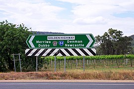 | |
| Direction sign at end of Bylong Valley Way | |
 East end West end | |
| Coordinates |
|
| General information | |
| Type | Highway |
| Length | 313 km (194 mi)[3] |
| Gazetted | August 1928 (as Main Road 62)[1] November 1996 (as State Highway 27)[2] |
| Route number(s) |
|
| Former route number | |
| Major junctions | |
| East end | Belford, New South Wales |
| West end | Dubbo, New South Wales |
| Location(s) | |
| Major settlements | Denman, Sandy Hollow, Merriwa, Dunedoo |
| Highway system | |
Route edit

Golden Highway commences at the intersection with Newell Highway in Dubbo and heads in an easterly direction as a four-lane, single-carriageway road, narrowing to two lanes through Dubbo's eastern suburbs, and continues through Dunedoo – where it is concurrent with Castlereagh Highway for approximately 10 kilometres (6.2 mi) – then through Merriwa, Sandy Hollow, Denman, Jerrys Plains and Mount Thorley, where it eventually terminates at the intersection with New England Highway at Belford, south of Singleton. Bylong Valley Way turns off Golden Highway 1 kilometre (0.62 mi) east of Sandy Hollow. Golden Highway and Putty Road are concurrent for around 2 kilometres (1.2 mi), east of the Mount Thorley industrial estate near Singleton. The highway then turns east onto Mitchells Line of Road while Putty Road continues to Singleton.[3]
Golden Highway provides a fairly low altitude crossing of the Great Dividing Range.[4] It runs through the Hunter Region[5] and gives access to the golden west of New South Wales.[6]
History edit
The passing of the Main Roads Act of 1924[7] through the Parliament of New South Wales provided for the declaration of Main Roads, roads partially funded by the State government through the Main Roads Board (later the Department of Main Roads, and eventually Transport for NSW). Main Road No. 62 was declared from the intersection with Great Northern Highway (today New England Highway) at Scone, via Merriwa and Cassilis to the intersection with Craboon-Mullaley Road at Coolah,[1] Main Road No. 206 was declared from the intersection of North-Western Highway (today Mitchell Highway) in Dubbo, via Ballimore to Dunedoo,[1] Main Road No. 209 was declared from Muswellbrook, via Denman to Merriwa,[1] and Main Road No. 213 was declared from Mount Thorley, via Jerrys Plains to Denman,[1] on the same day, 8 August 1928. With the passing of the Main Roads (Amendment) Act of 1929[8] to provide for additional declarations of State Highways and Trunk Roads, this was amended to Trunk Road 62 and Main Roads 206 and 209 and 213 on 8 April 1929.
The Department of Main Roads, which had succeeded the New South Wales MRB in 1932, re-routed the western end of Trunk Road 62 from Coolah to terminate at the intersection of Trunk Road 55 (later Castlereagh Highway) in Craboon (8km east of Dunedoo) on 29 June 1977;[9] the former alignment between Cassilis and Coolah was re-declared as Main Road 618.[9]
The passing of the Roads Act of 1993[10] through the Parliament of New South Wales updated road classifications and the way they could be declared within New South Wales. Under this act, Golden Highway was declared as State Highway 27 on 22 November 1996, from the intersection with New England Highway at Minimbah east of Whittingham via Mount Thorley, Jerrys Plains, Denman, Merriwa, Cassilis and Dunedoo to the intersection with Newell Highway in Dubbo, subsuming Main Roads 206 and 213;[2] The highway today, as Highway 27, still retains this declaration.[11]
State Route 84 was signed across Main Road 206, Trunk Road 62, and Main Road 213 - from Dubbo via Dunedoo, Cassilis, Merriwa and Denman to Muswellbrook - in 1974; when Golden Highway was declared in 1996, the eastern end of State Route 84 was altered to follow it and terminate at Belford. With the conversion to the newer alphanumeric system in 2013, this was replaced with route B84.[12]
Major junctions edit
| LGA | Location | km[3] | mi | Destinations | Notes |
|---|---|---|---|---|---|
| Singleton | Belford | 0.0 | 0.0 | Eastern terminus of Golden Highway and route B84 Eastern end of Mitchells Line of Road | |
| Mount Thorley | 10.0 | 6.2 | Putty Road (east) – Singleton | Eastern terminus of concurrency with Putty Road at T intersection Western end of Mitchells Line of Road | |
| 13.4 | 8.3 | Putty Road (west) – Putty, Windsor Mount Thorley Road (south) – Mount Thorley | Western terminus of concurrency with Putty Road at hybrid interchange | ||
| Warkworth | 23.4 | 14.5 | Wallaby Scrub Road – Bulga, to Putty Road | ||
| Hunter River | 46.7 | 29.0 | Bridge over the river (Bowmans Crossing) | ||
| Muswellbrook | Denman | 64.5 | 40.1 | Denman Road – Muswellbrook | T intersection |
| Hunter River | 65.3 | 40.6 | Bridge over the river (bridge name unknown) | ||
| Muswellbrook | Sandy Hollow | 82.6 | 51.3 | Bylong Valley Way – Bylong, Mudgee | |
| 83.0 | 51.6 | Wybong Road – Muswellbrook | |||
| Upper Hunter | Merriwa | 119 | 74 | Scone Road – Scone | |
| Merriwa River | 120 | 75 | Bridge over the river (bridge name unknown) | ||
| Krui River | 144 | 89 | Bridge over the river (Collaroy Bridge) | ||
| Warrumbungle | Leadville | 215 | 134 | Concurrency with route B55 | |
| Dunedoo | 225 | 140 | |||
| Dubbo | Dubbo | 313 | 194 | Western terminus of Golden Highway and route B84 at T intersection | |
1.000 mi = 1.609 km; 1.000 km = 0.621 mi
| |||||
See also edit
References edit
- ^ a b c d e "Main Roads Act, 1924-1927". Government Gazette of the State of New South Wales. No. 110. 17 August 1928. pp. 3814–20. Archived from the original on 3 August 2022. Retrieved 1 August 2022 – via National Library of Australia.
- ^ a b "Roads Act". Government Gazette of the State of New South Wales. No. 134. National Library of Australia. 22 November 1996. pp. 7657–62. Archived from the original on 13 October 2022. Retrieved 13 October 2022.
- ^ a b c d Google (17 November 2016). "Golden Highway" (Map). Google Maps. Google. Retrieved 17 November 2016.
- ^ "Golden Highway Home Page". Craigmhor Enterprises. Retrieved 7 March 2008.
- ^ "Upper Hunter Country". Retrieved 7 March 2008.
- ^ "Heart of Country, NSW, Accommodation, Tours, Events and Hire". Visit NSW.com.au. Retrieved 7 March 2008.
- ^ State of New South Wales, An Act to provide for the better construction, maintenance, and financing of main roads; to provide for developmental roads; to constitute a Main Roads Board Archived 11 August 2022 at the Wayback Machine 10 November 1924
- ^ State of New South Wales, An Act to amend the Main Roads Act, 1924-1927; to confer certain further powers upon the Main Roads Board; to amend the Local Government Act, 1919, and certain other Acts; to validate certain payments and other matters; and for purposes connected therewith. Archived 12 August 2022 at the Wayback Machine 8 April 1929
- ^ a b "Main Roads Act, 1924-1977". Government Gazette of the State of New South Wales. No. 82. National Library of Australia. 22 July 1977. p. 3034. Archived from the original on 13 October 2022. Retrieved 13 October 2022.
- ^ State of New South Wales, An Act to make provision with respect to the roads of New South Wales; to repeal the State Roads Act 1986, the Crown and Other Roads Act 1990 and certain other enactments; and for other purposes. Archived 11 August 2022 at the Wayback Machine 10 November 1924
- ^ Transport for NSW (August 2022). "Schedule of Classified Roads and Unclassified Regional Roads" (PDF). Government of New South Wales. Retrieved 1 August 2022.
- ^ "Road number and name changes in NSW" (PDF). Roads & Maritime Services. Government of New South Wales. 2012. Archived from the original (PDF) on 25 March 2016. Retrieved 7 November 2016.