


Summary
Grassy Hill (Chinese: 草山; Cantonese Yale: Chóu sāan) is the fourteenth highest mountain in Hong Kong. Peaked at 647 m (2,123 ft),[1] it is situated between Tsuen Wan and Tai Po and near Lead Mine Pass.[2] Stage 7 of MacLehose Trail runs near its peak.
| Grassy Hill | |
|---|---|
| 草山 | |
 View of Grassy Hill in September 2015 | |
| Highest point | |
| Elevation | 647 m (2,123 ft) |
| Coordinates | 22°24′45″N 114°9′54″E / 22.41250°N 114.16500°E |
| Geography | |
 Grassy Hill Location of Grassy Hill in | |
| Grassy Hill | |||||||||||||||||
|---|---|---|---|---|---|---|---|---|---|---|---|---|---|---|---|---|---|
| Chinese | 草山 | ||||||||||||||||
| Literal meaning | Grass Mountain | ||||||||||||||||
| |||||||||||||||||
The summit of the hill is located near point of contact of Tai Po District, Tsuen Wan District and Sha Tin District. The summit itself is located within Tsuen Wan District.
Geography edit
Grassy Hill has a cone-like shape. It forms the Shing Mun Reservoir catchment along with Needle Hill and Tai Mo Shan. Lead Mine Pass is in the western part of the hill.[3]
Geology edit
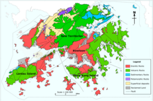
Grassy Hill consists of volcanic rocks (of which are mostly tuffs). These rocks are formed in the Late Jurassic Period at around 160 million years ago.[3]
See also edit
References edit
- ^ Owen, Bernie; Shaw, Raynor (2007-10-01). Hong Kong Landscapes: Shaping the Barren Rock. Hong Kong University Press. p. 101. ISBN 9789622098473.
- ^ Stokes, Edward (1995). Hong Kong's Wild Places: An Environmental Exploration. Oxford University Press. ISBN 9780195866018.
- ^ a b Agriculture, Fisheries and Conservation Department (2006-10-17). Central Ridge and West (in English and Chinese). Hong Kong: Cosmos Books Limited. p. 60. ISBN 9882113273.