


Summary
Great Eccleston is a village and civil parish in Lancashire, England situated on a coastal plain called the Fylde. The village lies to the south of the River Wyre and the A586 road, approximately 10 miles (16 km) upstream from Fleetwood. At the 2001 census, the parish had a population of 1,473,[1] rising slightly to 1,486 at the 2011 census.[2]
| Great Eccleston | |
|---|---|
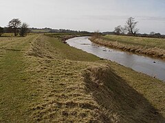 River Wyre at Great Eccleston | |
 Great Eccleston Shown within Wyre Borough  Great Eccleston Shown on the Fylde  Great Eccleston Location within Lancashire | |
| Population | 1,486 (2011 Census) |
| OS grid reference | SD428402 |
| Civil parish |
|
| District | |
| Shire county | |
| Region | |
| Country | England |
| Sovereign state | United Kingdom |
| Post town | PRESTON |
| Postcode district | PR3 |
| Dialling code | 01995 |
| Police | Lancashire |
| Fire | Lancashire |
| Ambulance | North West |
| UK Parliament | |
Great Eccleston is part of Wyre district and is in the parliamentary constituency of Wyre and Preston North. Locally, the village is known for its annual agricultural show.
History edit
Great Eccleston was listed in the Domesday Book of 1086 as Eglestun. In various 13th-century documents it was recorded as Ecclisto, Ecleston and Great Eccleston.[3] In 1066 when the Normans conquered England, the township of Great Eccleston—then part of the ancient hundred of Amounderness—was in the possession of Tostig Godwinson, the brother of King Harold II.[4] Tostig died at the Battle of Stamford Bridge and his lands were subsequently taken over by the Normans. Between 1069 and 1086 William the Conqueror gave Amounderness to Roger de Poitou, an Anglo-Norman baron.[5] In the Domesday Book, the area of Great Eccleston was estimated at two carucates (ploughlands) of land.[3]
The township was originally part of the ecclesiastical parish of St Michael's on Wyre and Great Eccleston's parishioners would have worshipped there at St Michael's Church.[6] In 1723, a chapel of ease to St Michael's was built in a part of Great Eccleston civil parish called Copp. It was dedicated to St Anne.[3]
Governance edit
Great Eccleston is governed locally by a parish council, which is made up of eight elected councillors.[7] Great Eccleston, with the parishes of Inskip with Sowerby, Upper Rawcliffe with Tarnacre and Out Rawcliffe, forms the ward of Great Eccleston, which elects two councillors. Susan Catterall, a Conservative politician, was elected councillor for the ward in 2008. Peter Cartridge, also a Conservative politician, was elected in 2019 as the other ward councillor.[8] The population of the ward at the 2011 Census was 3,581.[9] Great Eccleston was formerly part of the rural district of Garstang. In 1974, the district merged with those of Fleetwood, Thornton Cleveleys, Poulton-le-Fylde and Preesall to form Wyre Borough Council.[10]
The village is represented in the House of Commons of the Parliament of the United Kingdom as part of Wyre and Preston North. It elects one MP by the first past the post system of election. Since its creation for the 2010 general election, Wyre and Preston North has been represented at Parliament by Conservative MP Ben Wallace.[11] Prior to the 2010 general election, Great Eccleston was part of the constituency of Lancaster and Wyre. The village was part of the North West England constituency of the European Parliament.[12]
Geography edit
At 53°51′18″N 2°52′15.6″W / 53.85500°N 2.871000°W (53.855°, −2.871°), Great Eccleston lies 10 miles (16 km) north-east of Blackpool, approximately 6 miles (10 km) south-east of Poulton-le-Fylde and about 12 miles (19 km) north-west of Preston. Nearby villages include Little Eccleston, Elswick and St Michael's on Wyre and Singleton.
The Fylde Coastal Plain is relatively flat and low–lying, predominantly below 30 m (100 feet) above sea–level, but there is a small knoll called Whitprick Hill roughly halfway between Weston on the B5260 and Wesham that rises to 45 m (148 feet) above sea–level.
Transport edit
Great Eccleston is served mainly by Stagecoach Cumbria and North Lancashire service 42 between Lancaster Bus Station and Blackpool Abingdon St., hourly during the daytime during the hours 10.00 to 18.00 and every 90 minutes before 10.00, with an approximate three–hour morning gap Monday–Friday from 06.53 to 09.35, (no early morning service Saturday and Sunday) in the Blackpool–Lancaster direction, and support for a late–evening service providing three journeys at 90–minute intervals between 20.00 and 23.00 in each direction was recently re–introduced by Lancaster County Council, prior to this the service ended as early as 18.33 from Blackpool, necessitating either the use of trains and/or taxis from Poulton or Blackpool if you wanted to leave the resort later.
Hourly services are provided by Preston Bus Service 74 between Preston Bus Station and Fleetwood and by Blackpool Transport Service 78 between Great Eccleston and St. Annes, each of which runs between 07.00 and 19.00 Mondays–Saturdays with a few late evening journeys on Service 74 to Preston.
The nearest railway station is Poulton–Le–Fylde on the 25 kV electrified Blackpool–Manchester route, approximately 4 miles (6.2 km) away.
Climate edit
Great Eccleston has a generally temperate maritime climate like much of the British Isles, with cool summers and mild winters. In nearby Blackpool, there is an annual average rainfall of 871.3 millimetres (34.30 in).[13]
| Climate data for Blackpool (1971–2000 averages) | |||||||||||||
|---|---|---|---|---|---|---|---|---|---|---|---|---|---|
| Month | Jan | Feb | Mar | Apr | May | Jun | Jul | Aug | Sep | Oct | Nov | Dec | Year |
| Mean daily maximum °C (°F) | 6.8 (44.2) |
7.1 (44.8) |
9.1 (48.4) |
11.6 (52.9) |
15.2 (59.4) |
17.3 (63.1) |
19.4 (66.9) |
19.4 (66.9) |
17.0 (62.6) |
13.7 (56.7) |
9.8 (49.6) |
7.6 (45.7) |
12.9 (55.2) |
| Mean daily minimum °C (°F) | 1.7 (35.1) |
1.6 (34.9) |
3.1 (37.6) |
4.2 (39.6) |
6.9 (44.4) |
10.0 (50.0) |
12.4 (54.3) |
12.3 (54.1) |
10.2 (50.4) |
7.3 (45.1) |
4.3 (39.7) |
2.5 (36.5) |
6.4 (43.5) |
| Average rainfall mm (inches) | 81.1 (3.19) |
58.7 (2.31) |
68.3 (2.69) |
48.9 (1.93) |
49.0 (1.93) |
59.8 (2.35) |
59.5 (2.34) |
73.4 (2.89) |
82.5 (3.25) |
97.9 (3.85) |
94.0 (3.70) |
58.3 (2.30) |
871.3 (34.30) |
| Source: Met Office | |||||||||||||
Culture and community edit
The Great Eccleston Agricultural Show is held in the village over two days every July along with Tractor Pulling,[14] which also sees an event held in its own right at the same show ground during the August bank holiday.[15] Horse, steam and agricultural shows have been held in Great Eccleston since the mid-19th century. Like many similar rural events, the Great Eccleston Show waned in popularity and ceased to take place in the 1950s; it was reinstated in 1972.[15] Up to 40,000 people were expected to attend the 2011 show.[16] Displays typically feature livestock, horticulture, country crafts, local produce and agricultural vehicles.[17] A farmers' market is held in Great Eccleston every month.[18] A weekly general market takes place each week.
The village is home to three public houses: the Farmers Arms, in Halsalls Square, and the Black Bull Hotel and White Bull, both on High Street.[19]
In business between 1975 and 1998 was the Blinking Owl, an 85-seat restaurant located in a converted farm on Brock Road. The two-tier dining room was in what was formerly the barn. It served nightly (except Mondays) dinners and lunch on Sundays. Owners Keith and Barbara Baxendale took the restaurant's name from a pub in Yorkshire.[20]
See also edit
References edit
- Footnotes
- ^ "Parish Headcounts", Neighbourhood Statistics, Office for National Statistics, retrieved 17 July 2011
- ^ UK Census (2011). "Local Area Report – Great Eccleston Parish (E04005328)". Nomis. Office for National Statistics. Retrieved 27 March 2021.
- ^ a b c "Townships — Great Eccleston" in Farrer & Brownbill, pp. 276–279
- ^ "Amounderness hundred" in Farrer & Brownbill, pp. 68–71
- ^ Gooderson, p. 36
- ^ >"The Parish of St Michael-on-Wyre" in Farrer & Brownbill, pp. 68–71
- ^ "The Parish Council", greateccleston.org, Great Eccleston Parish Council, archived from the original on 12 March 2012, retrieved 17 July 2011
- ^ "Great Eccleston By-Election 2008", Wyre Borough Council Online, Wyre Borough Council, 22 May 2008, archived from the original on 27 September 2011, retrieved 17 July 2011
- ^ "Ward population 2011". Retrieved 5 June 2015.
- ^ "Mayoral Services — Coat of Arms", Wyre Borough Council Online, Wyre Borough Council, archived from the original on 13 June 2011, retrieved 17 July 2010
- ^ "Lancashire Teenager Voted 'To Make a Difference'", BBC News, BBC, 8 May 2010, retrieved 17 July 2011
- ^ "Members of the European Parliament", Wyre Borough Council Online, Wyre Borough Council, archived from the original on 22 July 2011, retrieved 17 July 2011
- ^ "Blackpool 1971–2000 Averages", official website, Met Office, archived from the original on 29 June 2011, retrieved 17 July 2011
- ^ North West Tractor Pullers Club events list Archived 19 July 2013 at the Wayback Machine
- ^ a b Mackie, John (2011), "The Great Eccleston Show — A Brief History", greatecclestonshow.co.uk, Great Eccleston & District Agricultural Society, archived from the original on 4 August 2011, retrieved 17 July 2011
- ^ "Thousands Expected at Great Eccleston Show", BBC News, BBC, 16 July 2011, retrieved 17 July 2011
- ^ "Great Eccleston Show Goes Ahead As Planned", Farmers Guardian, UBM, 13 July 2007, archived from the original on 30 September 2011, retrieved 17 July 2011
- ^ "Great Eccleston Market", Wyre Borough Council Online, Wyre Borough Council, 22 May 2008, archived from the original on 27 September 2011, retrieved 17 July 2011
- ^ Pubs in Great Eccleston - Google
- ^ An advert for the Blinking Owl, taken from an eBay listing
- Bibliography
- Farrer, William; Brownbill, J., eds. (1912), A History of the County of Lancaster: Volume 7, Constable, OCLC 59626695
- Gooderson, P. J. (1980), A History of Lancashire, London: Batsford, ISBN 0-7134-2588-1
- Hartwell, Clare; Pevsner, Nikolaus (2009) [1969]. Lancashire: North. New Haven and London: Yale University Press. ISBN 0-300-12667-0.
- Porter, John (1876), History of the Fylde of Lancashire, W. Porter, OCLC 12931605
Further reading edit
- Woode, Ann (1970), Great Eccleston 1066–1970, Preston: The Circlet Publishing Company
External links edit
![]() Media related to Great Eccleston at Wikimedia Commons
Media related to Great Eccleston at Wikimedia Commons