


Summary
Green Hill is a mountain or fell in north west England. Its summit is 628 metres (2,060 ft) above sea level.[1] It is located above Cowan Bridge, Lancashire, near Kirkby Lonsdale, Cumbria, and Ingleton, North Yorkshire. Its summit is about 4 kilometres (2+1⁄2 miles) almost due west of the summit of Whernside. It forms the watershed between the River Dee and the Leck Beck: both are tributaries of the River Lune.
| Green Hill | |
|---|---|
 Green Hill—the cairn marks the summit | |
| Highest point | |
| Elevation | 628 m (2,060 ft)[1] |
| Prominence | 24m. (79 ft) |
| Parent peak | Great Coum |
| Listing | Nuttall, sub-Hewitt |
| Coordinates | 54°13′59″N 2°27′28″W / 54.2331°N 2.4579°W |
| Geography | |
 Green Hill Location in the Yorkshire Dales  Green Hill Location in Lancashire 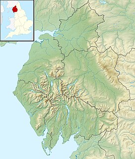 Green Hill Location in Cumbria 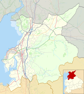 Green Hill Location in the City of Lancaster district | |
| Location | Lancashire-Cumbria, |
| OS grid | SD701820 |
| Topo map | OS Landranger 98 |
Geography edit
The highest point of the traditional county of Lancashire is Coniston Old Man, which, together with the rest of Furness became part of Cumbria in 1974. A walkers' guide[2] cites Green Hill, 51 kilometres (32 mi) south of the Old Man, as the county top for Lancashire, lying on the border with Cumbria, and Ordnance Survey data record Green Hill as one metre higher than Gragareth, about 2 kilometres (1 mi) southwest of Green Hill. Gragareth's summit trig point, at 627 metres (2,057 ft), lies a couple of hundred metres within Lancashire.[1]
Another county top close to Green Hill is Whernside, 736 metres (2,415 ft), the highest point in North Yorkshire.
The summit of Green Hill, although relatively dull in itself, provides many excellent views in all directions ranging from the Howgill Fells and Lakeland fells to the north, the Pennines in the east, and a majority of North Yorkshire to the south.
County Stone edit

Near to the summit of Green Hill, lies the County Stone, a large glacial erratic boulder which marks the triple point where the traditional counties of Westmorland, Yorkshire and Lancashire borders converged.[3]
References edit
- ^ a b c Bathurst, David (2012). Walking the county high points of England. Chichester: Summersdale. pp. 224–233. ISBN 978-1-84-953239-6.
- ^ Hardy, Ian, MVO. The Hardys - The UK's High Points (2010) 3rd Edition. Potters Bar, Hertfordshire: Ian Hardy. ISBN 978-0-9565533-3-1 (internet version, thehardys.org), ISBN 978-0-9565533-5-5 (DVD version).
- ^ Kelsall, Jan (2008). The Yorkshire Dales: South and West. Cicerone. p. 178. ISBN 9781852844851.