
KNOWPIA
WELCOME TO KNOWPIA

Gueures 
Summary
Gueures (French pronunciation: [ɡœʁ]) is a commune in the Seine-Maritime department in the Normandy region in northern France.
Gueures | |
|---|---|
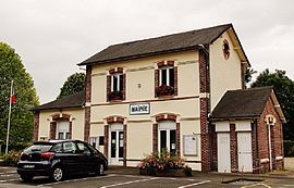 The town hall in Gueures | |
Location of Gueures .mw-parser-output .locmap .od{position:absolute}.mw-parser-output .locmap .id{position:absolute;line-height:0}.mw-parser-output .locmap .l0{font-size:0;position:absolute}.mw-parser-output .locmap .pv{line-height:110%;position:absolute;text-align:center}.mw-parser-output .locmap .pl{line-height:110%;position:absolute;top:-0.75em;text-align:right}.mw-parser-output .locmap .pr{line-height:110%;position:absolute;top:-0.75em;text-align:left}.mw-parser-output .locmap .pv>div{display:inline;padding:1px}.mw-parser-output .locmap .pl>div{display:inline;padding:1px;float:right}.mw-parser-output .locmap .pr>div{display:inline;padding:1px;float:left}html.skin-theme-clientpref-night .mw-parser-output .od,html.skin-theme-clientpref-night .mw-parser-output .od .pv>div,html.skin-theme-clientpref-night .mw-parser-output .od .pl>div,html.skin-theme-clientpref-night .mw-parser-output .od .pr>div{background:#000;color:#fff}html.skin-theme-clientpref-night .mw-parser-output .locmap{filter:grayscale(0.6)}@media(prefers-color-scheme:dark){html.skin-theme-clientpref-os .mw-parser-output .locmap{filter:grayscale(0.6)}html.skin-theme-clientpref-os .mw-parser-output .od,html.skin-theme-clientpref-os .mw-parser-output .od .pv>div,html.skin-theme-clientpref-os .mw-parser-output .od .pl>div,html.skin-theme-clientpref-os .mw-parser-output .od .pr>div{background:#000;color:#fff}}  Gueures  Gueures | |
| Coordinates: 49°50′40″N 0°57′47″E / 49.8444°N 0.9631°E | |
| Country | France |
| Region | Normandy |
| Department | Seine-Maritime |
| Arrondissement | Dieppe |
| Canton | Luneray |
| Intercommunality | CC Terroir de Caux |
| Government | |
| • Mayor (2020–2026) | Josette Avenel[1] |
| Area 1 | 6.07 km2 (2.34 sq mi) |
| Population (2021)[2] | 526 |
| • Density | 87/km2 (220/sq mi) |
| Time zone | UTC+01:00 (CET) |
| • Summer (DST) | UTC+02:00 (CEST) |
| INSEE/Postal code | 76334 /76730 |
| Elevation | 15–84 m (49–276 ft) (avg. 40 m or 130 ft) |
| 1 French Land Register data, which excludes lakes, ponds, glaciers > 1 km2 (0.386 sq mi or 247 acres) and river estuaries. | |
Geography edit
A farming village situated at the confluence of the Saâne and the Vienne rivers, in the Pays de Caux, some 8 miles (13 km) southwest of Dieppe at the junction of the D70, the D123 and the D152 roads.
Population edit
| Year | Pop. | ±% p.a. |
|---|---|---|
| 1968 | 552 | — |
| 1975 | 533 | −0.50% |
| 1982 | 484 | −1.37% |
| 1990 | 462 | −0.58% |
| 1999 | 530 | +1.54% |
| 2007 | 506 | −0.58% |
| 2012 | 538 | +1.23% |
| 2017 | 535 | −0.11% |
| Source: INSEE[3] | ||
Places of interest edit
- The church of St. Pierre, dating from the twelfth century.
- The eighteenth-century château.
- Some interesting houses dating from the seventeenth century.
See also edit
References edit
- ^ "Répertoire national des élus: les maires" (in French). data.gouv.fr, Plateforme ouverte des données publiques françaises. 13 September 2022.
- ^ "Populations légales 2021". The National Institute of Statistics and Economic Studies. 28 December 2023.
- ^ Population en historique depuis 1968, INSEE
Wikimedia Commons has media related to Gueures.