


Summary
Gurla Mandhata, also Naimona'nyi or Namu Nani, is the highest peak of the Nalakankar Himal, a small subrange of the Himalaya. It lies in the northwest corner of Nepal. It is the 34th-highest peak in the world (using a 500-metre prominence cutoff). It is also notable for being well within the interior of the Tibetan Plateau (most peaks of similar height – except notably Shishapangma, the world's 14th-highest peak – lie nearer to or outside the edge of the Plateau) and relatively far away from other peaks with heights greater than 7,500 metres. It sits roughly across Lake Manasarovar from the sacred peak of Mount Kailash.
| Gurla Mandhata | |
|---|---|
 Gurla Mandhata | |
| Highest point | |
| Elevation | 7,728 m (25,354 ft)[1] Ranked 34th |
| Prominence | 2,788 m (9,147 ft)[1] |
| Listing | Ultra |
| Coordinates | 30°26′09″N 81°17′45″E / 30.43583°N 81.29583°E[1] |
| Geography | |
 Gurla Mandhata Location in southwestern Tibet Autonomous Region 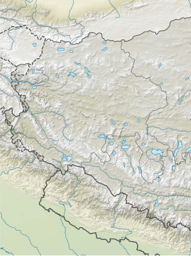 Gurla Mandhata Location in Ngari Prefecture  Gurla Mandhata Location near Nepal | |
| Location | Tibet Autonomous Region, China |
| Parent range | Nalakankar Himal, Himalaya |
| Climbing | |
| First ascent | 1985 by Cirenuoji, Jiabu, Jin Junxi, K. Matsubayashi, Song Zhiyu, K. Suita, Y. Suita, T. Wada[2] |
| Easiest route | West flank: snow/ice climb |
| Namu Nani | |||||||||
|---|---|---|---|---|---|---|---|---|---|
| Chinese name | |||||||||
| Traditional Chinese | 納木那尼峰 | ||||||||
| Simplified Chinese | 纳木那尼峰 | ||||||||
| Literal meaning | [phonetic from Tibetan] | ||||||||
| |||||||||
| Naimona'nyi | |||||||||
|---|---|---|---|---|---|---|---|---|---|
| Tibetan name | |||||||||
| Tibetan | གནས་མོ་སྣ་གཉིས མེ་མོ་ ན་ ཉི་ | ||||||||
| |||||||||
Names edit
Gurla Mandhata is a romanization of the Hindi name गुरला मन्धाता, Sanskrit: गन्धमादन. It supposedly derives from a pass near the mountain[3] and the legendary prehistoric Indian king Mandhata of the Raghuvaṃśa branch of the Solar Dynasty, who supposedly conquered the earth and passed the mountain on his way to the sacred lake Manasarovar beside the axis mundi Mount Kailash. In some versions of the story, the mountain is his body, transformed after death.[4]
Naimona'nyi is the Tibetan pinyin romanization of the Tibetan name གནས་མོ་སྣ་གཉིས།. The Wylie transcription of the same name is Gnas Mo Sna Gnyis. The name is also sometimes written as མེ་མོ་ ན་ ཉི་, Nemo Na Nyi. The American Alpine Journal has explained the name as deriving from naimo (supposedly meaning "traditional Tibetan medicine"), na ("black"), and nyi ("slab" or "slabs")[5] but Chinese sources say it instead means "Mountain of Our Lady" or "the Goddess".[6] This is sometimes mistakenly translated as "Fairy"[7] via the Chinese word 仙, which actually refers to a Taoist immortal or similar minor deities rather than a western fairy.
Namu Nani is the atonal pinyin romanization of the Chinese name written 納木那尼峰 in traditional characters or 纳木那尼峰 in simplified ones, transcribed Nàmù Nàní Fēng with its tones. The name is a transcription into Chinese of the Tibetan name, with the addition of the final character 峰, meaning "peak".
Climbing history edit
In 1905, T. G. Longstaff made an attempt on the west face of Gurla Mandhata with two alpine guides and six porters. After suffering a 900 feet (270 m) fall during an avalanche, they turned back around 7,000 m (23,000 ft) upon finding fresh snow was falling too heavily to reach the summit with their provisions.[2][4] This was a strong achievement for the time, especially for such a small group; at that time no summit of over 7,000 m had yet been climbed and Longstaff's height represented a world altitude record.
In 1935, the Viennese student Herbert Tichy made a trip to the holy mountain Kailash while disguised as an Indian pilgrim. On the way, he attempted Gurla Mandhata with one of his porters, Kitar. They reached a height of 23,400 feet (7,100 m) before being turned back by fresh snow and bad weather.[8]
In 1955, the mountain was the intended destination of the inaugural Welsh Himalayan Expedition led by Sydney Wignall.[9] The expedition was sponsored by the Liverpool Daily Post and intended to summit Gurla Mandata and plant three flags: the Welsh Dragon, the flag of the recently-overthrown Chinese Republic, and the Jolly Roger.[9] Before the climb could begin, the group was captured by the Chinese military, who imprisoned and tortured the climbers for two months under the belief they were CIA spies. (Wignall had in fact offered to spy for India.)[9]
The first successful ascent was by a joint Sino-Japanese team led by Katsutoshi Hirabayashi in May 1985, reaching the peak via its north face.[5] Since that time, there have been six additional successful ascents and two failed attempts on the peak.[10]
In 1997, an attempt was made to ascend the peak via the then-unclimbed[dubious ] North Face route by Quinn Simons, Soren Peters, and their guide, Charlie Fowler. The team made a valiant effort, climbing high on the mountain, but after severe storms and other difficulties had to retreat. Their descent ended in a fall of some 450 m (1,500 ft) down the North Face of the peak. Fowler was slightly injured, while Simons and Peters both suffered extreme frostbite on their extremities.[11]

The standard ascent route climbs the western flanks of the mountain ascending the Chaglung'mlungha Glacier to the summit plateau. Most teams choose to approach the mountain overland by jeep from either Lhasa, Tibet, or Kathmandu, Nepal. However, an alternate approach begins in the mountain hamlet of Simikot, Nepal, in the remote Humla district of west Nepal and follows the Karnali River northward, crossing into Tibet (China) in the village of Sher. Jeeps then take climbers north through Taklakot (Burang) to basecamp on the mountain.
References edit
- ^ a b c "China I: Tibet - Xizang". Peaklist.org. Retrieved 2014-05-29.
- ^ a b Neate, Jill (1989), "High Asia", The Mountaineers.
- ^ Mittal, J.P. (2006), History of Ancient India from 7300 BC to 4250 BC, Atlantic Publishers, p. 111, ISBN 9788126906154.
- ^ a b Ward, Michael (1996), "The Mountains of Central Tibet" (PDF), The Alpine Journal, p. 215.
- ^ a b American Alpine Journal (1986), p. 302.
- ^ Ngari Tibet, China Travel and Tourism Press, 2002, p. 28, ISBN 9787503219351.
- ^ "Mt Gurla Mandata Expedition", Himalaya Journey, Kathmandu, 2023
{{citation}}: CS1 maint: location missing publisher (link). - ^ American Alpine Journal (2019). "Peaks in Asia". American Alpine Journal.
- ^ a b c "Obituaries: Sydney Wignall". The Daily Telegraph. London. 25 April 2012. Retrieved 28 December 2017.
- ^ The Alpine Club's Himalayan Index (accessed 2007-07-21) lists five ascents and two failed attempts through 2001. The American Alpine Journal records no ascents or attempts from 2002 through 2005. The Expedition blog of the First American ascent of Gurla Mandhata records the only other ascent, in 2006. (There is some possibility of unrecorded ascents or attempts, so these numbers may be slight underestimates.)
- ^ American Alpine Journal 1999, pp. 211-213.
External links edit
- A list of prominent Asian peaks
- Digital Elevation Data (Go to n30e081)
- Historical photo of Gurla Mandhata with Mount Kailas taken from Lipu Pass, on a NASA-related site
- Virtual Aerial Video of Gurla Mandhata Archived 2019-05-01 at the Wayback Machine