


Summary
Gvardeysky District (Russian: Гварде́йский райо́н) is an administrative district (raion), one of the fifteen in Kaliningrad Oblast, Russia. It is located in the center of the oblast. The area of the district is 783 square kilometers (302 sq mi).[citation needed] Its administrative center is the town of Gvardeysk.[2] Population: 29,926 (2010 Census);[3] 32,101 (2002 Census);[7] 27,299 (1989 Census).[8] The population of Gvardeysk accounts for 46.4% of the district's total population.[3]
Gvardeysky District
Гвардейский район | |
|---|---|
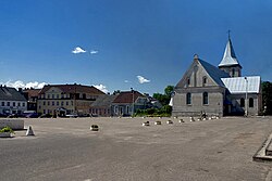 Gvardeisk market, Gvardeysky District | |
 Flag  Coat of arms | |
 Location of Gvardeysky District in Kaliningrad Oblast | |
| Coordinates: 54°39′N 21°04′E / 54.650°N 21.067°E | |
| Country | Russia |
| Federal subject | Kaliningrad Oblast[1] |
| Established | 1946 |
| Administrative center | Gvardeysk[2] |
| Area | |
| • Total | 783 km2 (302 sq mi) |
| Population | |
| • Total | 29,926 |
| • Estimate (2018)[4] | 29,258 (−2.2%) |
| • Density | 38/km2 (99/sq mi) |
| • Urban | 46.4% |
| • Rural | 53.6% |
| Administrative structure | |
| • Administrative divisions | 1 Towns of district significance, 4 Rural okrugs |
| • Inhabited localities[2] | 1 cities/towns, 61 rural localities |
| Municipal structure | |
| • Municipally incorporated as | Gvardeysky Urban Okrug[5] |
| Time zone | UTC+2 (MSK–1 |
| OKTMO ID | 27706000 |
| Website | http://gvardeysk.gov39.ru/ |
Geography edit
The district is situated in the center of the oblast, east of Kaliningrad, the administrative center of the oblast.
Main rivers in the district include the Pregolya and its branch the Deyma.
Administrative and municipal status edit
Within the framework of administrative divisions, Gvardeysky District is one of the fifteen in the oblast.[1] The town of Gvardeysk serves as its administrative center.[2]
As a municipal division, the district has been incorporated as Gvardeysky Urban Okrug since June 11, 2014.[5] Prior to that date, the district was incorporated as Gvardeysky Municipal District, which was subdivided into one urban settlement and four rural settlements.[9]
Demographics edit
The district is among the more densely populated districts of the oblast.[citation needed]
Economy edit
District economy is agrarian. The main railway line and road from Kaliningrad to Moscow pass through the district, parallel with the Pregolya.
References edit
Notes edit
- ^ a b Law #463
- ^ a b c d Resolution #639
- ^ a b c Russian Federal State Statistics Service (2011). Всероссийская перепись населения 2010 года. Том 1 [2010 All-Russian Population Census, vol. 1]. Всероссийская перепись населения 2010 года [2010 All-Russia Population Census] (in Russian). Federal State Statistics Service.
- ^ "26. Численность постоянного населения Российской Федерации по муниципальным образованиям на 1 января 2018 года". Federal State Statistics Service. Retrieved January 23, 2019.
- ^ a b Law #319
- ^ "Об исчислении времени". Официальный интернет-портал правовой информации (in Russian). June 3, 2011. Retrieved January 19, 2019.
- ^ Russian Federal State Statistics Service (May 21, 2004). Численность населения России, субъектов Российской Федерации в составе федеральных округов, районов, городских поселений, сельских населённых пунктов – районных центров и сельских населённых пунктов с населением 3 тысячи и более человек [Population of Russia, Its Federal Districts, Federal Subjects, Districts, Urban Localities, Rural Localities—Administrative Centers, and Rural Localities with Population of Over 3,000] (XLS). Всероссийская перепись населения 2002 года [All-Russia Population Census of 2002] (in Russian).
- ^ Всесоюзная перепись населения 1989 г. Численность наличного населения союзных и автономных республик, автономных областей и округов, краёв, областей, районов, городских поселений и сёл-райцентров [All Union Population Census of 1989: Present Population of Union and Autonomous Republics, Autonomous Oblasts and Okrugs, Krais, Oblasts, Districts, Urban Settlements, and Villages Serving as District Administrative Centers]. Всесоюзная перепись населения 1989 года [All-Union Population Census of 1989] (in Russian). Институт демографии Национального исследовательского университета: Высшая школа экономики [Institute of Demography at the National Research University: Higher School of Economics]. 1989 – via Demoscope Weekly.
- ^ Law #502
Sources edit
- Калининградская областная Дума. Закон №463 от 27 мая 2010 г. «Об административно-территориальном устройстве Калининградской области», в ред. Закона №450 от 3 июля 2015 г. «О внесении изменений в Закон Калининградской области "Об административно-территориальном устройстве Калининградской области"». Вступил в силу со дня официального опубликования. Опубликован: "Калининградская правда" (вкладыш "Ведомости Правительства Калининградской области"), №112, 26 июня 2010 г. (Kaliningrad Oblast Duma. Law #463 of May 27, 2010 On the Administrative-Territorial Structure of Kaliningrad Oblast, as amended by the Law #450 of July 3, 2015 On Amending the Law of Kaliningrad Oblast "On the Administrative-Territorial Structure of Kaliningrad Oblast". Effective as of the day of the official publication.).
- Правительство Калининградской области. Постановление №640 от 30 августа 2011 г. «Об утверждении реестра объектов административно-территориального деления Калининградской области», в ред. Постановления №877 от 21 ноября 2011 г «О внесении изменения в Постановление Правительства Калининградской области от 30 августа 2011 г. №640». Вступил в силу со дня официального опубликования. Опубликован: "Калининградская правда" (вкладыш "Официально"), №170, 15 сентября 2011 г. (Government of Kaliningrad Oblast. Resolution #640 of August 30, 2011 On the Adoption of the Registry of the Objects of the Administrative-Territorial Divisions of Kaliningrad Oblast, as amended by the Resolution #877 of November 21, 2011 On Amending the Resolution of the Government of Kaliningrad Oblast #640 of August 30, 2011. Effective as of the day of the official publication.).
- Калининградская областная Дума. Закон №319 от 10 июня 2014 г. «Об объединении поселений, входящих в состав муниципального образования "Гвардейский район", и организации местного самоуправления на объединённой территории». Вступил в силу со дня официального опубликования. Опубликован: "Калининградская правда" (вкладыш "Официальный вестник Правительства Калининградской области"), №103, 11 июня 2014 г. (Kaliningrad Oblast Duma. Law #319 of June 10, 2014 On the Merger of the Settlements Within the Municipal Formation of "Gvardeysky District" and on the Organization of the Local Self-Government on the Merged Territories. Effective as of the day of the official publication.).
- Калининградская областная Дума. Закон №502 от 24 февраля 2005 г. «О наделении муниципального образования "Гвардейский район" статусом муниципального района и об установлении границ и наделении соответствующим статусом муниципальных образований, находящихся на его территории», в ред. Закона №370 от 1 июля 2009 г «О составе территорий муниципальных образований Калининградской области». Вступил в силу со дня официального опубликования. Опубликован: "Российская газета" ("Запад России"), №44, 4 марта 2005 г. (Kaliningrad Oblast Duma. Law #502 of February 24, 2005 On Granting the Status of a Municipal District to the Municipal Formation of "Gvardeysky District" and on Establishing the Borders and Granting Appropriate Status to the Municipal Formations Located on Its Territory, as amended by the Law #370 of July 1, 2009 On the Composition of the Territories of the Municipal Formations of Kaliningrad Oblast. Effective as of the day of the official publication.).