


Summary
Hakenfelde (German pronunciation: [ˈhaːkŋ̍ˌfɛldə] ⓘ) is a German locality (Ortsteil) of Berlin in the borough (Bezirk) of Spandau.
Hakenfelde | |
|---|---|
 The Evangelical church Stiftskirche-Johannesstift | |
Location of Hakenfelde in Spandau district and Berlin 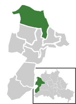 | |
 Hakenfelde  Hakenfelde | |
| Coordinates: 52°34′40″N 13°10′51″E / 52.57778°N 13.18083°E | |
| Country | Germany |
| State | Berlin |
| City | Berlin |
| Borough | Spandau |
| Founded | 1730 |
| Subdivisions | 2 zones |
| Area | |
| • Total | 20.4 km2 (7.9 sq mi) |
| Elevation | 40 m (130 ft) |
| Population (2020-12-31)[1] | |
| • Total | 31,327 |
| • Density | 1,500/km2 (4,000/sq mi) |
| Time zone | UTC+01:00 (CET) |
| • Summer (DST) | UTC+02:00 (CEST) |
| Postal codes | (nr. 0507) 13587 |
| Vehicle registration | B |
History edit
The name Hakenfelde is derived a dairy-farm built in 1730 on the outskirts of Spandau.[2] Part of the town of Spandau it merged into Berlin in 1920 with the "Greater Berlin Act". Due to its position at the borders of West Berlin within East Germany it was largely crossed, from 1961 to 1989, by the Berlin Wall.[3] In 2003 it became an autonomous Ortsteil, separated (with Falkenhagener Feld and Wilhelmstadt) from the one of Spandau.
Geography edit
Overview edit
Located in the northeastern suburb of the city, Hakenfelde is surrounded by the Spandauer Forest and separated from the district of Reinickendorf by the river Havel. It borders with the Brandenburger municipalities of Falkensee, Schönwalde-Glien and Hennigsdorf, all in the district of Havelland. The bordering Ortsteil are Falkenhagener Feld, Haselhorst, Spandau, Reinickendorf and Konradshöhe (both in Reinickendorf district).
On the Havel there is an island (Eiswerder) and 3 islets (Pionierinsel, Großer Wall and Kleiner Wall) belonging to Hakenfelde. Eiswerder, situated in the middle of the Lake Spandau (Spandauer See), is linked to Hakenfelde and Haselhorst by 2 bridges.
Subdivision edit
The locality counts 2 zones (Ortslagen):
Photogallery edit
-
 Eiswerder island
 -
 A disused rail track on the Spandauer Forest
 -
 Aerial view of northern side of Hakenfelde


Transport edit
Hakenfelde is not served by railways, it is simply traversed by the industrial track of the Osthavelländische Eisenbahn and the abandoned Bötzowbahn. It is served by several lines of the bus network and by some private ferry lines.
References edit
- ^ "Einwohnerinnen und Einwohner im Land Berlin am 31. Dezember 2020" (PDF). Amt für Statistik Berlin-Brandenburg. February 2021.
- ^ (in German) Industrial history of Hakenfelde
- ^ Berlin Wall maps on "Berlin Wall Online"
- ^ (in German) Infos and maps on Gartenfreunde Spandau
- ^ (in German) Article on the Berliner Zeitung
External links edit
![]() Media related to Hakenfelde at Wikimedia Commons
Media related to Hakenfelde at Wikimedia Commons
- (in German) Hakenfelde page on www.berlin.de