
KNOWPIA
WELCOME TO KNOWPIA

Hallu 
Summary
Hallu (French pronunciation: [aly]) is a commune in the Somme department in Hauts-de-France in northern France.
Hallu | |
|---|---|
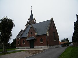 The church in Hallu | |
Location of Hallu .mw-parser-output .locmap .od{position:absolute}.mw-parser-output .locmap .id{position:absolute;line-height:0}.mw-parser-output .locmap .l0{font-size:0;position:absolute}.mw-parser-output .locmap .pv{line-height:110%;position:absolute;text-align:center}.mw-parser-output .locmap .pl{line-height:110%;position:absolute;top:-0.75em;text-align:right}.mw-parser-output .locmap .pr{line-height:110%;position:absolute;top:-0.75em;text-align:left}.mw-parser-output .locmap .pv>div{display:inline;padding:1px}.mw-parser-output .locmap .pl>div{display:inline;padding:1px;float:right}.mw-parser-output .locmap .pr>div{display:inline;padding:1px;float:left}html.skin-theme-clientpref-night .mw-parser-output .od,html.skin-theme-clientpref-night .mw-parser-output .od .pv>div,html.skin-theme-clientpref-night .mw-parser-output .od .pl>div,html.skin-theme-clientpref-night .mw-parser-output .od .pr>div{background:#000;color:#fff}html.skin-theme-clientpref-night .mw-parser-output .locmap{filter:grayscale(0.6)}@media(prefers-color-scheme:dark){html.skin-theme-clientpref-os .mw-parser-output .locmap{filter:grayscale(0.6)}html.skin-theme-clientpref-os .mw-parser-output .od,html.skin-theme-clientpref-os .mw-parser-output .od .pv>div,html.skin-theme-clientpref-os .mw-parser-output .od .pl>div,html.skin-theme-clientpref-os .mw-parser-output .od .pr>div{background:#000;color:#fff}}  Hallu  Hallu | |
| Coordinates: 49°47′37″N 2°47′23″E / 49.7936°N 2.7897°E | |
| Country | France |
| Region | Hauts-de-France |
| Department | Somme |
| Arrondissement | Péronne |
| Canton | Moreuil |
| Intercommunality | CC Terre de Picardie |
| Government | |
| • Mayor (2020–2026) | Patrice Vallée[1] |
| Area 1 | 3.85 km2 (1.49 sq mi) |
| Population (2021)[2] | 144 |
| • Density | 37/km2 (97/sq mi) |
| Time zone | UTC+01:00 (CET) |
| • Summer (DST) | UTC+02:00 (CEST) |
| INSEE/Postal code | 80409 /80320 |
| Elevation | 76–91 m (249–299 ft) (avg. 83 m or 272 ft) |
| 1 French Land Register data, which excludes lakes, ponds, glaciers > 1 km2 (0.386 sq mi or 247 acres) and river estuaries. | |
Geography edit
Hallu is situated on the D39 road, some 26 miles (42 km) southeast of Amiens, just a few hundred yards from the A1 autoroute.
Population edit
| Year | Pop. | ±% p.a. |
|---|---|---|
| 1968 | 137 | — |
| 1975 | 108 | −3.34% |
| 1982 | 110 | +0.26% |
| 1990 | 121 | +1.20% |
| 1999 | 154 | +2.72% |
| 2007 | 171 | +1.32% |
| 2012 | 178 | +0.81% |
| 2017 | 177 | −0.11% |
| Source: INSEE[3] | ||
See also edit
References edit
- ^ "Répertoire national des élus: les maires". data.gouv.fr, Plateforme ouverte des données publiques françaises (in French). 2 December 2020.
- ^ "Populations légales 2021". The National Institute of Statistics and Economic Studies. 28 December 2023.
- ^ Population en historique depuis 1968, INSEE
Wikimedia Commons has media related to Hallu.