


Summary
Hamilton Heights is a neighborhood in the northern part of Manhattan in New York City. It is the northernmost part of the West Harlem area, along with Manhattanville and Morningside Heights to its south,[4] and it contains the sub-neighborhood and historic district of Sugar Hill. Washington Heights lies to Hamilton Heights' north, and to its east is Central Harlem.[5]
Hamilton Heights | |
|---|---|
 St. Mark's United Methodist Church | |
| Location in New York CityCoordinates: .mw-parser-output .geo-default,.mw-parser-output .geo-dms,.mw-parser-output .geo-dec{display:inline}.mw-parser-output .geo-nondefault,.mw-parser-output .geo-multi-punct,.mw-parser-output .geo-inline-hidden{display:none}.mw-parser-output .longitude,.mw-parser-output .latitude{white-space:nowrap}40°49′30″N 73°56′56″W / 40.825°N 73.949°W | |
| Country | |
| State | |
| City | New York City |
| Borough | Manhattan |
| Community District | Manhattan 9[1] |
| Area | |
| • Total | 1.08 km2 (0.416 sq mi) |
| Population (2016)[2] | |
| • Total | 47,531 |
| • Density | 44,000/km2 (110,000/sq mi) |
| Ethnicity | |
| • Hispanic | 52.2% |
| • Black | 32.2 |
| • White | 10.9 |
| • Asian | 2.2 |
| • Others | 2.6 |
| Economics | |
| • Median income | $43,673 |
| Time zone | UTC−5 (Eastern) |
| • Summer (DST) | UTC−4 (EDT) |
| ZIP Codes | 10031, 10032, 10039 |
| Area code | 212, 332, 646, and 917 |
Hamilton Heights is bounded by 135th Street to the south, Riverside Drive to the west, 155th Street to the north, and Edgecombe Avenue and Saint Nicholas Avenue to the east. The community derives its name from Founding Father Alexander Hamilton, who lived the last two years of his life in what is now the Hamilton Grange National Memorial, back when Upper Manhattan was mostly farmland.[5]
Hamilton Heights is part of Manhattan Community District 9, and its primary ZIP Codes are 10031, 10032, and 10039.[1] It is patrolled by the 30th Precinct of the New York City Police Department.
Demographics edit
Based on data from the 2010 United States Census, the population of Hamilton Heights was 48,520, a decrease of 2,035 (4.0%) from the 50,555 counted in 2000. Covering an area of 367.41 acres (148.69 ha), the neighborhood had a population density of 132.1 inhabitants per acre (84,500/sq mi; 32,600/km2).[6] The racial makeup of the neighborhood was 10.9% (5,287) White, 32.2% (15,646) African American, 0.2% (119) Native American, 2.2% (1,067) Asian, 0.0% (15) Pacific Islander, 0.4% (178) from other races, and 1.8% (884) from two or more races. Hispanic or Latino of any race were 52.2% (25,324) of the population.[3]
The most significant changes in the racial composition of Hamilton Heights from 2000 to 2010 were the increase in the White population by 231% (3,691) and the decrease in the Black population by 26% (5,366). The Hispanic / Latino population also decreased by 2% (648) but remained the majority. Meanwhile, the Asian population increased by 90% (506) but remained a small minority, and the small population of all other races decreased by 15% (218).[7]
The entirety of Community District 9, which consists of Hamilton Heights, Manhattanville, and Morningside Heights, had 111,287 inhabitants as of NYC Health's 2018 Community Health Profile, with an average life expectancy of 81.4 years.[8]: 2, 20 This is about the same as the median life expectancy of 81.2 for all New York City neighborhoods.[9]: 53 (PDF p. 84) Most residents are children and middle-aged adults: 34% are between the ages of 25–44, while 21% are between 45 and 64, and 17% are between 0–17. The ratio of college-aged and elderly residents was lower, at 16% and 12% respectively.[8]: 2
As of 2017, the median household income in Community District 9 was $50,048,[10] though the median income in Hamilton Heights individually was $43,673.[2] In 2018, an estimated 24% of Community District 9 residents lived in poverty, compared to 14% in all of Manhattan and 20% in all of New York City. One in twelve residents (8%) were unemployed, compared to 7% in Manhattan and 9% in New York City. Rent burden, or the percentage of residents who have difficulty paying their rent, is 51% in Community District 9, compared to the boroughwide and citywide rates of 45% and 51% respectively. Based on this calculation, as of 2018[update], Community District 9 is considered to be gentrifying: according to the Community Health Profile, the district was low-income in 1990 and has seen above-median rent growth up to 2010.[8]: 7
Housing and diversity edit

Most of the housing dates from the extension of the elevated and subway lines at the end of the 19th and the start of the 20th century.[5] This fairly elegant housing became less desirable to white residents in the 1930s and 1940s as the population changed from white to black, even though the black residents were just as affluent as the white residents.[5] There are spacious apartment buildings, brownstones and other row houses prominently lining the leafy eastern streets of Hamilton Heights, an area traditionally home to a substantial black professional class. The brownstone revival of the 1960s and 1970s led to a new movement of middle-class blacks in the area. Latinos arrived in large numbers in the 1980s, with Dominicans making up the majority.[5] Today the local population is changing again, with Hispanics constituting a majority of the population followed by African Americans, West Indians and Whites. Gentrification since 2005 has dramatically increased the proportion of non-Hispanic whites. Many actors, artists, teachers, and other professionals now reside in Hamilton Heights.[11]
After the Russian Revolution, especially after the 1940s, many Ukrainians, Russian White émigré, and Polish found their way to New York City. Hamilton Heights had a very heavy population of Eastern European heritage, with a predominantly large amount of Russians living in this immediate area. There were a couple of Russian Orthodox Churches erected, Russian book stores, bakeries, grocery and delicatessen stores, with theatres all along Broadway. The house on the corner of Broadway and W. 141st Street was known as the "Russian House" (Русский Дом) and a Russian library was on the other corner. During the late 1950s and throughout the 1960s, a lot of these Russians began to move out to suburban areas of New York and New Jersey. The only remaining landmark of this era is the Holy Fathers Russian Orthodox Church Russian Orthodox Church Outside Russia, located on 524 W. 153rd Street,[12] with some notable Russian Americans buried at the bordering Trinity Cemetery.[11]
Notable sites edit
Hamilton Heights is the home of City College of New York (CCNY), Dance Theatre of Harlem, The Harlem School of the Arts and Aaron Davis Hall.
Historic Hamilton Heights comprises the Hamilton Heights Historic District and the Hamilton Heights/Sugar Hill Historic District Extension, both designated by the New York City Landmarks Preservation Commission. One of the highest hills in Hamilton Heights slopes up from the Hudson River at 155th Street, and contains the Trinity Cemetery.[5] Many individual buildings in the district are also landmarked, including Shepard Hall on the CCNY campus, and the building that once housed The High School of Music & Art.
The Audubon Mural Project paints the neighborhood with images of the birds depicted by John James Audubon in his early 19th century folio The Birds of America.[13]

Parks edit

The neighborhood offers several parks, including the Riverbank State Park, embedded in Riverside Park, which runs along the Hudson River west of Hamilton Heights.[14] Other parks in the neighborhood include Jackie Robinson Park,[15] St. Nicholas Park,[16] and smaller sites such as Johnny Hartman Square,[17] Carmansville Playground,[18] and William A. Harris Garden.
Police and crime edit
Hamilton Heights is served mostly by the 30th Precinct of the NYPD, located at 451 West 151st Street,[19] although the City College area south of 141st Street and east of Amsterdam Avenue is actually served by the 26th Precinct.[20] The 30th Precinct has a lower crime rate than in the 1990s, with crimes across all categories having decreased by 78.0% between 1990 and 2019. The precinct reported 4 murders, 20 rapes, 190 robberies, 178 felony assaults, 69 burglaries, 289 grand larcenies, and 27 grand larcenies auto in 2019.[21] Of the five major violent felonies (murder, rape, felony assault, robbery, and burglary), the 30th Precinct had a rate of 760 crimes per 100,000 residents in 2019, compared to the boroughwide average of 632 crimes per 100,000 and the citywide average of 572 crimes per 100,000.[22][23][24]
As of 2018[update], Manhattan Community District 9 has a non-fatal assault hospitalization rate of 57 per 100,000 people, compared to the boroughwide rate of 49 per 100,000 and the citywide rate of 59 per 100,000. Its incarceration rate is 633 per 100,000 people, compared to the boroughwide rate of 407 per 100,000 and the citywide rate of 425 per 100,000.[8]: 8
In 2019, the highest concentrations of felony assaults in Hamilton Heights were near the intersection of 135th Street and Broadway, where there were 10 felony assaults, and near the intersection of 145th Street and Amsterdam Avenue, where there were 11. The highest concentrations of robberies were nearby, around the intersection of 137th Street and Broadway, where there were 11 robberies, and around the intersection of 145th Street and Broadway, where there were 14.[22]
Fire safety edit

Hamilton Heights is served by the New York City Fire Department (FDNY)'s Engine Company 80/Ladder Company 23, located at 503 West 139th Street.[25][26]
Health edit
Preterm and teenage births in Community District 9 are lower than the city average. In Community District 9, there were 82 preterm births per 1,000 live births (compared to 87 per 1,000 citywide), and 10.9 births to teenage mothers per 1,000 live births (compared to 19.3 per 1,000 citywide).[8]: 11 Community District 9 has a low population of residents who are uninsured. In 2018, this population was estimated to be 11%, slightly less than the citywide rate of 12%.[8]: 14
The concentration of fine particulate matter, the deadliest type of air pollutant, in Community District 9 is 0.008 milligrams per cubic metre (8.0×10⁻⁹ oz/cu ft), more than the city average.[8]: 9 Seventeen percent of Community District 9 residents are smokers, which is more than the city average of 14% of residents being smokers.[8]: 13 In Community District 9, 21% of residents are obese, 10% are diabetic, and 29% have high blood pressure—compared to the citywide averages of 24%, 11%, and 28% respectively.[8]: 16 In addition, 25% of children are obese, compared to the citywide average of 20%.[8]: 12
Eighty-eight percent of residents eat some fruits and vegetables every day, which is about the same as the city's average of 87%. In 2018, 83% of residents described their health as "good", "very good", or "excellent", more than the city's average of 78%.[8]: 13 For every supermarket in Community District 9, there are 11 bodegas.[8]: 10
The nearest hospital is the Harlem Hospital Center, located in Central Harlem.[27]
Post offices and ZIP Codes edit
Hamilton Heights is located in multiple ZIP Codes. Most of the neighborhood is in 10031; however, the area north of 153rd Street is in 10032, and the Polo Grounds Towers are in 10039.[28] The United States Postal Service operates two post offices in or near Hamilton Heights:
- Hamilton Grange Station Post Office – 521 West 146th Street
- College Station Post Office - 217 West 140th Street
- Fort Washington Post Office – 556 West 158th Street[29]
Education edit

Community District 9 has a higher rate of college-educated residents than the rest of the city as of 2018[update]. A plurality of residents age 25 and older (49%) have a college education or higher, while 21% have less than a high school education and 30% are high school graduates or have some college education. By contrast, 64% of Manhattan residents and 43% of city residents have a college education or higher.[8]: 6 The percentage of students in Community District 9 excelling in math rose from 25% in 2000 to 49% in 2011, and reading achievement increased from 32% to 35% during the same time period.[30]
Community District 9's rate of elementary school student absenteeism is higher than the rest of New York City. In the 2016–2017 school year, 27% of elementary school students missed twenty or more days per school year, more than the citywide average of 20%.[9]: 24 (PDF p. 55) [8]: 6 Additionally, 65% of high school students in Community District 9 graduate on time, less than the citywide average of 75%.[8]: 6
Schools edit
The New York City Department of Education operates the following public elementary and middle schools in Hamilton Heights as part of Community School District 5:[31]
- Hamilton Heights School (grades K–5)[32]
- New Design Middle School (grades 6–8)[33]
- PS 153 Adam Clayton Powell (grades PK–5)[34]
- PS 192 Jacob H Schiff (grades PK–5)[35]
- PS/IS 210 21st Century Academy For Community Leaders (grades PK–8)[36]
The following public high schools are also located in Hamilton Heights, serving grades 9–12:[31]
- A. Philip Randolph Campus High School[37]
- High School for Math, Science and Engineering at City College – a specialized high school[38]
Higher education edit
The City College of New York, of the City University of New York system, is located in Hamilton Heights.
Library edit
The New York Public Library (NYPL) operates the Hamilton Grange branch at 503 West 145th Street. It is named after "founding father" Alexander Hamilton, who lived at Hamilton Grange. The branch, a Carnegie library, opened in 1907 and was renovated in 1975; it is listed on the National Register of Historic Places.[39]
Transportation edit
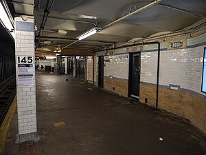
The New York City Subway's IRT Broadway–Seventh Avenue Line stops in Hamilton Heights at the 137th Street–City College and 145th Street stations (1 train). The IND Eighth Avenue Line runs under St. Nicholas Avenue, providing service at 135th Street (A, B, and C trains), 145th Street (A, B, C, and D trains) and 155th Street (A and C trains). The IND Concourse Line branches off north of the 145th Street station, and runs under Saint Nicholas Place to serve 155th Street (B and D trains).[40]
The MTA Regional Bus Operations' M3, M4, M5, M10, M11, M100, M101, Bx6, Bx6 SBS, Bx19 and Bx33 buses serve the area.[41]
Notable people edit
- Count Basie (1904–1984), musician
- Harry Belafonte (1927-2023), singer
- Diahann Carroll (1935–2019), singer, actress
- Duke Ellington (1899–1974), musician
- Ralph Ellison (1913–1994), author[42]
- Álvaro Enrigue (born 1969), writer[43]
- ASAP Ferg (born 1988), rapper[44]
- George Gershwin (1898–1937), composer[42]
- Alexander Hamilton (1755–1804), former Secretary of the Treasury
- Oscar Hammerstein I (1846–1919), composer
- Lena Horne (1917–2010), singer[42]
- Valeria Luiselli (born 1983), author[45]
- Yoselyn Ortega – Dominican-born American nanny convicted of stabbing to death children Lucia and Leo Krim in 2012.
- Beverly Peer (1912–1997), jazz double-bassist.[46]
- Norman Rockwell (1894–1978), artist
- Juelz Santana (born 1982), musician
- Nicholas Teliatnikow (1909–1970), photojournalist, photographer
- Malcolm X (1925–1965), civil rights activist
See also edit
References edit
- ^ a b "NYC Planning | Community Profiles". communityprofiles.planning.nyc.gov. New York City Department of City Planning. Retrieved March 18, 2019.
- ^ a b c d "Hamilton Heights neighborhood in New York". Retrieved March 18, 2019.
- ^ a b Table PL-P3A NTA: Total Population by Mutually Exclusive Race and Hispanic Origin - New York City Neighborhood Tabulation Areas*, 2010, Population Division - New York City Department of City Planning, March 29, 2011. Accessed June 14, 2016.
- ^ "The District - Manhattan Community Board 9". www.cb9m.org. Retrieved March 31, 2020.
- ^ a b c d e f Jackson, Kenneth T., ed. (1995). The Encyclopedia of New York City. New Haven: Yale University Press. pp. 519–520. ISBN 0300055366.
- ^ Table PL-P5 NTA: Total Population and Persons Per Acre - New York City Neighborhood Tabulation Areas*, 2010, Population Division - New York City Department of City Planning, February 2012. Accessed June 16, 2016.
- ^ "Race / Ethnic Change by Neighborhood" (Excel file). Center for Urban Research, The Graduate Center, CUNY. May 23, 2011. Retrieved March 20, 2020.
- ^ a b c d e f g h i j k l m n o "Morningside Heights and Hamilton Heights (Including Hamilton Heights, Manhattanville, Morningside Heights and West Harlem)" (PDF). nyc.gov. NYC Health. 2018. Retrieved March 2, 2019.
- ^ a b "2016-2018 Community Health Assessment and Community Health Improvement Plan: Take Care New York 2020" (PDF). nyc.gov. New York City Department of Health and Mental Hygiene. 2016. Retrieved September 8, 2017.
- ^ "NYC-Manhattan Community District 9--Hamilton Heights, Manhattanville & West Harlem PUMA, NY". Retrieved July 17, 2018.
- ^ a b "Hamilton Heights: Awaiting a Bounce (Published 2011)". The New York Times. Archived from the original on December 11, 2011.
- ^ "The Parish of the Holy Fathers Church" Archived December 10, 2011, at the Wayback Machine
- ^ Delson, Susan (October 23, 2015). "Retracing Audubon's Steps, Painting His Birds Anew". Wall Street Journal. Retrieved October 26, 2017.
- ^ Miller, Vernice D. (1994). "Planning, Power and Politics: A Case Study of the Land Use and Siting History of the North River Water Pollution Control Plant". Fordham Urban Law Journal. 21 (3).
- ^ "Jackie Robinson Park : NYC Parks". New York City Department of Parks & Recreation. June 26, 1939. Retrieved March 24, 2020.
- ^ "St. Nicholas Park : NYC Parks". New York City Department of Parks & Recreation. June 26, 1939. Retrieved March 24, 2020.
- ^ "Johnny Hartman Square : NYC Parks". New York City Department of Parks & Recreation. June 26, 1939. Retrieved March 24, 2020.
- ^ "Carmansville Playground : NYC Parks". New York City Department of Parks & Recreation. June 26, 1939. Retrieved March 24, 2020.
- ^ "NYPD – 30th Precinct". www.nyc.gov. New York City Police Department. Retrieved October 3, 2016.
- ^ "NYPD – 26th Precinct". www.nyc.gov. New York City Police Department. Retrieved October 3, 2016.
- ^ "30th Precinct CompStat Report" (PDF). www.nyc.gov. New York City Police Department. Retrieved March 18, 2020.
- ^ a b "NYC Crime Map". www.nyc.gov. New York City Police Department. Retrieved March 23, 2020.
- ^ "Citywide Seven Major Felony Offenses 2000-2019" (PDF). www.nyc.gov. New York Police Department. Retrieved March 23, 2020.
- ^ "Citywide Seven Major Felony Offenses by Precinct 2000-2019" (PDF). www.nyc.gov. New York Police Department. Retrieved March 23, 2020.
- ^ "Engine Company 80/Ladder Company 24". FDNYtrucks.com. Retrieved March 14, 2019.
- ^ "FDNY Firehouse Listing – Location of Firehouses and companies". NYC Open Data; Socrata. New York City Fire Department. September 10, 2018. Retrieved March 14, 2019.
- ^ "Manhattan Hospital Listings". New York Hospitals. Retrieved March 20, 2019.
- ^ "Hamilton Heights, New York City-Manhattan, New York Zip Code Boundary Map (NY)". United States Zip Code Boundary Map (USA). Retrieved March 26, 2019.
- ^ "PO Locator - USPS". USPS.com. Retrieved March 18, 2020.
- ^ "Morningside Heights/Hamilton – MN 06" (PDF). Furman Center for Real Estate and Urban Policy. 2011. Retrieved October 5, 2016.
- ^ a b "Hamilton Heights New York School Ratings and Reviews". Zillow. Retrieved March 17, 2019.
- ^ "Hamilton Heights School". New York City Department of Education. December 19, 2018. Retrieved March 26, 2019.
- ^ "New Design Middle School". New York City Department of Education. December 19, 2018. Retrieved March 26, 2019.
- ^ "P.S. 153 Adam Clayton Powell". New York City Department of Education. December 19, 2018. Retrieved March 26, 2019.
- ^ "P.S. 192 Jacob H. Schiff". New York City Department of Education. December 19, 2018. Retrieved March 26, 2019.
- ^ "P.S./I.S. 210 - Twenty-first Century Academy for Community Leadership". New York City Department of Education. December 19, 2018. Retrieved March 26, 2019.
- ^ "A. Philip Randolph Campus High School". New York City Department of Education. December 19, 2018. Retrieved March 26, 2019.
- ^ "High School for Mathematics, Science and Engineering at City College". New York City Department of Education. December 19, 2018. Retrieved March 26, 2019.
- ^ "About the Hamilton Grange Library". The New York Public Library. Retrieved March 23, 2019.
- ^ "Subway Map" (PDF). Metropolitan Transportation Authority. September 2021. Retrieved September 17, 2021.
- ^ "Manhattan Bus Map" (PDF). Metropolitan Transportation Authority. July 2019. Retrieved December 1, 2020.
- ^ a b c Jordan, Adrienne. "A guide to local favorites in Hamilton Heights Manhattan", The Washington Post. Accessed December 16, 2020. "The brownstones in Hamilton Heights once housed famous creatives like Ralph Ellison, Lena Horne and George Gershwin."
- ^ Enrigue, Álvaro. "Álvaro Enrigue: Hope for America on a Snow Day in Harlem; Defying the Trump Administration, One Stoop at a Time", Literary Hub, April 17, 2017. Accessed December 16, 2020. "I live in Hamilton Heights, a Harlem neighborhood that because of its recent history and location has reached a kind of idyllic integration equilibrium."
- ^ Muhammad, Ali Shaheed; and Kelley, Frannie. "ASAP Ferg: 'I Want This Moment To Last Forever'", WNYC, March 18, 2015.Accessed December 16, 2020. "KELLEY: Can you tell us the difference between Hamilton Heights and, like, the East side of Harlem, not East Harlem but just the other side? A$AP FERG: Huh? KELLEY: Is there a difference between Hamilton Heights and the rest of Harlem? A$AP FERG: I don't know Hamilton Heights.... A$AP FERG: Yeah. Washington Heights. I go to Washington Heights. But Hamilton Heights. It is such thing as Hamilton Heights, I think, but Hamilton Place is my block. That's like the whole strip from 145th all the way to 140th. Yeah. And Hamilton."
- ^ Felsenthal, Julia. "Married Mexican Writers Álvaro Enrigue and Valeria Luiselli on Their Buzzy New Novels and New York Life", Vogue, March 3, 2016. Accessed December 16, 2020. "Their processes differ—Enrigue writes largely based on archival material, Luiselli in 'a close register of what’s going on around me'—but they’ve long worked side by side: first in Mexico City, then in this walk-up apartment in their upper Manhattan neighborhood of Hamilton Heights, where they moved in 2011 for her Ph.D. and his Cullman Center Fellowship."
- ^ Holden, Stephen. "Beverly Peer, 84, Bass Player Who Accompanied Bobby Short", January 27, 1997. Accessed December 6, 2020. "Mr. Peer grew up on West 137th Street in Hamilton Heights and studied piano, then as a teen-ager switched to the bass violin."
External links edit
- NYC's Guide to Hamilton Heights Pamphlet
- Some photos of CCNY and Hamilton Heights, Forgotten NY