
KNOWPIA
WELCOME TO KNOWPIA

Heers 
Summary
Heers (Dutch pronunciation: [ˈɦeːrs] ⓘ, Limburgish: Hiër [ˈɦiəʀ])[tone?] is a municipality located in the Belgian province of Limburg.
Heers | |
|---|---|
 Vechmaal: Sint Martinus church | |
 Flag  Coat of arms | |
Location of Heers .mw-parser-output .locmap .od{position:absolute}.mw-parser-output .locmap .id{position:absolute;line-height:0}.mw-parser-output .locmap .l0{font-size:0;position:absolute}.mw-parser-output .locmap .pv{line-height:110%;position:absolute;text-align:center}.mw-parser-output .locmap .pl{line-height:110%;position:absolute;top:-0.75em;text-align:right}.mw-parser-output .locmap .pr{line-height:110%;position:absolute;top:-0.75em;text-align:left}.mw-parser-output .locmap .pv>div{display:inline;padding:1px}.mw-parser-output .locmap .pl>div{display:inline;padding:1px;float:right}.mw-parser-output .locmap .pr>div{display:inline;padding:1px;float:left}html.skin-theme-clientpref-night .mw-parser-output .od,html.skin-theme-clientpref-night .mw-parser-output .od .pv>div,html.skin-theme-clientpref-night .mw-parser-output .od .pl>div,html.skin-theme-clientpref-night .mw-parser-output .od .pr>div{background:#000;color:#fff}html.skin-theme-clientpref-night .mw-parser-output .locmap{filter:grayscale(0.6)}@media(prefers-color-scheme:dark){html.skin-theme-clientpref-os .mw-parser-output .locmap{filter:grayscale(0.6)}html.skin-theme-clientpref-os .mw-parser-output .od,html.skin-theme-clientpref-os .mw-parser-output .od .pv>div,html.skin-theme-clientpref-os .mw-parser-output .od .pl>div,html.skin-theme-clientpref-os .mw-parser-output .od .pr>div{background:#000;color:#fff}}  Heers Location in Belgium
Location of Heers in Limburg 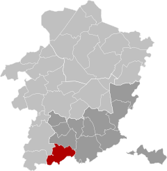 | |
| Coordinates: 50°45′N 05°17′E / 50.750°N 5.283°E | |
| Country | |
| Community | Flemish Community |
| Region | Flemish Region |
| Province | Limburg |
| Arrondissement | Tongeren |
| Government | |
| • Mayor | Kristof Pirard (VLDumont) |
| • Governing party/ies | VLDumont |
| Area | |
| • Total | 53.06 km2 (20.49 sq mi) |
| Population (2018-01-01)[1] | |
| • Total | 7,290 |
| • Density | 140/km2 (360/sq mi) |
| Postal codes | 3870 |
| NIS code | 73022 |
| Area codes | 011 |
| Website | www.heers.be |
History edit
Merger municipality edit

The municipality of Heers was formed by several mergers. In 1971:
- Heers was merged with Batsheers, Opheers, Veulen, Gutschoven and Mettekoven.
- Mechelen-Bovelingen and Rukkelingen-Loon were merged to form Bovelingen municipality
- Heks, Horpmaal, and Vechmaal were merged to form Heks municipality
- Klein-Gelmen was merged with Gelinden, Engelmanshoven and Groot Gelmen to form Gelmen municipality
In 1977 the current municipality of Heers was formed by merging:
- Heers municipality
- Bovelingen municipality
- Heks municipality
- Klein-Gelmen village (The rest of Gelmen was merged into the municipality of Sint-Truiden).
References edit
- ^ "Wettelijke Bevolking per gemeente op 1 januari 2018". Statbel. Retrieved 9 March 2019.
External links edit
 Media related to Heers at Wikimedia Commons
- Site (personal) on Heers – Description of and historical information about each of the parishes of Heers (in Dutch)