


Summary
Hegebeintum (Dutch: Hogebeintum) is a small village in Noardeast-Fryslân in the province of Friesland, the Netherlands. It had a population of around 90 in January 2017.[3] Before 2019, the village was part of the Ferwerderadiel municipality.[4]
Hegebeintum
Hogebeintum | |
|---|---|
Village | |
 Church and dwarf of Hegebeintum | |
 Flag  Coat of arms | |
 Location in the former Ferwerderadiel municipality | |
 Hegebeintum Location in the Netherlands  Hegebeintum Hegebeintum (Netherlands) | |
| Coordinates: 53°20′12″N 5°50′58″E / 53.33667°N 5.84944°E | |
| Country | |
| Province | |
| Municipality | Noardeast-Fryslân |
| Area | |
| • Total | 3.89 km2 (1.50 sq mi) |
| Elevation | 0.5 m (1.6 ft) |
| Population (2021)[1] | |
| • Total | 85 |
| • Density | 22/km2 (57/sq mi) |
| Postal code | 9022[1] |
| Dialing code | 0518 |
Hegebeintum is home to the highest artificial dwelling hill, or terp, in the Netherlands, measuring around 8.8 metres (29 ft) tall.[4] The high ground of the terp was historically used as a place of refuge during unusually high tides and storm floods, and also had a number of dwellings. There is a well-known restored windmill located south of the village: the Hegebeintumer Mûne.
History edit
The village was first mentioned between 819 and c. 825 as Bintheim, and means "high settlement with moor grass (Molinia).[5] Hegebeintum is a terp village with a near perfect radial structure. It developed several centuries before Christ. The Dutch Reformed church dates from the 12th century. It was enlarged around 1550. The 13th century tower was rebuilt in 1717 with yellow bricks.[6]
The polder mill Hegebeintumer Mûne was built in 1860. In 1969, it was decommissioned, because nobody was willing to move to Hegebeintum to operate wind mill, and a pumping station was installed. In 2006, it has been designated as a backup system.[7]
In 1840, Hegebeintum was home to 190 people.[4] Between 1896 and 1905, parts of the terp were excavated which has resulted in a very steep hill.[6] The old terp used to cover 9.5 hectares (23 acres).[4]
Gallery edit
-
 Hegebeintum church
 -
 Hegebeintumer Mûne
 -
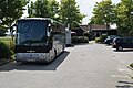 Tour buses in Hegebeintum
 -
 House in Hegebeintum


References edit
- ^ a b c "Kerncijfers wijken en buurten 2021". Central Bureau of Statistics. Retrieved 31 March 2022.
- ^ "Postcodetool for 9173AA". Actueel Hoogtebestand Nederland (in Dutch). Het Waterschapshuis. Retrieved 31 March 2022.
- ^ Aantal inwoners per woonplaats in Ferwerderadiel op 1 januari 2017 Archived 2017-10-21 at the Wayback Machine - Ferwerderadiel
- ^ a b c d "Hegebeintum". Plaatsengids (in Dutch). Retrieved 31 March 2022.
- ^ "Hegebeintum - (geografische naam)". Etymologiebank (in Dutch). Retrieved 31 March 2022.
- ^ a b Ronald Stenvert & Sabine Broekhoven (2000). "Hegebeintum" (in Dutch). Zwolle: Waanders. ISBN 90 400 9476 4. Retrieved 31 March 2022.
- ^ "Hegebeintumer Mûne / De Hogebeintumermolen". Molen database (in Dutch). Retrieved 31 March 2022.
External links edit
![]() Media related to Hegebeintum at Wikimedia Commons
Media related to Hegebeintum at Wikimedia Commons