
KNOWPIA
WELCOME TO KNOWPIA

Heumen 
Summary
Heumen (Dutch pronunciation: [ˈɦøːmə(n)] ⓘ) is a municipality and a village in the eastern Netherlands.
Heumen | |
|---|---|
 Windmill near Overasselt | |
 Flag  Coat of arms | |
 Location in Gelderland | |
| Coordinates: 51°47′N 5°51′E / 51.783°N 5.850°E | |
| Country | Netherlands |
| Province | Gelderland |
| Government | |
| • Body | Municipal council |
| • Mayor | Marriët Mittendorff[1] (CDA) |
| Area | |
| • Total | 41.54 km2 (16.04 sq mi) |
| • Land | 39.76 km2 (15.35 sq mi) |
| • Water | 1.78 km2 (0.69 sq mi) |
| Elevation | 11 m (36 ft) |
| Population (January 2021)[5] | |
| • Total | 16,569 |
| • Density | 417/km2 (1,080/sq mi) |
| Demonym | Heumenaar |
| Time zone | UTC+1 (CET) |
| • Summer (DST) | UTC+2 (CEST) |
| Postcode | 6580–6582, 6610–6612 |
| Area code | 024 |
| Website | www |
Population centres edit
- Heumen
- Malden (administrative centre)
- Molenhoek (partly)
- Nederasselt
- Overasselt
Topography edit
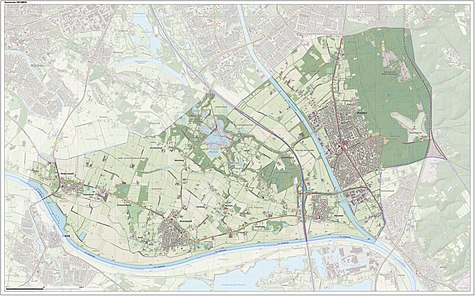
Dutch Topographic map of the municipality of Heumen, June 2015
Notable people edit
- Wisse Alfred Pierre Smit (1903–1986) a poet and an influential Dutch literary historian of the Dutch Golden Age
- Frans Thijssen (born 1952 in Malden) a former international Dutch footballer with 628 club caps
- Sabina Brons (born 1965) stage name Selena a Dutch singer
- Bram Nuytinck (born 1990) a Dutch footballer with over 270 club caps
Gallery edit
-
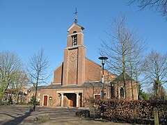 Heumen, the catholic church
 -
 Heumen, water tap
 -
 Mook-Heumense schans
 -
 Heumen, the reformed church
 -
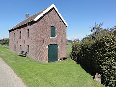 Nederasselt (Heumen, Gld) Dijkmagazijn


References edit
- ^ "Waarnemend burgemeester bekend" (in Dutch). Heumen municipality. Retrieved 25 March 2017.
- ^ "Samenstelling college" [Members of the board] (in Dutch). Gemeente Heumen. Retrieved 8 July 2014.
- ^ "Kerncijfers wijken en buurten 2020" [Key figures for neighbourhoods 2020]. StatLine (in Dutch). CBS. 24 July 2020. Retrieved 19 September 2020.
- ^ "Postcodetool for 6581AC". Actueel Hoogtebestand Nederland (in Dutch). Het Waterschapshuis. Archived from the original on 21 September 2013. Retrieved 8 July 2014.
- ^ "Bevolkingsontwikkeling; regio per maand" [Population growth; regions per month]. CBS Statline (in Dutch). CBS. 1 January 2021. Retrieved 2 January 2022.
External links edit
 Media related to Heumen at Wikimedia Commons
- Official website